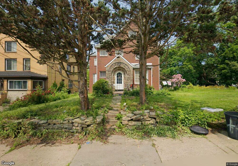
431 Freeport Rd New Kensington, PA 15068
Estimated Value: $142,628 - $294,000
--
Bed
--
Bath
--
Sq Ft
0.34
Acres
About This Home
This home is located at 431 Freeport Rd, New Kensington, PA 15068 and is currently estimated at $188,157. 431 Freeport Rd is a home located in Westmoreland County with nearby schools including Mary Queen of Apostles School.
Ownership History
Date
Name
Owned For
Owner Type
Purchase Details
Closed on
Jun 28, 2016
Sold by
Thompson Hopeton A and Thompson Sharon
Bought by
Hedfors Thomas C
Current Estimated Value
Home Financials for this Owner
Home Financials are based on the most recent Mortgage that was taken out on this home.
Original Mortgage
$72,000
Outstanding Balance
$57,626
Interest Rate
3.66%
Mortgage Type
New Conventional
Estimated Equity
$130,532
Purchase Details
Closed on
Feb 10, 2004
Sold by
Gilg Cathleen Mcdade and Gilg Harry E
Bought by
Thompson Hopeton A and Thompson Sharon
Home Financials for this Owner
Home Financials are based on the most recent Mortgage that was taken out on this home.
Original Mortgage
$54,000
Interest Rate
5.65%
Mortgage Type
Unknown
Create a Home Valuation Report for This Property
The Home Valuation Report is an in-depth analysis detailing your home's value as well as a comparison with similar homes in the area
Home Values in the Area
Average Home Value in this Area
Purchase History
| Date | Buyer | Sale Price | Title Company |
|---|---|---|---|
| Hedfors Thomas C | $90,000 | None Available | |
| Thompson Hopeton A | $60,000 | -- |
Source: Public Records
Mortgage History
| Date | Status | Borrower | Loan Amount |
|---|---|---|---|
| Open | Hedfors Thomas C | $72,000 | |
| Previous Owner | Thompson Hopeton A | $54,000 |
Source: Public Records
Tax History Compared to Growth
Tax History
| Year | Tax Paid | Tax Assessment Tax Assessment Total Assessment is a certain percentage of the fair market value that is determined by local assessors to be the total taxable value of land and additions on the property. | Land | Improvement |
|---|---|---|---|---|
| 2025 | $5,583 | $34,970 | $7,770 | $27,200 |
| 2024 | $5,531 | $34,970 | $7,770 | $27,200 |
| 2023 | $5,234 | $34,970 | $7,770 | $27,200 |
| 2022 | $5,074 | $34,970 | $7,770 | $27,200 |
| 2021 | $4,958 | $34,970 | $7,770 | $27,200 |
| 2020 | $4,853 | $34,970 | $7,770 | $27,200 |
| 2019 | $4,731 | $34,970 | $7,770 | $27,200 |
| 2018 | $4,661 | $34,970 | $7,770 | $27,200 |
| 2017 | $4,591 | $34,970 | $7,770 | $27,200 |
| 2016 | $4,591 | $34,970 | $7,770 | $27,200 |
| 2015 | $4,591 | $34,970 | $7,770 | $27,200 |
| 2014 | $4,411 | $34,970 | $7,770 | $27,200 |
Source: Public Records
Map
Nearby Homes
- 533 Freeport Rd
- 1218 Woodmont Ave
- 327 Charles Ave
- 318 Ridge Ave
- 1134 Leishman Ave
- 620 Ridge Ave
- 486 McCargo St
- 1308 Taylor Ave
- 1312 Woodmont Ave
- 1216 Kenneth Ave
- 201 Locust St
- 254 Ridge Ave
- 105 Locust St
- 1025 Kenneth Ave
- 1024 Knollwood Rd
- 1233 Kenneth Ave
- 1400 Orchard Ave
- 1506 Victoria Ave
- 1515 Woodmont Ave
- 1520 Woodmont Ave
- 427 Freeport Rd
- 427 Freeport Rd Unit 1/2
- 502 Locust St
- 508 Locust St
- 425 Freeport Rd
- 423 Freeport Rd
- 440 Ridge Ave
- 432 Ridge Ave
- 436 Freeport Rd
- 432 Freeport Rd
- 430 Ridge Ave
- 419 Freeport Rd
- 440 Freeport Rd
- 503 Locust St
- 428 Ridge Ave
- 501 Freeport Rd
- 414 Freeport Rd
- 426 Ridge Ave
- 800 Locust Street Extension
- 424 Ridge Ave