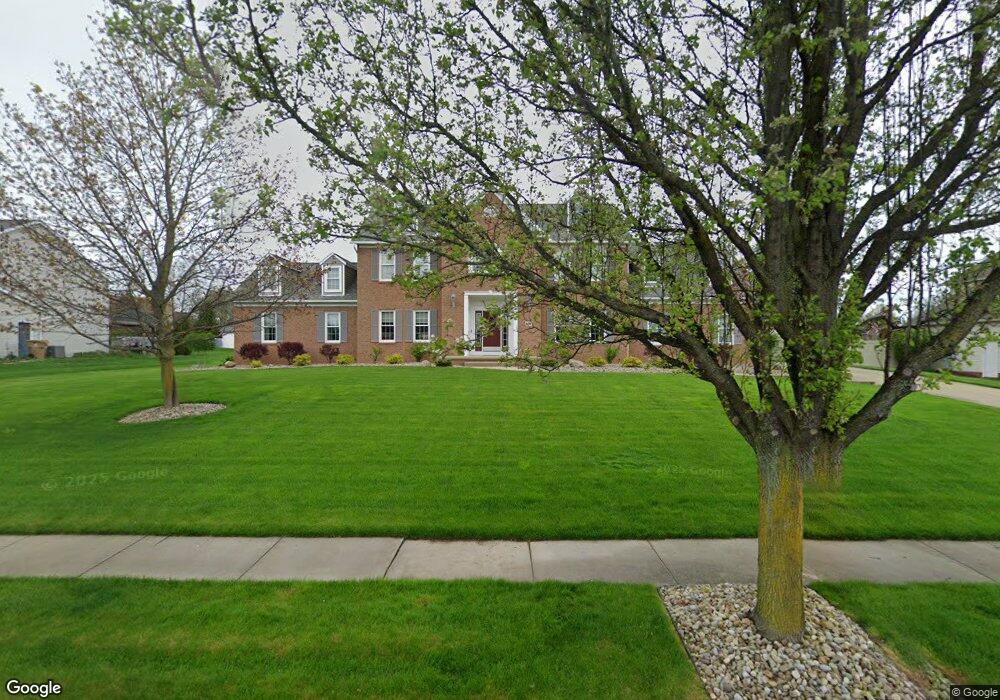
431 Heathrow Dr Cuyahoga Falls, OH 44223
Estimated Value: $522,000 - $582,000
4
Beds
3
Baths
3,279
Sq Ft
$166/Sq Ft
Est. Value
About This Home
This home is located at 431 Heathrow Dr, Cuyahoga Falls, OH 44223 and is currently estimated at $542,854, approximately $165 per square foot. 431 Heathrow Dr is a home located in Summit County with nearby schools including Woodridge Middle School, Woodridge High School, and Immaculate Heart Of Mary School.
Ownership History
Date
Name
Owned For
Owner Type
Purchase Details
Closed on
Nov 12, 2018
Sold by
Moretti Robb A and Moretti Jannifer L
Bought by
Moretti Robb A and Moretti Jennifer L
Current Estimated Value
Purchase Details
Closed on
May 14, 1997
Sold by
Union Commerce Group
Bought by
Moretti Robb A and Moretti Jennifer L
Home Financials for this Owner
Home Financials are based on the most recent Mortgage that was taken out on this home.
Original Mortgage
$230,900
Outstanding Balance
$48,038
Interest Rate
8.27%
Mortgage Type
New Conventional
Estimated Equity
$494,816
Create a Home Valuation Report for This Property
The Home Valuation Report is an in-depth analysis detailing your home's value as well as a comparison with similar homes in the area
Home Values in the Area
Average Home Value in this Area
Purchase History
| Date | Buyer | Sale Price | Title Company |
|---|---|---|---|
| Moretti Robb A | -- | None Available | |
| Moretti Robb A | $61,500 | -- |
Source: Public Records
Mortgage History
| Date | Status | Borrower | Loan Amount |
|---|---|---|---|
| Open | Moretti Robb A | $230,900 |
Source: Public Records
Tax History Compared to Growth
Tax History
| Year | Tax Paid | Tax Assessment Tax Assessment Total Assessment is a certain percentage of the fair market value that is determined by local assessors to be the total taxable value of land and additions on the property. | Land | Improvement |
|---|---|---|---|---|
| 2025 | $8,624 | $147,179 | $24,136 | $123,043 |
| 2024 | $8,624 | $147,179 | $24,136 | $123,043 |
| 2023 | $8,624 | $147,179 | $24,136 | $123,043 |
| 2022 | $7,741 | $117,744 | $19,310 | $98,434 |
| 2021 | $7,810 | $117,744 | $19,310 | $98,434 |
| 2020 | $7,714 | $117,740 | $19,310 | $98,430 |
| 2019 | $7,705 | $108,720 | $18,540 | $90,180 |
| 2018 | $8,029 | $108,720 | $18,540 | $90,180 |
| 2017 | $6,935 | $108,720 | $18,540 | $90,180 |
| 2016 | $6,904 | $97,860 | $18,540 | $79,320 |
| 2015 | $6,935 | $97,860 | $18,540 | $79,320 |
| 2014 | $6,542 | $97,860 | $18,540 | $79,320 |
| 2013 | $6,435 | $96,440 | $18,540 | $77,900 |
Source: Public Records
Map
Nearby Homes
- 419 W Bath Rd
- 708 Dominic Dr
- 1983 Fox Trace Trail
- 1032 Foxglove Cir
- 1977 Fox Trace Trail
- 2694 High Hampton Trail
- 154 Michael Ln
- 3608 Northampton Rd
- 3164 Old Mill Dr
- 3168 Old Mill Dr
- 2195 Pinebrook Trail Unit 2195
- 3254 Cherie Cercle
- 3429 Brookpoint Ln
- 2180 Stone Creek Trail Unit 2180
- 2152 Pinebrook Trail Unit 2152
- 374 Timber Ridge
- 595 Meredith Ln
- 2130 Pinebrook Trail
- 609 Meredith Ln
- 2125 Pinebrook Trail
- 443 Heathrow Dr
- 419 Heathrow Dr
- 430 Keyser Pkwy
- 442 Keyser Pkwy
- 418 Keyser Pkwy
- 434 Heathrow Dr
- 422 Heathrow Dr
- 455 Heathrow Dr
- 407 Heathrow Dr
- 446 Heathrow Dr
- 454 Keyser Pkwy
- 410 Heathrow Dr
- 406 Keyser Pkwy
- 458 Heathrow Dr
- 435 Hillbrook Dr
- 423 Hillbrook Dr
- 433 Keyser Pkwy
- 395 Heathrow Dr
- 421 Keyser Pkwy
- 447 Hillbrook Dr