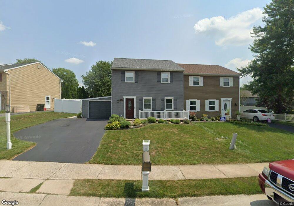
431 Larkspur Loop Lancaster, PA 17602
Fertility NeighborhoodEstimated Value: $248,000 - $275,626
3
Beds
2
Baths
1,296
Sq Ft
$203/Sq Ft
Est. Value
About This Home
This home is located at 431 Larkspur Loop, Lancaster, PA 17602 and is currently estimated at $262,907, approximately $202 per square foot. 431 Larkspur Loop is a home located in Lancaster County with nearby schools including Smoketown Elementary School, Gerald G. Huesken Middle School, and Conestoga Valley High School.
Ownership History
Date
Name
Owned For
Owner Type
Purchase Details
Closed on
Oct 27, 2006
Sold by
Heidelbaugh Todd A and Heidelbaugh Bonnie J
Bought by
Collazo Jose R and Santiago Samayra
Current Estimated Value
Home Financials for this Owner
Home Financials are based on the most recent Mortgage that was taken out on this home.
Original Mortgage
$131,000
Outstanding Balance
$78,658
Interest Rate
6.48%
Mortgage Type
Purchase Money Mortgage
Estimated Equity
$184,249
Create a Home Valuation Report for This Property
The Home Valuation Report is an in-depth analysis detailing your home's value as well as a comparison with similar homes in the area
Home Values in the Area
Average Home Value in this Area
Purchase History
| Date | Buyer | Sale Price | Title Company |
|---|---|---|---|
| Collazo Jose R | $131,000 | First American Title Ins Co |
Source: Public Records
Mortgage History
| Date | Status | Borrower | Loan Amount |
|---|---|---|---|
| Open | Collazo Jose R | $131,000 |
Source: Public Records
Tax History
| Year | Tax Paid | Tax Assessment Tax Assessment Total Assessment is a certain percentage of the fair market value that is determined by local assessors to be the total taxable value of land and additions on the property. | Land | Improvement |
|---|---|---|---|---|
| 2025 | $2,357 | $116,400 | $36,200 | $80,200 |
| 2024 | $2,357 | $116,400 | $36,200 | $80,200 |
| 2023 | $2,302 | $116,400 | $36,200 | $80,200 |
| 2022 | $2,245 | $116,400 | $36,200 | $80,200 |
| 2021 | $2,166 | $116,400 | $36,200 | $80,200 |
| 2020 | $2,166 | $116,400 | $36,200 | $80,200 |
| 2019 | $2,119 | $116,400 | $36,200 | $80,200 |
| 2018 | $2,442 | $116,400 | $36,200 | $80,200 |
| 2017 | $1,879 | $86,800 | $22,900 | $63,900 |
| 2016 | $1,857 | $86,800 | $22,900 | $63,900 |
| 2015 | $474 | $86,800 | $22,900 | $63,900 |
| 2014 | $1,192 | $86,800 | $22,900 | $63,900 |
Source: Public Records
Map
Nearby Homes
- 305 Greenland Dr Unit 385
- 352 Dohner Dr Unit 69
- 40 Harvest Rd
- 2187 Lincoln Hwy E
- 2009 Millstream Rd
- 225 Black Oak Dr
- 8 White Tail Path
- 312 Laurel Oak Ln
- 26 Midway Farms Ln
- 1829 Krystle Dr
- 32 Greenfield Rd
- 77 Highland Dr
- 83 Highland Dr
- 89 Greenfield Rd
- 257 Longfellow Dr
- 142 Hostetter Ln
- 2453 Lincoln Hwy E
- 2318 Rockvale Rd
- 806 Lightfoot Dr
- 2498 Old Philadelphia Park
- 429 Larkspur Loop
- 433 Larkspur Loop
- 427 Larkspur Loop
- 303 Dohner Dr
- 305 Dohner Dr
- 425 Larkspur Loop
- 301 Dohner Dr
- 307 Dohner Dr
- 426 Larkspur Loop
- 424 Larkspur Loop
- 422 Larkspur Loop
- 423 Larkspur Loop
- 426 Coreopsis Dr
- 428 Larkspur Loop
- 430 Larkspur Loop
- 432 Larkspur Loop
- 422 Coreopsis Dr
- 428 Coreopsis Dr
- 434 Larkspur Loop
- 420 Larkspur Loop
Your Personal Tour Guide
Ask me questions while you tour the home.