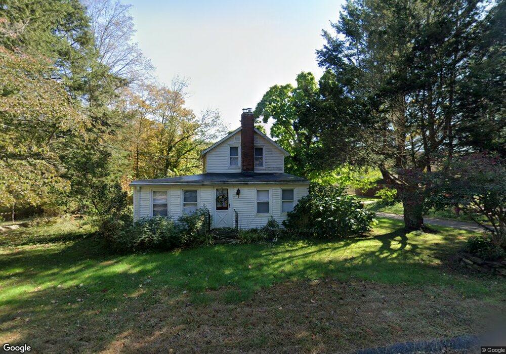
431 Mansfield Rd Ashford, CT 06278
Estimated Value: $293,783 - $355,000
3
Beds
1
Bath
1,136
Sq Ft
$285/Sq Ft
Est. Value
About This Home
This home is located at 431 Mansfield Rd, Ashford, CT 06278 and is currently estimated at $323,696, approximately $284 per square foot. 431 Mansfield Rd is a home located in Windham County with nearby schools including Ashford School and E.O. Smith High School.
Ownership History
Date
Name
Owned For
Owner Type
Purchase Details
Closed on
Dec 26, 2019
Sold by
Stankowski Jason L
Bought by
Stankowski Jason L and Winter Stephanie
Current Estimated Value
Home Financials for this Owner
Home Financials are based on the most recent Mortgage that was taken out on this home.
Original Mortgage
$123,200
Outstanding Balance
$108,384
Interest Rate
3.6%
Mortgage Type
New Conventional
Estimated Equity
$215,312
Purchase Details
Closed on
Sep 19, 2005
Sold by
Paradis William F
Bought by
Stankowski Jason L
Home Financials for this Owner
Home Financials are based on the most recent Mortgage that was taken out on this home.
Original Mortgage
$80,000
Interest Rate
5.84%
Mortgage Type
Purchase Money Mortgage
Create a Home Valuation Report for This Property
The Home Valuation Report is an in-depth analysis detailing your home's value as well as a comparison with similar homes in the area
Home Values in the Area
Average Home Value in this Area
Purchase History
| Date | Buyer | Sale Price | Title Company |
|---|---|---|---|
| Stankowski Jason L | -- | None Available | |
| Stankowski Jason L | -- | None Available | |
| Stankowski Jason L | $100,000 | -- | |
| Stankowski Jason L | $100,000 | -- |
Source: Public Records
Mortgage History
| Date | Status | Borrower | Loan Amount |
|---|---|---|---|
| Open | Stankowski Jason L | $123,200 | |
| Closed | Stankowski Jason L | $123,200 | |
| Previous Owner | Stankowski Jason L | $80,000 |
Source: Public Records
Tax History Compared to Growth
Tax History
| Year | Tax Paid | Tax Assessment Tax Assessment Total Assessment is a certain percentage of the fair market value that is determined by local assessors to be the total taxable value of land and additions on the property. | Land | Improvement |
|---|---|---|---|---|
| 2025 | $4,097 | $112,630 | $49,070 | $63,560 |
| 2024 | $3,870 | $112,630 | $49,070 | $63,560 |
| 2023 | $3,727 | $112,630 | $49,070 | $63,560 |
| 2022 | $3,635 | $112,630 | $49,070 | $63,560 |
| 2021 | $1,980 | $101,700 | $45,100 | $56,600 |
| 2020 | $1,951 | $105,400 | $45,100 | $60,300 |
| 2019 | $1,919 | $105,400 | $45,100 | $60,300 |
| 2018 | $1,900 | $105,400 | $45,100 | $60,300 |
| 2017 | $2,043 | $105,400 | $45,100 | $60,300 |
| 2016 | $3,502 | $108,200 | $55,500 | $52,700 |
| 2015 | $3,566 | $108,200 | $55,500 | $52,700 |
| 2014 | $3,480 | $108,200 | $55,500 | $52,700 |
Source: Public Records
Map
Nearby Homes
- 94 Mansfield Rd
- 685 Wormwood Hill Rd
- 90-94 & 93 Upton Rd
- 283 Tower Hill Rd
- 66 Bebbington Rd
- 102 Krapf Rd
- 150 Krapf Rd
- 164 Tower Hill Rd
- 241 Wormwood Hill Rd
- 60 Chaplin St
- 368 Warrenville Rd
- 69 N Bedlam Rd
- 173 Westford Hill Rd
- 9 Storrs Heights Rd
- 29 Windswept Ln
- 934 Storrs Rd
- 985 Storrs Rd
- 144 Phoenixville Rd
- 287 S Bear Hill Rd
- 29 Chaffeeville Rd
- 430 Mansfield Rd
- 414 Mansfield Rd
- 420 Mansfield Rd
- 396 Mansfield Rd
- 1052 Warrenville Rd
- 48 Portland Dr
- 00 Mansfield Rd
- 32 Portland Dr
- 44 Portland Dr
- 20 Portland Dr
- 582 Bebbington Rd
- 54 Portland Dr
- 574 Bebbington Rd
- 53 Nollett Rd
- 53 Nollett Rd
- 572 Bebbington Rd
- 1017 Warrenville Rd
- 40 Portland Dr
- 71 Nollett Rd
- 61 Nollett Rd