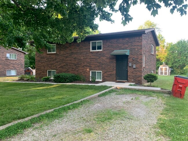
431 Mason St Unit 433 Dundee, MI 48131
2
Beds
1
Bath
800
Sq Ft
0.26
Acres
About This Home
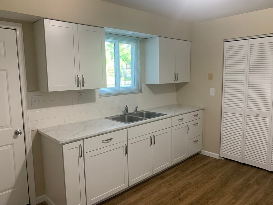
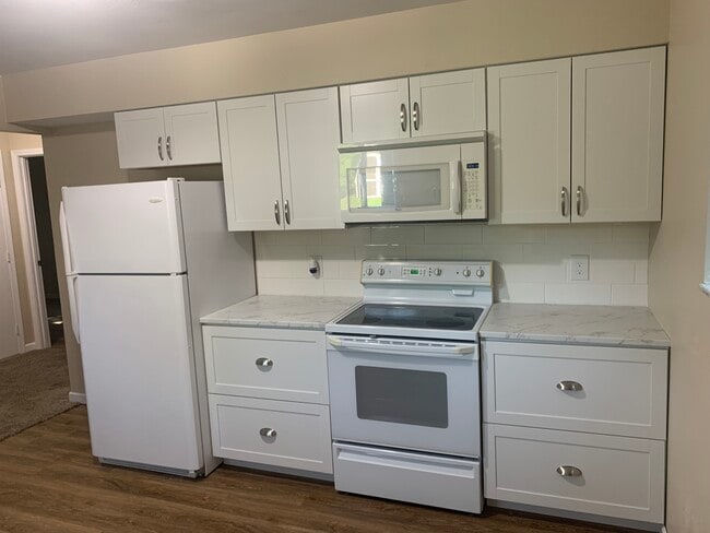
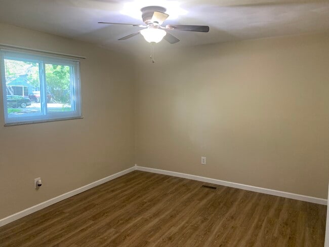
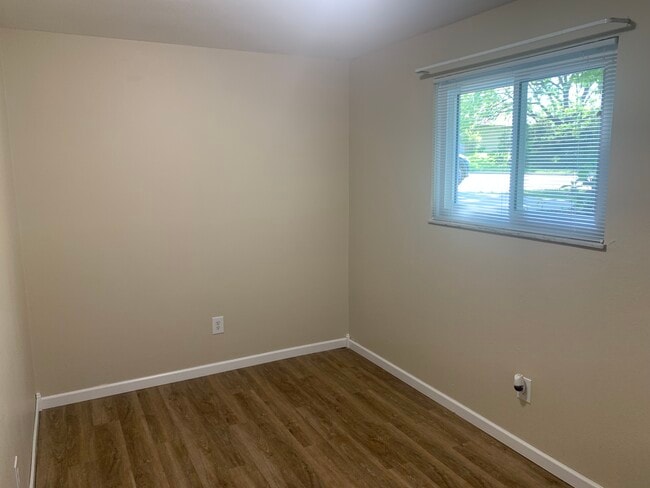
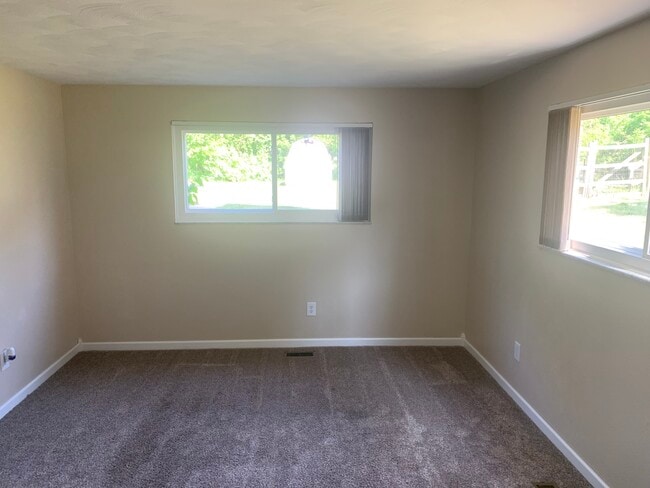
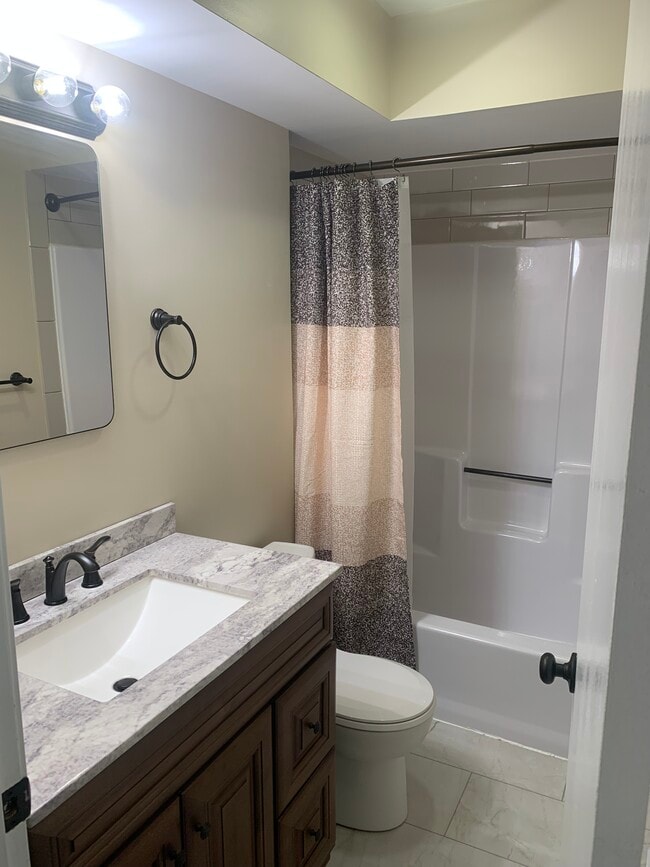
The unit was recently remodeled, new kitchen cabinets, new kitchen countertops & tile backsplash, new bedroom and bathroom flooring, new bathroom vanity, countertops & faucet, new medicine cabinet, new lighting fixtures and new door & base board trim. New washer & dryer. New windows.
Includes refrigerator, range, microwave and dishwasher. Large patio and backyard. Lower unit. Separate entry. On quiet dead end street. Within walking distance to downtown restaurants & shops, schools, post office and Wolverine Park. No pets allowed.
Listing Provided By

Map
Nearby Homes
- 190 Sidney St
- 439 E Monroe St
- 495 Mcbride St
- 000 Lloyd Rd
- 644 Elk Ridge Dr
- 209 Dundee Ridge Dr
- 209 Caribou Run
- 289 White Owl Ln Unit 234
- 295 White Owl Ln Unit 235
- 703 Chase Hanna St Unit 1
- 671 Elk Ridge Dr
- 150 Waterstradt Commerce Dr
- 715 Chase Hanna St Unit 6
- 5057 Wilshire Dr Unit 71
- 5080 Wilshire Dr Unit 53
- 1437 Wells Rd
- 769 Falcon Dr
- 449 Corinth Cir
- 465 Corinth
- 217 Potterstone Dr
- 500 E Monroe St
- 500 E Monroe St Unit 304
- 500 E Monroe St
- 715 Chase Hanna St Unit 6
- 765 Chase Hanna St Unit 17
- 140 Helle Blvd
- 140 Lauff Dr
- 124 E Main St Unit 124 East Main Street
- 13 W Main St Unit . 1
- 888 Plum Park Dr Unit 18
- 866 Plum Park Dr Unit 23 / Bldg 4
- 838 Plum Park Dr Unit 43
- 846 Plum Park Dr Unit 37
- 834 Plum Park Dr Unit 39
- 219 Marvin St
- 875 Plum Village Dr
- 230 W Main St Unit 2
- 461 Greentree Ln
- 8620 Willow Rd
- 300 Twin Oaks Ct