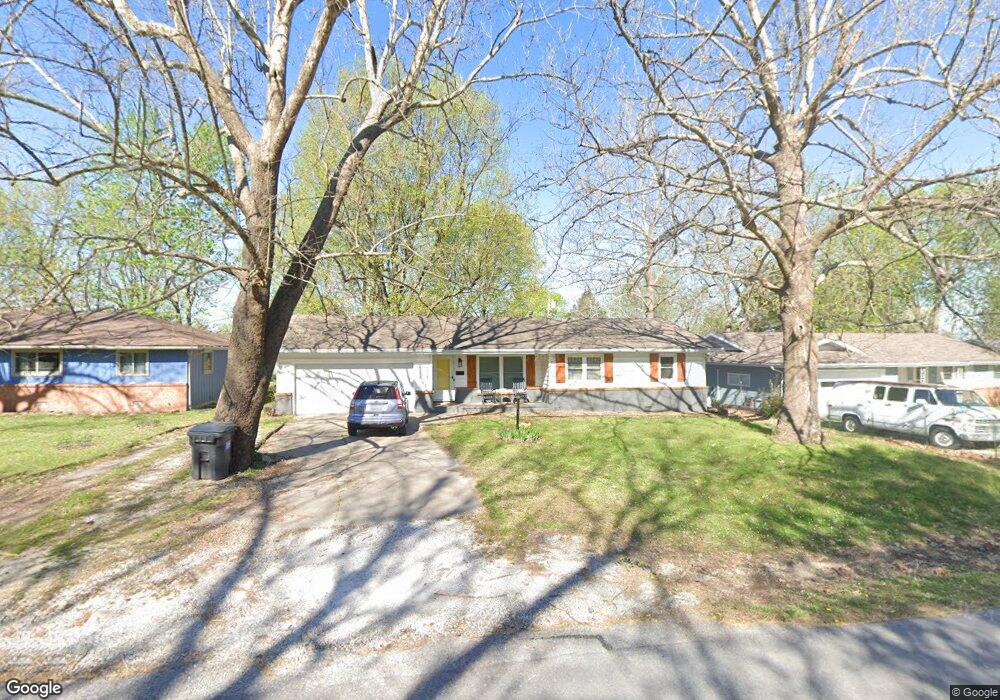
431 N Lone Pine Ave Springfield, MO 65802
Cooper Park NeighborhoodEstimated Value: $210,000 - $236,000
4
Beds
2
Baths
1,800
Sq Ft
$122/Sq Ft
Est. Value
About This Home
This home is located at 431 N Lone Pine Ave, Springfield, MO 65802 and is currently estimated at $219,317, approximately $121 per square foot. 431 N Lone Pine Ave is a home located in Greene County with nearby schools including Bingham Elementary School, Hickory Hills K-8 School, and Central High School.
Ownership History
Date
Name
Owned For
Owner Type
Purchase Details
Closed on
Dec 5, 2025
Sold by
Parrish Jason and Parrish Heather
Bought by
Adkins Daniel R
Current Estimated Value
Home Financials for this Owner
Home Financials are based on the most recent Mortgage that was taken out on this home.
Original Mortgage
$239,000
Outstanding Balance
$238,540
Interest Rate
6.19%
Mortgage Type
VA
Estimated Equity
-$19,223
Purchase Details
Closed on
Sep 5, 2025
Sold by
Robert Carl Stueven Revocable Trust and Stueven Robert Carl
Bought by
Parrish Jason and Parrish Heather
Purchase Details
Closed on
Jun 30, 2010
Sold by
Jackson Jerald and Jackson Amanda
Bought by
Seaman Joshua D
Home Financials for this Owner
Home Financials are based on the most recent Mortgage that was taken out on this home.
Original Mortgage
$98,572
Interest Rate
5.5%
Mortgage Type
FHA
Create a Home Valuation Report for This Property
The Home Valuation Report is an in-depth analysis detailing your home's value as well as a comparison with similar homes in the area
Home Values in the Area
Average Home Value in this Area
Purchase History
| Date | Buyer | Sale Price | Title Company |
|---|---|---|---|
| Adkins Daniel R | -- | None Listed On Document | |
| Parrish Jason | -- | None Listed On Document | |
| Parrish Jason | -- | None Listed On Document | |
| Seaman Joshua D | -- | None Available |
Source: Public Records
Mortgage History
| Date | Status | Borrower | Loan Amount |
|---|---|---|---|
| Open | Adkins Daniel R | $239,000 | |
| Previous Owner | Seaman Joshua D | $98,572 |
Source: Public Records
Tax History
| Year | Tax Paid | Tax Assessment Tax Assessment Total Assessment is a certain percentage of the fair market value that is determined by local assessors to be the total taxable value of land and additions on the property. | Land | Improvement |
|---|---|---|---|---|
| 2025 | $1,208 | $24,250 | $5,720 | $18,530 |
| 2024 | $1,069 | $19,920 | $3,330 | $16,590 |
| 2023 | $1,063 | $19,920 | $3,330 | $16,590 |
| 2022 | $999 | $18,300 | $3,330 | $14,970 |
| 2021 | $999 | $18,300 | $3,330 | $14,970 |
| 2020 | $1,014 | $17,750 | $3,330 | $14,420 |
| 2019 | $985 | $17,750 | $3,330 | $14,420 |
| 2018 | $863 | $15,560 | $2,850 | $12,710 |
| 2017 | $854 | $15,030 | $2,850 | $12,180 |
| 2016 | $824 | $15,030 | $2,850 | $12,180 |
| 2015 | $816 | $15,030 | $2,850 | $12,180 |
| 2014 | $807 | $14,760 | $2,850 | $11,910 |
Source: Public Records
Map
Nearby Homes
- 417 N Lone Pine Ave
- 502 N Oak Grove Ave
- 634 N Lone Pine Ave
- 707 N Lone Pine Ave
- 746 N Oak Grove Ave
- 217 N Ken Ave
- 2700 E Horning St
- 319 S Airwood Ave
- 2545 E Cherry St
- 2114 E Cairo St
- 541 S Villa Rose Ave
- 514 S Prince Ln
- 1936 E Cairo St
- 607 S Grandview Ave
- 613 S Wildan Ave
- 620 S Belcrest Ave
- 2143 E Madison St
- 2918 E Monroe Terrace
- 846 S Barnes Ave
- 1737 E Walnut St
- 423 N Lone Pine Ave
- 509 N Lone Pine Ave
- 515 N Lone Pine Ave
- 432 N Belview Ave
- 424 N Belview Ave
- 504 N Belview Ave
- 416 N Belview Ave
- 502 N Lone Pine Ave
- 424 N Lone Pine Ave
- 521 N Lone Pine Ave
- 418 N Lone Pine Ave
- 512 N Belview Ave
- 410 N Belview Ave
- 514 N Lone Pine Ave
- 410 N Lone Pine Ave
- 529 N Lone Pine Ave
- 526 N Lone Pine Ave
- 526 N Lone Pine Ave Unit A-D
- 518 N Belview Ave
- 503 N Oak Grove Ave
Your Personal Tour Guide
Ask me questions while you tour the home.