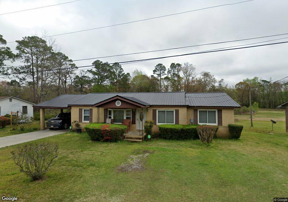
431 Robin Rd Swainsboro, GA 30401
Estimated Value: $120,340 - $180,000
3
Beds
1
Bath
1,644
Sq Ft
$94/Sq Ft
Est. Value
About This Home
This home is located at 431 Robin Rd, Swainsboro, GA 30401 and is currently estimated at $154,835, approximately $94 per square foot. 431 Robin Rd is a home located in Emanuel County with nearby schools including Swainsboro Primary School, Swainsboro Elementary School, and Swainsboro Middle School.
Ownership History
Date
Name
Owned For
Owner Type
Purchase Details
Closed on
Mar 24, 1999
Sold by
Quarterman Christine
Bought by
Quarterman Gregory
Current Estimated Value
Purchase Details
Closed on
Oct 28, 1991
Bought by
Quarterman Moses and Quarterman Hr
Create a Home Valuation Report for This Property
The Home Valuation Report is an in-depth analysis detailing your home's value as well as a comparison with similar homes in the area
Home Values in the Area
Average Home Value in this Area
Purchase History
| Date | Buyer | Sale Price | Title Company |
|---|---|---|---|
| Quarterman Gregory | -- | -- | |
| Quarterman Moses | -- | -- |
Source: Public Records
Tax History Compared to Growth
Tax History
| Year | Tax Paid | Tax Assessment Tax Assessment Total Assessment is a certain percentage of the fair market value that is determined by local assessors to be the total taxable value of land and additions on the property. | Land | Improvement |
|---|---|---|---|---|
| 2024 | $1,642 | $43,226 | $860 | $42,366 |
| 2023 | $588 | $39,693 | $860 | $38,832 |
| 2022 | $786 | $33,676 | $860 | $32,816 |
| 2021 | $748 | $31,524 | $748 | $30,776 |
| 2020 | $597 | $24,339 | $1,200 | $23,139 |
| 2019 | $597 | $24,339 | $1,200 | $23,139 |
| 2018 | $643 | $24,339 | $1,200 | $23,139 |
| 2017 | $644 | $24,278 | $1,200 | $23,078 |
| 2016 | $591 | $24,278 | $1,200 | $23,078 |
| 2015 | -- | $24,278 | $1,200 | $23,078 |
| 2014 | -- | $23,228 | $1,200 | $22,028 |
| 2013 | -- | $23,111 | $1,200 | $21,911 |
Source: Public Records
Map
Nearby Homes
- 14.53 ACRES Gumlog Rd
- 625 N Main St
- 1513 Paris Ave
- 646 N Main St
- 217 Fowler St
- 402 N Main St
- 400 N Main St
- 629 Thompson Rd
- 219 Loblolly Dr
- 219 Lucky St
- 327 W Church St
- 508 Barbara Ave
- 0 S Highway 1 Unit 10340744
- 323 N Main St
- 211 Wells St
- 423 E Martin Luther King Junior Blvd
- 625 Allen St Unit 12
- 316 W Moring St
- 547 W Moring St
- 0 Modoc Rd Unit 10587358