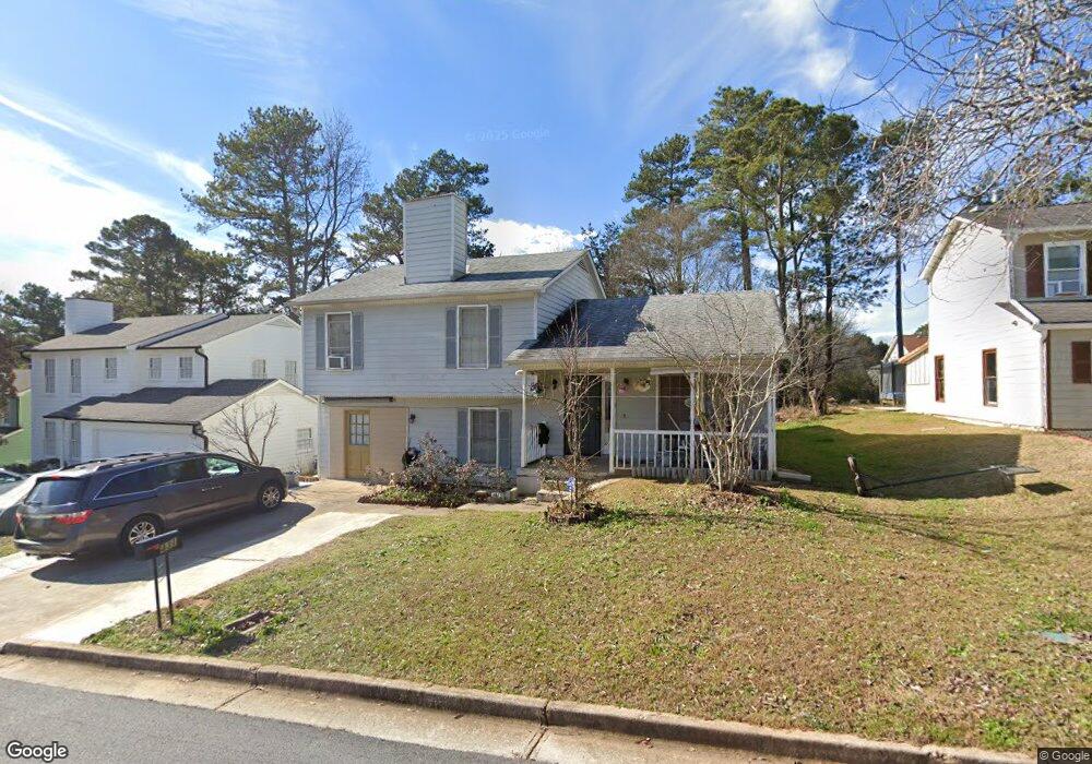
431 Sheppard Crook Unit 431 Stone Mountain, GA 30083
Estimated Value: $239,262 - $291,000
3
Beds
2
Baths
1,488
Sq Ft
$171/Sq Ft
Est. Value
About This Home
This home is located at 431 Sheppard Crook Unit 431, Stone Mountain, GA 30083 and is currently estimated at $255,066, approximately $171 per square foot. 431 Sheppard Crook Unit 431 is a home located in DeKalb County with nearby schools including Allgood Elementary School, Freedom Middle School, and Clarkston High School.
Ownership History
Date
Name
Owned For
Owner Type
Purchase Details
Closed on
Jun 5, 2018
Sold by
Binti Bilal Rahimah
Bought by
Binti Bilal Rahimah and Hussain Mohamad Amin Nazir
Current Estimated Value
Home Financials for this Owner
Home Financials are based on the most recent Mortgage that was taken out on this home.
Original Mortgage
$114,147
Outstanding Balance
$99,064
Interest Rate
4.75%
Mortgage Type
FHA
Estimated Equity
$156,002
Purchase Details
Closed on
May 25, 1999
Sold by
Mckenney Vicki K
Bought by
Hamilton Stacey and Hamilton Darren
Home Financials for this Owner
Home Financials are based on the most recent Mortgage that was taken out on this home.
Original Mortgage
$95,861
Interest Rate
6.84%
Mortgage Type
FHA
Create a Home Valuation Report for This Property
The Home Valuation Report is an in-depth analysis detailing your home's value as well as a comparison with similar homes in the area
Home Values in the Area
Average Home Value in this Area
Purchase History
| Date | Buyer | Sale Price | Title Company |
|---|---|---|---|
| Binti Bilal Rahimah | -- | -- | |
| Binti Bilal Rahimah | $120,000 | -- | |
| Hamilton Stacey | $96,000 | -- |
Source: Public Records
Mortgage History
| Date | Status | Borrower | Loan Amount |
|---|---|---|---|
| Open | Binti Bilal Rahimah | $114,147 | |
| Closed | Binti Bilal Rahimah | $114,147 | |
| Previous Owner | Hamilton Stacey | $95,861 |
Source: Public Records
Tax History Compared to Growth
Tax History
| Year | Tax Paid | Tax Assessment Tax Assessment Total Assessment is a certain percentage of the fair market value that is determined by local assessors to be the total taxable value of land and additions on the property. | Land | Improvement |
|---|---|---|---|---|
| 2025 | $4,513 | $93,560 | $16,160 | $77,400 |
| 2024 | $4,252 | $87,640 | $16,160 | $71,480 |
| 2023 | $4,252 | $92,480 | $16,160 | $76,320 |
| 2022 | $3,640 | $75,800 | $15,000 | $60,800 |
| 2021 | $2,808 | $56,840 | $6,160 | $50,680 |
| 2020 | $2,372 | $46,920 | $6,160 | $40,760 |
| 2019 | $2,127 | $41,320 | $6,160 | $35,160 |
| 2018 | $1,406 | $33,440 | $6,160 | $27,280 |
| 2017 | $1,683 | $31,080 | $6,160 | $24,920 |
| 2016 | $1,533 | $27,600 | $6,160 | $21,440 |
| 2014 | $1,068 | $16,680 | $6,160 | $10,520 |
Source: Public Records
Map
Nearby Homes
- 440 Sheppard Xing Ct
- 488 Barclay Ct
- 550 S Rays (8 6 Acres) Rd
- 550 S Rays Rd
- 573 Allgood Rd
- 534 Woodcrest Manor Dr
- 550 S Rays (9 74 Acres) Rd
- 4328 Rockbridge Rd
- 4556 Forrest Rd
- 494 Rue Montaigne
- 4610 Rockbridge Rd
- 4250 Village Square Ln
- 539 Rue Montaigne
- 4238 Rue Saint Michel
- 487 Magnolia Dr
- 4210 Rockbridge Rd
- 539 Prince of Wales
- 573 Hambrick Square
- 497 Prince of Wales
- 498 Prince of Wales
- 431 Sheppard Crook Unit 24
- 431 Sheppard Crook
- 437 Sheppard Crook
- 427 Sheppard Crook
- 434 Sheppard Xing Ct Unit 3
- 441 Sheppard Crook
- 430 Sheppard Xing Ct
- 423 Sheppard Crook
- 424 Sheppard Xing Ct
- 440 Sheppard Crossing Ct
- 432 Sheppard Crook
- 438 Sheppard Crook
- 444 Sheppard Xing Ct
- 447 Sheppard Crook
- 428 Sheppard Crook
- 428 Sheppard Crook Unit 2/16
- 442 Sheppard Crook
- 0 Sheppard Crook Unit 9021722
- 0 Sheppard Crook Unit 8877281
- 0 Sheppard Crook Unit 7053330