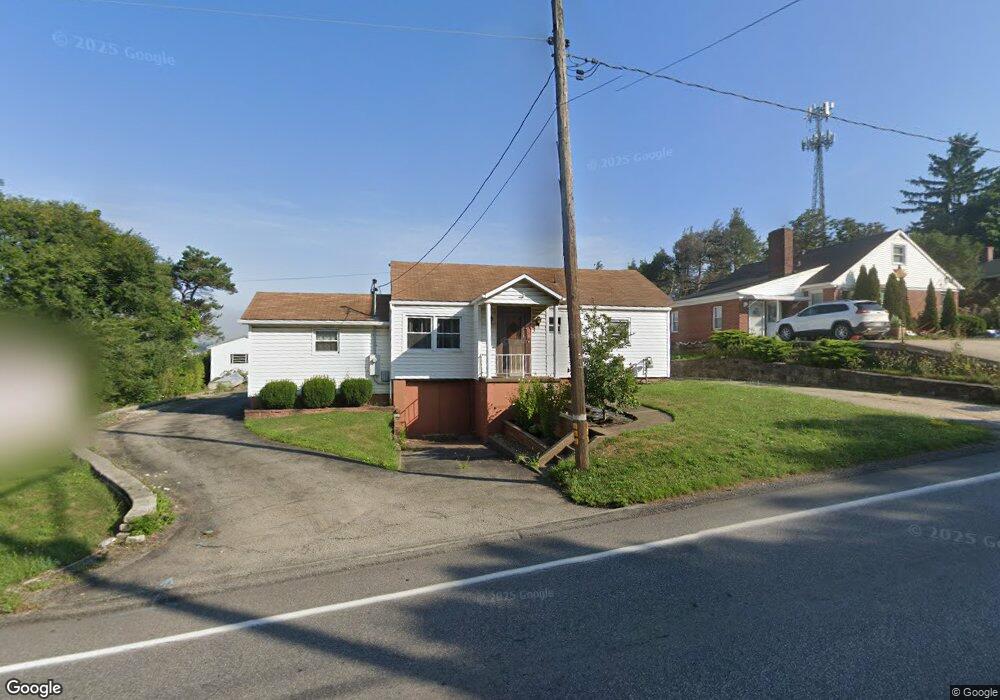
431 Stoystown Rd Somerset, PA 15501
Estimated Value: $108,000 - $186,000
3
Beds
1
Bath
1,056
Sq Ft
$139/Sq Ft
Est. Value
About This Home
This home is located at 431 Stoystown Rd, Somerset, PA 15501 and is currently estimated at $147,042, approximately $139 per square foot. 431 Stoystown Rd is a home located in Somerset County with nearby schools including Maple Ridge Elementary School, Eagle View Elementary School, and Somerset Area Junior/Senior High School.
Ownership History
Date
Name
Owned For
Owner Type
Purchase Details
Closed on
Jun 14, 2013
Sold by
Ankney Lewis A and Ankney Ray Ellen
Bought by
Ankney Tyler
Current Estimated Value
Home Financials for this Owner
Home Financials are based on the most recent Mortgage that was taken out on this home.
Original Mortgage
$89,636
Outstanding Balance
$63,819
Interest Rate
3.51%
Mortgage Type
VA
Estimated Equity
$83,223
Purchase Details
Closed on
Jun 3, 2011
Sold by
Gross Charles and Gross Sandra
Bought by
Ankney Lewis A and Ankney Ray Allen
Home Financials for this Owner
Home Financials are based on the most recent Mortgage that was taken out on this home.
Original Mortgage
$86,250
Interest Rate
4.74%
Mortgage Type
New Conventional
Create a Home Valuation Report for This Property
The Home Valuation Report is an in-depth analysis detailing your home's value as well as a comparison with similar homes in the area
Home Values in the Area
Average Home Value in this Area
Purchase History
| Date | Buyer | Sale Price | Title Company |
|---|---|---|---|
| Ankney Tyler | -- | None Available | |
| Ankney Lewis A | $115,000 | None Available |
Source: Public Records
Mortgage History
| Date | Status | Borrower | Loan Amount |
|---|---|---|---|
| Open | Ankney Tyler | $89,636 | |
| Closed | Ankney Lewis A | $86,250 |
Source: Public Records
Tax History Compared to Growth
Tax History
| Year | Tax Paid | Tax Assessment Tax Assessment Total Assessment is a certain percentage of the fair market value that is determined by local assessors to be the total taxable value of land and additions on the property. | Land | Improvement |
|---|---|---|---|---|
| 2025 | $1,579 | $25,560 | $0 | $0 |
| 2024 | $1,579 | $25,560 | $0 | $0 |
| 2023 | $1,534 | $25,560 | $0 | $0 |
| 2022 | $1,488 | $25,560 | $0 | $0 |
| 2021 | $1,448 | $25,560 | $0 | $0 |
| 2020 | $1,448 | $25,560 | $0 | $0 |
| 2019 | $1,448 | $25,560 | $0 | $0 |
| 2018 | $1,448 | $25,560 | $5,240 | $20,320 |
| 2017 | $1,448 | $25,560 | $5,240 | $20,320 |
| 2016 | -- | $25,560 | $5,240 | $20,320 |
| 2015 | -- | $25,550 | $5,235 | $20,315 |
| 2014 | -- | $25,550 | $5,235 | $20,315 |
Source: Public Records
Map
Nearby Homes
- 102 Lillian Ln
- 403 Rebecca St
- 218 Missoura St
- 213 Stoystown Rd
- 129 Missoura St
- 575 Stoystown Rd
- 120 W Catherine St
- 527 N Edgewood Ave
- 158 W Union St
- 127 W Main St
- 711 E Main St
- 348 W Catherine St
- 100 Burgess St
- 372 Lincoln St
- 0 E Garrett St
- 331 W Main St
- 152 E Garrett St
- 726 Stoystown Rd
- 248 Plank Rd
- Lot 32 Gilmour Rd
- 433 Stoystown Rd
- 427 Stoystown Rd
- 437 Stoystown Rd
- 428 Stoystown Rd
- 0 W Arlington Dr
- . W Arlington Dr
- 438 Stoystown Rd
- 444 Stoystown Rd
- 413 Stoystown Rd
- 107 Locust St
- 130 Meadow St
- 450 Stoystown Rd
- 406 Stoystown Rd
- 128 W Arlington Dr
- 125 Locust St
- 115 Meadow St
- 132 Locust St
- 127 Meadow St
- 457 Stoystown Rd
- 135 Meadow St