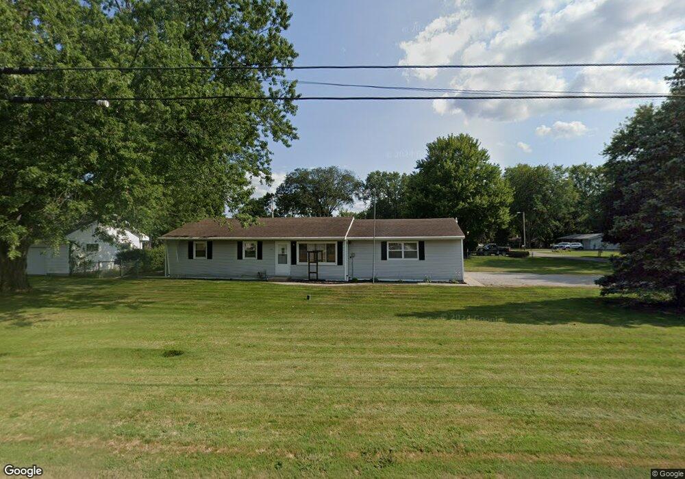
431 W Airport Hwy Swanton, OH 43558
Estimated Value: $166,000 - $201,000
3
Beds
1
Bath
1,040
Sq Ft
$180/Sq Ft
Est. Value
About This Home
This home is located at 431 W Airport Hwy, Swanton, OH 43558 and is currently estimated at $187,353, approximately $180 per square foot. 431 W Airport Hwy is a home located in Fulton County with nearby schools including Swanton High School, Swanton Middle School, and St. Richard School.
Ownership History
Date
Name
Owned For
Owner Type
Purchase Details
Closed on
Oct 24, 2022
Sold by
Hester Jay C
Bought by
Hester Glynis R
Current Estimated Value
Purchase Details
Closed on
Sep 14, 2016
Sold by
Steusloff Nicholas P
Bought by
Hester Jay and Hester Glynis
Home Financials for this Owner
Home Financials are based on the most recent Mortgage that was taken out on this home.
Original Mortgage
$98,940
Interest Rate
3.45%
Mortgage Type
New Conventional
Purchase Details
Closed on
Mar 17, 2010
Sold by
Steusloff Larry G and Steusloff Peggy J
Bought by
Steusloff Larry G
Create a Home Valuation Report for This Property
The Home Valuation Report is an in-depth analysis detailing your home's value as well as a comparison with similar homes in the area
Home Values in the Area
Average Home Value in this Area
Purchase History
| Date | Buyer | Sale Price | Title Company |
|---|---|---|---|
| Hester Glynis R | -- | -- | |
| Hester Jay | $102,500 | Port Lawrence-First Amer Tit | |
| Steusloff Larry G | -- | Attorney |
Source: Public Records
Mortgage History
| Date | Status | Borrower | Loan Amount |
|---|---|---|---|
| Previous Owner | Hester Jay | $98,940 |
Source: Public Records
Tax History Compared to Growth
Tax History
| Year | Tax Paid | Tax Assessment Tax Assessment Total Assessment is a certain percentage of the fair market value that is determined by local assessors to be the total taxable value of land and additions on the property. | Land | Improvement |
|---|---|---|---|---|
| 2024 | $2,004 | $49,390 | $10,220 | $39,170 |
| 2023 | $2,028 | $49,390 | $10,220 | $39,170 |
| 2022 | $1,652 | $36,480 | $8,510 | $27,970 |
| 2021 | $1,752 | $36,480 | $8,510 | $27,970 |
| 2020 | $1,776 | $36,480 | $8,510 | $27,970 |
| 2019 | $1,424 | $28,320 | $8,510 | $19,810 |
| 2018 | $1,122 | $28,320 | $8,510 | $19,810 |
| 2017 | $1,113 | $28,320 | $8,510 | $19,810 |
| 2016 | $875 | $25,030 | $8,510 | $16,520 |
| 2015 | $829 | $25,030 | $8,510 | $16,520 |
| 2014 | $846 | $25,030 | $8,510 | $16,520 |
| 2013 | $1,127 | $30,350 | $8,020 | $22,330 |
Source: Public Records
Map
Nearby Homes
- 7893 County Road 2
- 510 S Main St
- 214 Franklin Ave
- 227 Kierra Ln
- 103 Cherry St
- 404 E Garfield Ave
- 407 E Garfield Ave
- 433 Church St
- 6854 County Road 3
- 0 Waterwood Dr
- 225 Kierra Ln
- 204 Hickory St
- 6042 County Road 1-1
- 215 Hickory St
- 1200 County Road F
- 4303 S Berkey Southern Rd
- 4555 S Fulton Lucas Rd
- 13645 Shaffer Rd
- 3121 County Road Ef
- 2076 County Rd E
- 421 W Airport Hwy
- 439 W Airport Hwy
- 1902 U S 20a
- 1962 Us Highway 20
- 303 S Munson Rd
- 233 S Munson Rd
- 7493 County Road 2
- 231 S Munson Rd
- LOT 2 County Road 2
- LOT 4 County Road 2
- LOT 3 County Road 2
- LOT 1 County Road 2
- LOT 13 County Road 2
- 7289 County Road 2
- 7268 County Road 2
- 7267 County Road 2
- 74/1 County Road 2
- 229 S Munson Rd
- 2043 Holiday Dr Unit 1
- 7228 County Road 2