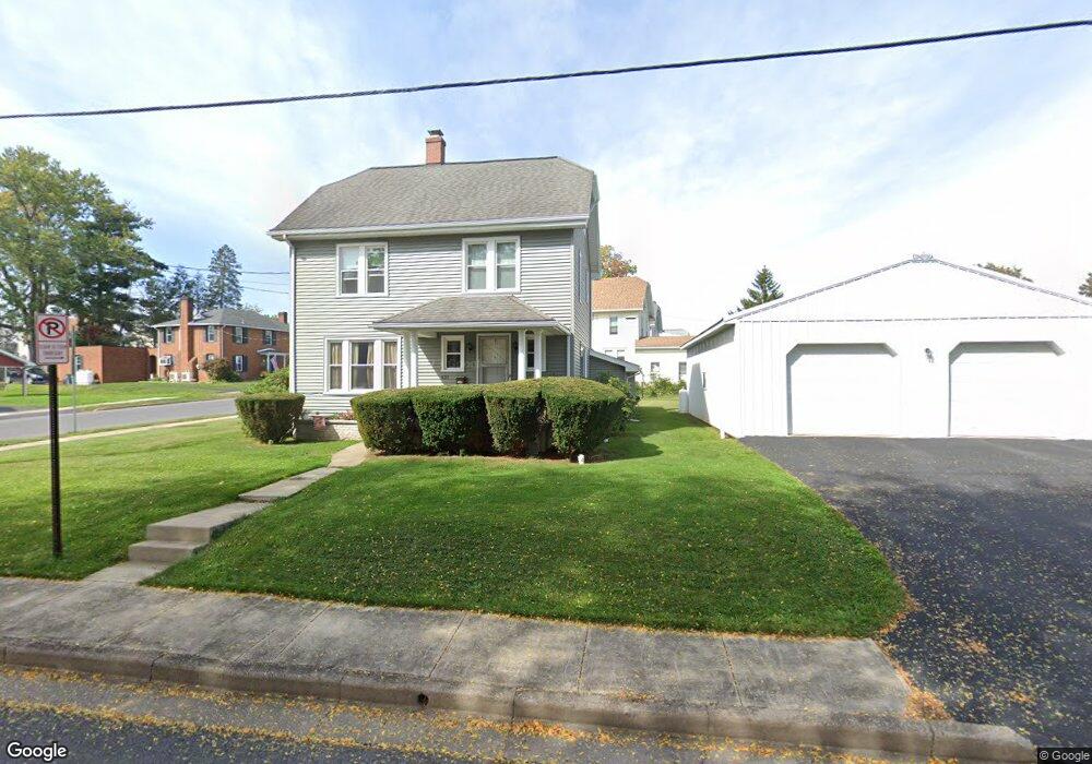
431 W Walnut St Lock Haven, PA 17745
Estimated Value: $181,535 - $215,000
3
Beds
1
Bath
1,780
Sq Ft
$112/Sq Ft
Est. Value
About This Home
This home is located at 431 W Walnut St, Lock Haven, PA 17745 and is currently estimated at $199,634, approximately $112 per square foot. 431 W Walnut St is a home located in Clinton County with nearby schools including Lock Haven Christian School, Lock Haven Catholic Elementary School, and Wordsong Christian School.
Ownership History
Date
Name
Owned For
Owner Type
Purchase Details
Closed on
Jul 11, 2022
Sold by
Gail Ott
Bought by
Ott Gail and Ott Lester
Current Estimated Value
Home Financials for this Owner
Home Financials are based on the most recent Mortgage that was taken out on this home.
Original Mortgage
$81,100
Outstanding Balance
$66,811
Interest Rate
2.93%
Mortgage Type
VA
Estimated Equity
$132,823
Purchase Details
Closed on
Mar 16, 2009
Sold by
Grand Wesley P and Grand Lynda A
Bought by
Jones Randy and Jones Gail
Home Financials for this Owner
Home Financials are based on the most recent Mortgage that was taken out on this home.
Original Mortgage
$98,430
Interest Rate
5.14%
Mortgage Type
New Conventional
Purchase Details
Closed on
Oct 1, 1985
Bought by
Jones Gail Et Vir
Create a Home Valuation Report for This Property
The Home Valuation Report is an in-depth analysis detailing your home's value as well as a comparison with similar homes in the area
Home Values in the Area
Average Home Value in this Area
Purchase History
| Date | Buyer | Sale Price | Title Company |
|---|---|---|---|
| Ott Gail | -- | New Title Company Name | |
| Jones Randy | $95,700 | None Available | |
| Jones Gail Et Vir | $39,500 | -- |
Source: Public Records
Mortgage History
| Date | Status | Borrower | Loan Amount |
|---|---|---|---|
| Open | Ott Gail | $81,100 | |
| Previous Owner | Jones Randy | $98,430 |
Source: Public Records
Tax History Compared to Growth
Tax History
| Year | Tax Paid | Tax Assessment Tax Assessment Total Assessment is a certain percentage of the fair market value that is determined by local assessors to be the total taxable value of land and additions on the property. | Land | Improvement |
|---|---|---|---|---|
| 2025 | $5,152 | $101,200 | $19,000 | $82,200 |
| 2024 | $5,536 | $101,200 | $19,000 | $82,200 |
| 2023 | $5,429 | $101,200 | $19,000 | $82,200 |
| 2022 | $5,429 | $101,200 | $19,000 | $82,200 |
| 2021 | $5,205 | $101,200 | $19,000 | $82,200 |
| 2020 | $5,207 | $101,200 | $0 | $0 |
| 2019 | $5,161 | $101,200 | $0 | $0 |
| 2018 | $2,850 | $101,200 | $0 | $0 |
| 2017 | $2,819 | $101,200 | $0 | $0 |
| 2016 | $2,557 | $101,200 | $0 | $0 |
| 2015 | $2,499 | $101,200 | $0 | $0 |
| 2014 | $2,548 | $101,200 | $0 | $0 |
Source: Public Records
Map
Nearby Homes
- 101 Pearl St
- 205 Rose St
- 329 W Clinton St
- 319 Logan St
- 38 N Fairview St
- 16 N Jones St
- 310 W Clinton St
- 42 N Fairview St
- 908 W 3rd St
- 908 W 3rd St Unit LOT 15
- 468 W 4th St
- 77 N Fairview St
- 65 Spring St
- 116 Irwin St
- 130 N Fairview St
- 220 W Church St
- 1045 W 4th St
- 385 Herr St
- 55 W Main St
- 520 W Main St