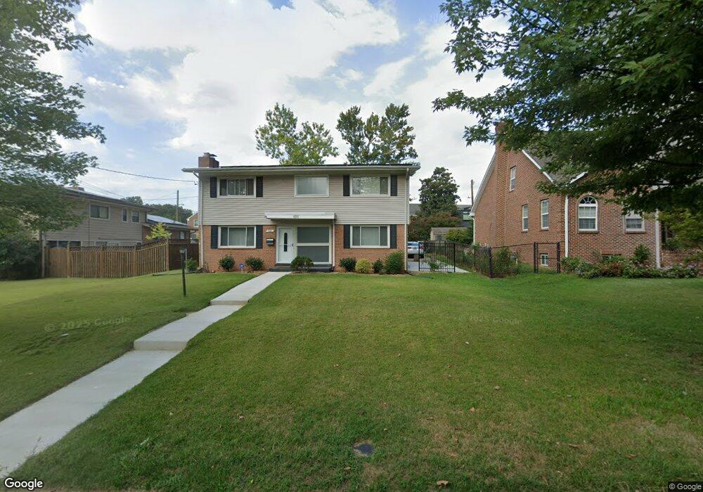
4310 20th St NE Washington, DC 20018
Woodridge NeighborhoodEstimated Value: $693,000 - $771,973
4
Beds
3
Baths
1,850
Sq Ft
$399/Sq Ft
Est. Value
About This Home
This home is located at 4310 20th St NE, Washington, DC 20018 and is currently estimated at $738,993, approximately $399 per square foot. 4310 20th St NE is a home located in District of Columbia with nearby schools including Bunker Hill Elementary School, Brookland Middle School, and Dunbar High School.
Ownership History
Date
Name
Owned For
Owner Type
Purchase Details
Closed on
Jul 20, 2009
Sold by
Ray Sarah E
Bought by
Woody Thomas J
Current Estimated Value
Home Financials for this Owner
Home Financials are based on the most recent Mortgage that was taken out on this home.
Original Mortgage
$375,920
Outstanding Balance
$247,697
Interest Rate
5.58%
Mortgage Type
New Conventional
Estimated Equity
$491,296
Create a Home Valuation Report for This Property
The Home Valuation Report is an in-depth analysis detailing your home's value as well as a comparison with similar homes in the area
Home Values in the Area
Average Home Value in this Area
Purchase History
| Date | Buyer | Sale Price | Title Company |
|---|---|---|---|
| Woody Thomas J | $469,900 | -- |
Source: Public Records
Mortgage History
| Date | Status | Borrower | Loan Amount |
|---|---|---|---|
| Open | Woody Thomas J | $375,920 |
Source: Public Records
Tax History Compared to Growth
Tax History
| Year | Tax Paid | Tax Assessment Tax Assessment Total Assessment is a certain percentage of the fair market value that is determined by local assessors to be the total taxable value of land and additions on the property. | Land | Improvement |
|---|---|---|---|---|
| 2025 | $5,493 | $736,100 | $375,510 | $360,590 |
| 2024 | $5,388 | $720,970 | $373,700 | $347,270 |
| 2023 | $5,173 | $695,330 | $360,780 | $334,550 |
| 2022 | $4,748 | $637,290 | $325,690 | $311,600 |
| 2021 | $4,552 | $611,920 | $320,860 | $291,060 |
| 2020 | $4,447 | $598,850 | $314,160 | $284,690 |
| 2019 | $4,248 | $574,670 | $295,540 | $279,130 |
| 2018 | $4,122 | $558,290 | $0 | $0 |
| 2017 | $3,882 | $529,180 | $0 | $0 |
| 2016 | $3,588 | $493,840 | $0 | $0 |
| 2015 | $3,495 | $482,600 | $0 | $0 |
| 2014 | $3,303 | $458,790 | $0 | $0 |
Source: Public Records
Map
Nearby Homes
- 4200 19th St NE
- 4417 20th St NE
- 4016 21st St NE
- 1821 Shepherd St NE
- 1719 Taylor St NE
- 1739 Allison St NE
- 1929 Randolph St NE
- 3921 22nd St NE
- 3811 S Dakota Ave NE
- 4716 Queens Chapel Terrace NE
- 2004 Perry St NE
- 2107 Brighton Rd
- 1612 Buchanan St NE
- 1604 Crittenden St NE
- 1355 Michigan Ave NE
- 4210 29th St
- 2222 Otis St NE
- 1828 Newton St NE
- 1617 Otis St NE
- 4414 13th Place NE
- 4316 20th St NE
- 1920 Upshur St NE
- 4309 19th Place NE
- 4313 19th Place NE
- 4305 19th Place NE
- 4317 19th Place NE
- 1933 Varnum St NE
- 4336 20th St NE
- 1929 Varnum St NE
- 1925 Varnum St NE
- 4309 20th St NE
- 4313 20th St NE
- 4305 20th St NE
- 4335 19th Place NE
- 4317 20th St NE
- 2000 Upshur St NE
- 1925 Upshur St NE
- 4321 20th St NE
- 4325 20th St NE
- 1923 Upshur St NE