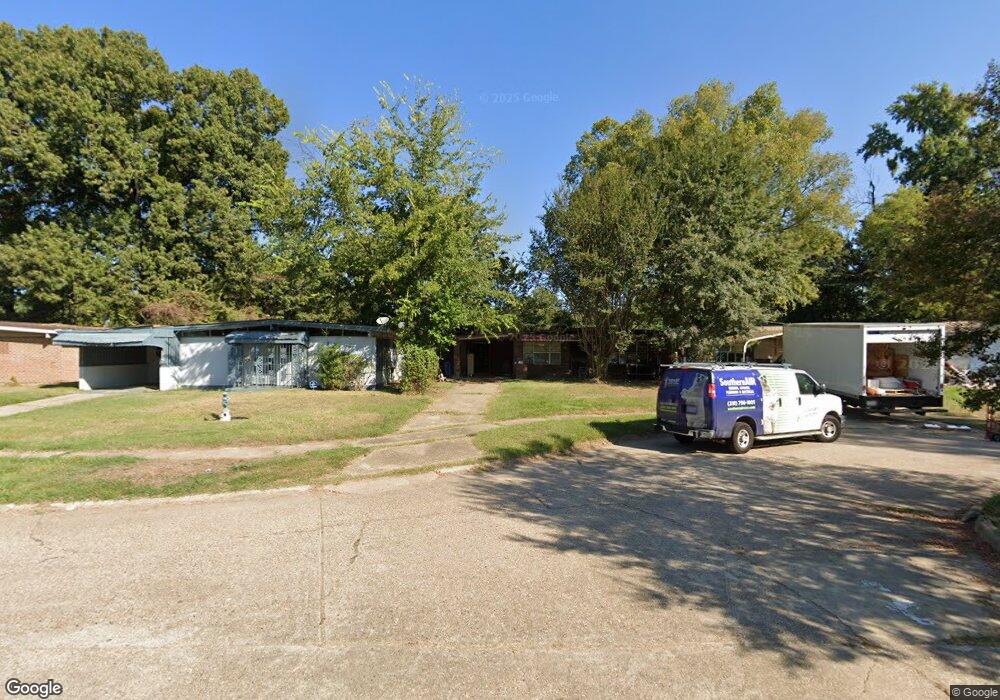
4310 Cole Place Shreveport, LA 71109
Mooretown and Hollywood Heights NeighborhoodEstimated Value: $14,760 - $52,000
--
Bed
--
Bath
1,499
Sq Ft
$25/Sq Ft
Est. Value
About This Home
This home is located at 4310 Cole Place, Shreveport, LA 71109 and is currently estimated at $38,190, approximately $25 per square foot. 4310 Cole Place is a home located in Caddo Parish with nearby schools including Oak Park Elementary School, Judson Fundamental Elementary School, and Fairfield Magnet School.
Ownership History
Date
Name
Owned For
Owner Type
Purchase Details
Closed on
Dec 30, 2024
Sold by
Tuke Properties Llc
Bought by
Redic Real Estate Investments Llc
Current Estimated Value
Purchase Details
Closed on
May 15, 2012
Sold by
Chaff Londell and Goldston-Chaff Irene
Bought by
New Song Investments Llc
Home Financials for this Owner
Home Financials are based on the most recent Mortgage that was taken out on this home.
Original Mortgage
$200,000
Interest Rate
4.02%
Mortgage Type
Unknown
Create a Home Valuation Report for This Property
The Home Valuation Report is an in-depth analysis detailing your home's value as well as a comparison with similar homes in the area
Home Values in the Area
Average Home Value in this Area
Purchase History
| Date | Buyer | Sale Price | Title Company |
|---|---|---|---|
| Redic Real Estate Investments Llc | $14,000 | Landowners Abstract & Title | |
| New Song Investments Llc | $24,500 | None Available |
Source: Public Records
Mortgage History
| Date | Status | Borrower | Loan Amount |
|---|---|---|---|
| Previous Owner | New Song Investments Llc | $200,000 |
Source: Public Records
Tax History Compared to Growth
Tax History
| Year | Tax Paid | Tax Assessment Tax Assessment Total Assessment is a certain percentage of the fair market value that is determined by local assessors to be the total taxable value of land and additions on the property. | Land | Improvement |
|---|---|---|---|---|
| 2024 | $551 | $3,534 | $723 | $2,811 |
| 2023 | $558 | $3,500 | $689 | $2,811 |
| 2022 | $558 | $3,500 | $689 | $2,811 |
| 2021 | $549 | $3,500 | $689 | $2,811 |
| 2020 | $549 | $3,500 | $689 | $2,811 |
| 2019 | $610 | $3,773 | $689 | $3,084 |
| 2018 | $486 | $3,773 | $689 | $3,084 |
| 2017 | $620 | $3,773 | $689 | $3,084 |
| 2015 | $525 | $4,050 | $690 | $3,360 |
| 2014 | $529 | $4,050 | $690 | $3,360 |
| 2013 | -- | $4,050 | $690 | $3,360 |
Source: Public Records
Map
Nearby Homes
- 4814 Mcdaniel Dr
- 4513 Rochester Dr
- 4310 Saint Louis Ave
- 4302 Illinois Ave
- 5717 Fallowmont St
- 5600 Norton St
- 4144 Clover St
- 5222 Broadway Ave
- 3 Broadway Ave
- 2 Broadway Ave
- 1 Broadway Ave
- 4209 Lamar Ave
- 4710 Erin Ln
- 4138 Powell St
- 4144 Marston Ave
- 4738 3l Westwood Park Dr
- 4136 Mayfield St
- 4130 Mayfield St
- 3735 Tate St
- 4210 Via St
- 4314 Cole Place
- 4306 Cole Place
- 4318 Cole Place
- 4383 Walter St
- 4381 Walter St
- 4385 Walter St
- 4317 Cole Place
- 4379 Walter St
- 4326 Cole Place
- 4305 Cole Place
- 4321 Cole Place
- 4313 Cole Place
- 4377 Walter St
- 4309 Cole Place
- 4330 Cole Place
- 4325 Cole Place
- 4375 Walter St
- 4329 Cole Place
- 4334 Cole Place
- 4626 Alton St