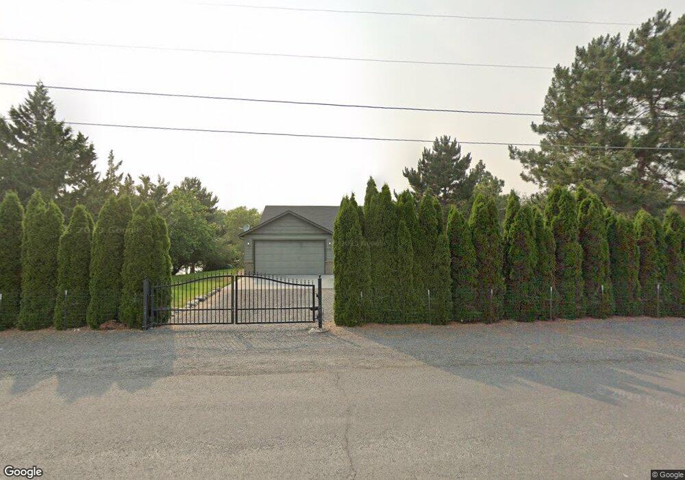
4310 Shorecrest Dr NE Moses Lake, WA 98837
Estimated Value: $697,000 - $893,668
4
Beds
3
Baths
1,840
Sq Ft
$430/Sq Ft
Est. Value
About This Home
This home is located at 4310 Shorecrest Dr NE, Moses Lake, WA 98837 and is currently estimated at $791,417, approximately $430 per square foot. 4310 Shorecrest Dr NE is a home located in Grant County with nearby schools including Larson Heights Elementary School, Endeavor Middle School, and Moses Lake High School.
Ownership History
Date
Name
Owned For
Owner Type
Purchase Details
Closed on
Dec 21, 2011
Sold by
Wright Scott and Wright Joyce O
Bought by
Pozzi Clinton Dewaine and Pozzi Christie Ann
Current Estimated Value
Purchase Details
Closed on
Feb 13, 2009
Sold by
Wright Donald E and Wright Alma J
Bought by
Wright Scott and Wright Joyce O
Purchase Details
Closed on
Aug 26, 2008
Sold by
Wright Scott and Donald E & Alma J Wright Trust
Bought by
Wright Scott and Wright Joyce O
Create a Home Valuation Report for This Property
The Home Valuation Report is an in-depth analysis detailing your home's value as well as a comparison with similar homes in the area
Home Values in the Area
Average Home Value in this Area
Purchase History
| Date | Buyer | Sale Price | Title Company |
|---|---|---|---|
| Pozzi Clinton Dewaine | $125,000 | Stewart Title | |
| Wright Scott | -- | None Available | |
| Wright Scott | -- | None Available | |
| Wright Scott | -- | None Available |
Source: Public Records
Tax History Compared to Growth
Tax History
| Year | Tax Paid | Tax Assessment Tax Assessment Total Assessment is a certain percentage of the fair market value that is determined by local assessors to be the total taxable value of land and additions on the property. | Land | Improvement |
|---|---|---|---|---|
| 2024 | $7,745 | $679,895 | $143,000 | $536,895 |
| 2023 | $6,866 | $542,475 | $143,000 | $399,475 |
| 2022 | $6,223 | $542,475 | $143,000 | $399,475 |
| 2021 | $3,861 | $542,475 | $143,000 | $399,475 |
| 2020 | $5,241 | $322,695 | $143,000 | $179,695 |
| 2019 | $5,112 | $367,225 | $134,000 | $233,225 |
| 2018 | $5,853 | $386,600 | $134,000 | $252,600 |
| 2017 | $5,751 | $372,565 | $134,000 | $238,565 |
| 2016 | $5,958 | $378,605 | $134,000 | $244,605 |
| 2013 | -- | $339,720 | $100,000 | $239,720 |
Source: Public Records
Map
Nearby Homes
- 4114 Shorecrest Dr NE
- 4898 Shorecrest Dr NE
- 4926 Shorecrest Dr NE
- 7613 Cox St NE
- 7887 Dahl Rd NE
- 6401 Farrer Way
- 6354 Murray Way NE
- 3406 Wild Goose Rd NE
- 4268 Hedman Ct
- 4815 Airway Dr NE Unit 12
- 4815 Airway Dr NE Unit 105
- 7322 Blue Goose Rd NE
- 8334 8336 Terminal St NE
- 4095 Quinn Dr NE Unit A-4
- 9035 Forrestal Ln
- 3348 Westshore Dr NE
- 802 Lindberg Ln
- 410 Biggs Dr NE
- 9008 Bong Loop Unit B
- 8654 Broad St NE
- 4330 Shorecrest Dr NE
- 4296 Shorecrest Dr NE
- 4346 Shorecrest Dr NE
- 4276 Shorecrest Dr NE
- 4362 Shorecrest Dr NE
- 4283 Shorecrest Dr NE
- 4260 Shorecrest Dr NE
- 4382 Shorecrest Dr NE
- 4244 Shorecrest Dr NE
- 4247 Shorecrest Dr NE
- 4398 Shorecrest Dr NE
- 4226 Shorecrest Dr NE
- 4337 Shorecrest Dr NE
- 4213 Shorecrest Dr NE
- 4383 Shorecrest Dr NE
- 4190 Shorecrest Dr NE
- 7316 Redmond Rd NE
- 4172 Shorecrest Dr NE
- 7338 Redmond Rd NE
- 4177 Shorecrest Dr NE