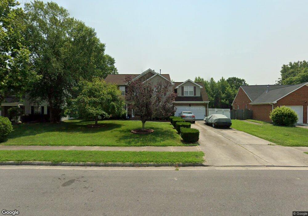
4311 Heron Point Portsmouth, VA 23703
Churchland NeighborhoodEstimated Value: $397,000 - $432,000
3
Beds
3
Baths
2,361
Sq Ft
$176/Sq Ft
Est. Value
About This Home
This home is located at 4311 Heron Point, Portsmouth, VA 23703 and is currently estimated at $415,710, approximately $176 per square foot. 4311 Heron Point is a home located in Portsmouth City with nearby schools including Churchland Primary/Intermediate School, Churchland Middle School, and Churchland High School.
Ownership History
Date
Name
Owned For
Owner Type
Purchase Details
Closed on
Nov 30, 2004
Sold by
Jackson Jack P
Bought by
Mahone Charles and Mitchell,David W
Current Estimated Value
Purchase Details
Closed on
Aug 17, 1999
Sold by
Bishop Green L L C
Bought by
Sartor Timothy
Home Financials for this Owner
Home Financials are based on the most recent Mortgage that was taken out on this home.
Original Mortgage
$132,538
Interest Rate
7.6%
Create a Home Valuation Report for This Property
The Home Valuation Report is an in-depth analysis detailing your home's value as well as a comparison with similar homes in the area
Home Values in the Area
Average Home Value in this Area
Purchase History
| Date | Buyer | Sale Price | Title Company |
|---|---|---|---|
| Mahone Charles | $260,000 | -- | |
| Sartor Timothy | $130,000 | -- |
Source: Public Records
Mortgage History
| Date | Status | Borrower | Loan Amount |
|---|---|---|---|
| Previous Owner | Sartor Timothy | $132,538 |
Source: Public Records
Tax History Compared to Growth
Tax History
| Year | Tax Paid | Tax Assessment Tax Assessment Total Assessment is a certain percentage of the fair market value that is determined by local assessors to be the total taxable value of land and additions on the property. | Land | Improvement |
|---|---|---|---|---|
| 2025 | $4,584 | $386,810 | $114,780 | $272,030 |
| 2024 | $4,584 | $372,710 | $114,780 | $257,930 |
| 2023 | $4,256 | $340,470 | $114,780 | $225,690 |
| 2022 | $4,073 | $313,280 | $95,650 | $217,630 |
| 2021 | $3,539 | $272,200 | $74,720 | $197,480 |
| 2020 | $3,361 | $258,570 | $71,170 | $187,400 |
| 2019 | $3,335 | $256,560 | $71,170 | $185,390 |
| 2018 | $3,335 | $256,560 | $71,170 | $185,390 |
| 2017 | $3,335 | $256,560 | $71,170 | $185,390 |
| 2016 | $3,230 | $248,490 | $71,170 | $177,320 |
| 2015 | $3,152 | $242,450 | $71,170 | $171,280 |
| 2014 | $3,079 | $242,450 | $71,170 | $171,280 |
Source: Public Records
Map
Nearby Homes
- 5833 Hawthorne Ln
- 21 Windy Pines Crescent
- 4224 Burnham Dr
- 4200 Quince Rd
- 8 Compass Ct
- 4100 Mayfair Way
- 4232 Summerset Dr
- 5728 Hawthorne Ln
- 4444 Southampton Arch
- 17 Shoal Ct
- 5807 Dunkin St
- 4071 Long Point Blvd
- 4028 Swannanoa Dr
- 4619 River Shore Rd
- 3433 Willow Breeze Dr
- 3866 Augustine Cir
- 4726 River Shore Rd
- 5606 Gregory Ct
- 3860 Sugar Creek Cir
- 3818 Peach Orchard Cir
- 4307 Heron Point
- 4315 Heron Point
- 4310 Heron Point
- 5919 Eagle Point
- 4306 Heron Point
- 5915 Eagle Point
- 4314 Heron Point
- 4201 White Heron Point
- 4253 Sedgewyck Cir
- 4257 Sedgewyck Cir
- 5911 Eagle Point
- 4205 White Heron Point
- 5927 Eagle Point
- 4249 Sedgewyck Cir
- 4261 Sedgewyck Cir
- 4209 White Heron Point
- 4265 Sedgewyck Cir
- 4403 Pelican Point
- 4322 Heron Point
- 4406 Pelican Point