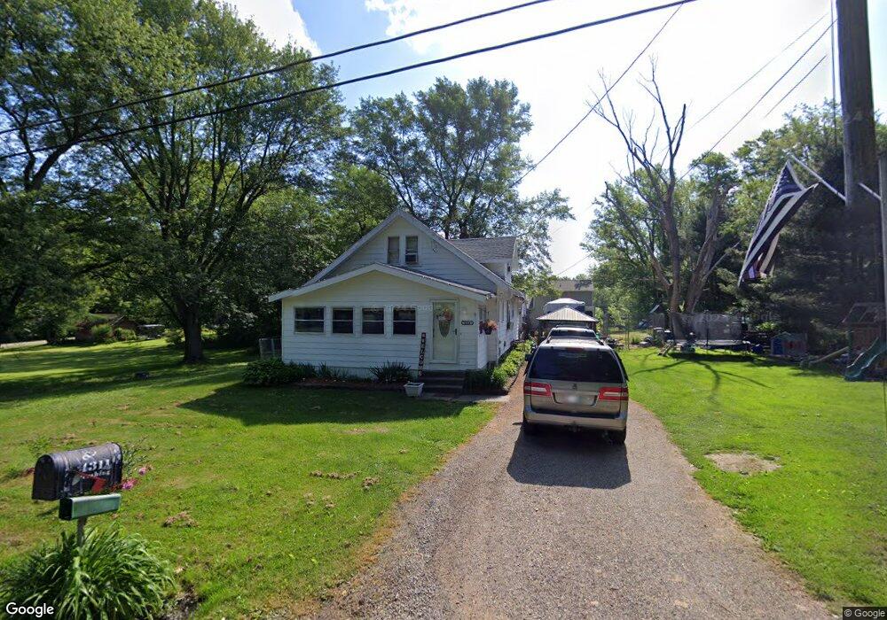
4311 Pershing St Norton, OH 44203
Estimated Value: $131,986 - $212,000
3
Beds
1
Bath
1,147
Sq Ft
$145/Sq Ft
Est. Value
About This Home
This home is located at 4311 Pershing St, Norton, OH 44203 and is currently estimated at $166,497, approximately $145 per square foot. 4311 Pershing St is a home located in Summit County with nearby schools including Norton Primary Elementary School, Norton Middle School, and Norton High School.
Ownership History
Date
Name
Owned For
Owner Type
Purchase Details
Closed on
May 31, 2016
Sold by
Frame Michele
Bought by
Beneficial Financial I Inc
Current Estimated Value
Purchase Details
Closed on
Oct 28, 1998
Sold by
Johnson Arlita R
Bought by
Frame Steven A and Frame Michele
Home Financials for this Owner
Home Financials are based on the most recent Mortgage that was taken out on this home.
Original Mortgage
$76,000
Interest Rate
6.68%
Create a Home Valuation Report for This Property
The Home Valuation Report is an in-depth analysis detailing your home's value as well as a comparison with similar homes in the area
Home Values in the Area
Average Home Value in this Area
Purchase History
| Date | Buyer | Sale Price | Title Company |
|---|---|---|---|
| Beneficial Financial I Inc | $46,000 | None Available | |
| Frame Steven A | $80,000 | Buckeye Reserve Title Agency |
Source: Public Records
Mortgage History
| Date | Status | Borrower | Loan Amount |
|---|---|---|---|
| Previous Owner | Frame Steven A | $76,000 |
Source: Public Records
Tax History Compared to Growth
Tax History
| Year | Tax Paid | Tax Assessment Tax Assessment Total Assessment is a certain percentage of the fair market value that is determined by local assessors to be the total taxable value of land and additions on the property. | Land | Improvement |
|---|---|---|---|---|
| 2025 | $2,994 | $33,446 | $5,278 | $28,168 |
| 2024 | $1,400 | $33,446 | $5,278 | $28,168 |
| 2023 | $2,994 | $33,446 | $5,278 | $28,168 |
| 2022 | $1,298 | $25,477 | $3,938 | $21,539 |
| 2021 | $1,305 | $25,477 | $3,938 | $21,539 |
| 2020 | $1,222 | $25,480 | $3,940 | $21,540 |
| 2019 | $1,295 | $23,710 | $5,650 | $18,060 |
| 2018 | $1,274 | $23,710 | $5,650 | $18,060 |
| 2017 | $1,352 | $23,710 | $5,650 | $18,060 |
| 2016 | $3,158 | $23,060 | $5,650 | $17,410 |
| 2015 | $1,352 | $23,060 | $5,650 | $17,410 |
| 2014 | $1,340 | $23,060 | $5,650 | $17,410 |
| 2013 | $1,425 | $24,780 | $5,650 | $19,130 |
Source: Public Records
Map
Nearby Homes
- 4636 Albert St
- 3978 Bushey Ave
- 3918 Bushey Ave
- 3732 Alumina Dr
- Birch w/ Basement Plan at Brookside Greens - 2-Story
- Aspen w/ Basement Plan at Brookside Greens - 2-Story
- Elder w/ Basement Plan at Brookside Greens - 2-Story
- Cedar w/ Basement Plan at Brookside Greens - 2-Story
- 3923 Higgins Dr
- 4666 Roop Ave
- 3738 Kirkham Dr
- 3433 Greenwich Rd
- 3720 Strawboard Ave
- 3726 Alumina Dr
- 3733 Alumina Dr
- Grand Cayman Plan at Brookside Greens - Ranches
- Eden Cay Plan at Brookside Greens - Ranches
- Aruba Bay Plan at Brookside Greens - Ranches
- Grand Bahama Plan at Brookside Greens - Ranches
- 3873 Easton Rd