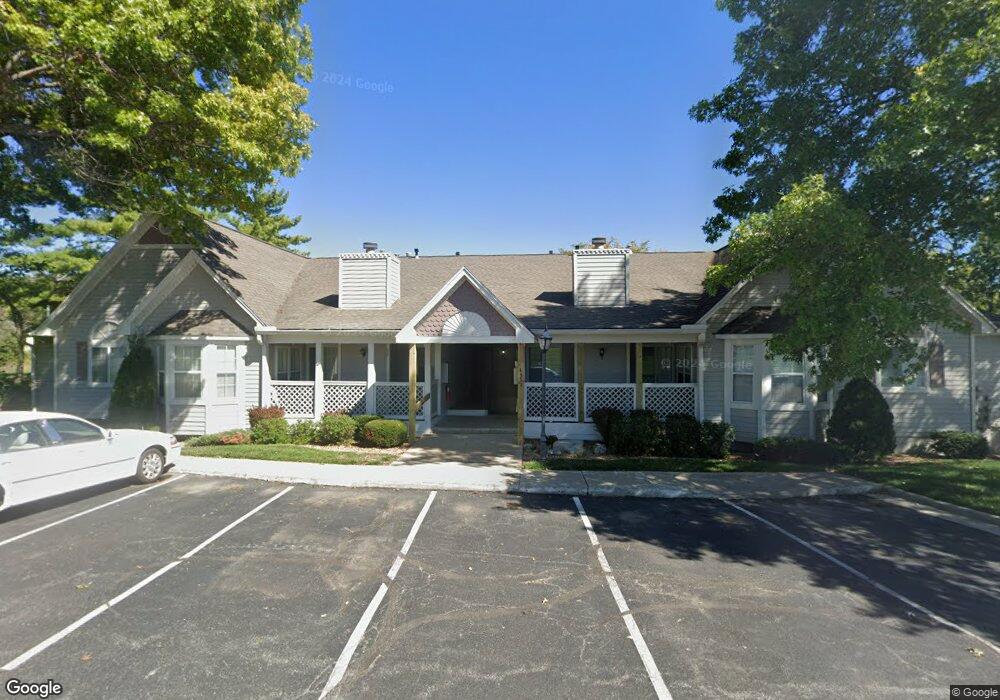
4311 S Megan Ct Unit 26 Independence, MO 64055
39th East NeighborhoodEstimated Value: $172,000 - $188,000
2
Beds
2
Baths
1,321
Sq Ft
$136/Sq Ft
Est. Value
About This Home
This home is located at 4311 S Megan Ct Unit 26, Independence, MO 64055 and is currently estimated at $179,457, approximately $135 per square foot. 4311 S Megan Ct Unit 26 is a home located in Jackson County with nearby schools including William Southern Elementary School, Bridger Middle School, and Pioneer Ridge Middle School.
Ownership History
Date
Name
Owned For
Owner Type
Purchase Details
Closed on
Feb 28, 2020
Sold by
Clairmont James L
Bought by
Sampson Michael L
Current Estimated Value
Home Financials for this Owner
Home Financials are based on the most recent Mortgage that was taken out on this home.
Original Mortgage
$80,000
Outstanding Balance
$54,988
Interest Rate
3.5%
Mortgage Type
New Conventional
Estimated Equity
$124,469
Purchase Details
Closed on
May 28, 2015
Sold by
Baldwin Max D and Baldwin Shirley J
Bought by
Federal National Mortgage Association
Create a Home Valuation Report for This Property
The Home Valuation Report is an in-depth analysis detailing your home's value as well as a comparison with similar homes in the area
Home Values in the Area
Average Home Value in this Area
Purchase History
| Date | Buyer | Sale Price | Title Company |
|---|---|---|---|
| Sampson Michael L | $110,000 | None Available | |
| Federal National Mortgage Association | $81,000 | None Available |
Source: Public Records
Mortgage History
| Date | Status | Borrower | Loan Amount |
|---|---|---|---|
| Open | Sampson Michael L | $80,000 |
Source: Public Records
Tax History Compared to Growth
Tax History
| Year | Tax Paid | Tax Assessment Tax Assessment Total Assessment is a certain percentage of the fair market value that is determined by local assessors to be the total taxable value of land and additions on the property. | Land | Improvement |
|---|---|---|---|---|
| 2025 | $1,659 | $27,531 | $4,427 | $23,104 |
| 2024 | $1,659 | $23,940 | $903 | $23,037 |
| 2023 | $1,621 | $23,940 | $3,074 | $20,866 |
| 2022 | $1,642 | $22,230 | $989 | $21,241 |
| 2021 | $1,641 | $22,230 | $989 | $21,241 |
| 2020 | $1,483 | $19,512 | $989 | $18,523 |
| 2019 | $1,459 | $19,512 | $989 | $18,523 |
| 2018 | $886,715 | $14,994 | $989 | $14,005 |
| 2017 | $1,174 | $14,994 | $989 | $14,005 |
| 2016 | $1,169 | $14,773 | $989 | $13,784 |
| 2014 | $1,163 | $15,029 | $989 | $14,040 |
Source: Public Records
Map
Nearby Homes
- 4326 S Bryant Dr
- 4162 S Bryant Dr
- 4317 S Coachman Dr
- 16904 E 43rd St S
- 15711 E 44th Terrace S
- 16002 E 41st St S
- 3920 S Milton Dr
- 17012 E 46th Street Ct S
- 4705 S Brentwood Ave
- 17103 E 45th St S
- 4707 S Brentwood Ave
- 3909 S Milton Dr
- 15506 E 43rd Terrace S
- 17209 E 44th St Ct S N A
- 16001 E Us 40 Hwy
- 3909 S Marshall Dr
- 15398 E 45th Place S
- Hawthorne Villas Plan at Ashton Farms
- Aspen Villas Plan at Ashton Farms
- 3813 Queen Ridge Dr
- 4311 S Megan Ct Unit 1
- 4311 S Megan Ct Unit 6
- 4311 S Megan Ct Unit 21
- 4311 S Megan Ct Unit 24
- 4311 S Megan Ct Unit 25
- 4311 S Megan Ct Unit 22
- 4311 S Megan Ct Unit 23
- 4311 S Megan Ct Unit 3
- 4311 S Megan Ct
- 4304 S Bryant #2 Ct
- 4317 S Megan Ct
- 4317 S Megan Ct
- 4317 S Megan Ct Unit 6
- 4317 S Megan Ct Unit 5
- 4317 S Megan Ct Unit 2
- 4317 S Megan Ct Unit 4
- 4317 S Megan Ct Unit 8
- 4317 S Megan Ct Unit 10
- 4317 S Megan Ct Unit 20
- 4317 S Megan Ct Unit 18