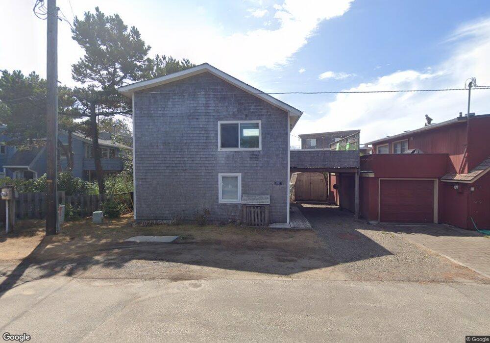
4315 Mt Angel Ave Neskowin, OR 97149
Estimated Value: $586,000 - $840,000
4
Beds
2
Baths
1,080
Sq Ft
$633/Sq Ft
Est. Value
About This Home
This home is located at 4315 Mt Angel Ave, Neskowin, OR 97149 and is currently estimated at $683,259, approximately $632 per square foot. 4315 Mt Angel Ave is a home with nearby schools including Nestucca K-8 School and Nestucca High School.
Ownership History
Date
Name
Owned For
Owner Type
Purchase Details
Closed on
Sep 3, 2020
Sold by
Parks Douglas D
Bought by
Parks Douglas D and Parks Family Revocable Living
Current Estimated Value
Purchase Details
Closed on
Aug 10, 2020
Sold by
Parks Christopher R and Parks Kimberly P
Bought by
Parks Douglas D and Parks Family Revocable Living
Purchase Details
Closed on
Sep 19, 2017
Sold by
Parks Timothy J and Parks Douglas D
Bought by
Parks Timothy J and Parks Douglas D
Create a Home Valuation Report for This Property
The Home Valuation Report is an in-depth analysis detailing your home's value as well as a comparison with similar homes in the area
Home Values in the Area
Average Home Value in this Area
Purchase History
| Date | Buyer | Sale Price | Title Company |
|---|---|---|---|
| Parks Douglas D | -- | None Available | |
| Parks Douglas D | -- | None Available | |
| Parks Timothy J | -- | None Available |
Source: Public Records
Tax History Compared to Growth
Tax History
| Year | Tax Paid | Tax Assessment Tax Assessment Total Assessment is a certain percentage of the fair market value that is determined by local assessors to be the total taxable value of land and additions on the property. | Land | Improvement |
|---|---|---|---|---|
| 2024 | $3,115 | $252,170 | $106,000 | $146,170 |
| 2023 | $3,123 | $244,830 | $102,920 | $141,910 |
| 2022 | $3,012 | $237,700 | $99,920 | $137,780 |
| 2021 | $2,927 | $230,780 | $97,010 | $133,770 |
| 2020 | $2,854 | $224,060 | $94,190 | $129,870 |
| 2019 | $2,794 | $217,540 | $91,450 | $126,090 |
| 2018 | $2,579 | $211,210 | $88,790 | $122,420 |
| 2017 | $2,322 | $205,060 | $86,210 | $118,850 |
| 2016 | $2,138 | $199,090 | $83,700 | $115,390 |
| 2015 | $2,210 | $193,300 | $81,260 | $112,040 |
| 2014 | $2,157 | $187,670 | $78,890 | $108,780 |
| 2013 | -- | $182,210 | $76,590 | $105,620 |
Source: Public Records
Map
Nearby Homes
- 48250 Hawk St
- 6600 Schoolhouse Rd
- 4850 Schoolhouse Rd
- 48988 Highway 101 S Unit 338
- 48988 Highway 101 S Unit 137-F
- 49002 S Hwy Unit B share B
- 49002 U S 101 S
- 4800 Blk Valley View Dr Tl 4000
- 48988 S Highway 101 (#338) Hwy
- 0 Hilltop Ln Unit 704164730
- V/L 6500 Hill Crest Dr
- 49400 Blk Nescove Dr Tl303
- 0 S Fairway Rd Unit 653571953
- 0 S Fairway Rd Unit 315656510
- 0 S Fairway Rd Unit 454757988
- TL 3102 S Beach Rd
- 3102 S Beach Rd
- 46995 Beach Crest Dr
- 49750 Nescove Dr
- TL48 Vanora Unit LOT 48
- 48025 Breakers Blvd
- 48035 Breakers Blvd
- 4325 Mount Angel Ave
- 0 Beaudry Unit 11 15301921
- 4320 Mt Angel Ave
- 4335 Mt Angel Ave
- 48045 Breakers Blvd
- 48060 Breakers #5 Blvd
- 48060 Breakers #11 Blvd
- 47955 Breakers Blvd
- 4355 Mt Angel Ave
- 48065 Breakers Blvd
- 4360 Mount Angel Ave
- 4395 Mt Angel Ave
- 4395 Mount Angel Ave
- 47935 Breakers Blvd
- 4405 Mount Angel Ave
- 47940 Breakers Blvd
- 47980 Breakers Blvd
- 48000 Breakers Ave