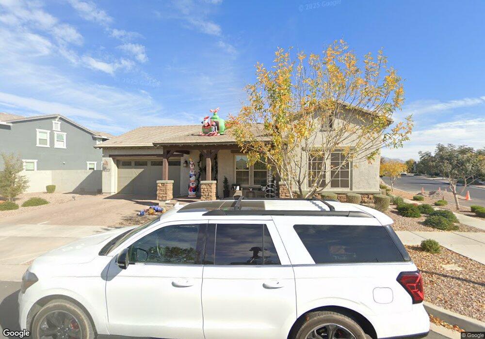
4317 S Apollo Mesa, AZ 85212
Eastmark NeighborhoodEstimated Value: $794,000 - $985,476
--
Bed
1
Bath
3,392
Sq Ft
$259/Sq Ft
Est. Value
About This Home
This home is located at 4317 S Apollo, Mesa, AZ 85212 and is currently estimated at $879,119, approximately $259 per square foot. 4317 S Apollo is a home with nearby schools including Desert Ridge Jr. High School and Desert Ridge High School.
Ownership History
Date
Name
Owned For
Owner Type
Purchase Details
Closed on
Jul 5, 2022
Sold by
Charles Brunk Kyle and Joyce Samantha
Bought by
Brunk Family Living Trust
Current Estimated Value
Purchase Details
Closed on
Jun 30, 2020
Sold by
Jen Arizona 31 Llc
Bought by
Ashton Woods Arizona Llc
Home Financials for this Owner
Home Financials are based on the most recent Mortgage that was taken out on this home.
Original Mortgage
$435,497
Interest Rate
2.71%
Mortgage Type
Purchase Money Mortgage
Purchase Details
Closed on
May 20, 2020
Sold by
Aston Woods Arizona Llc
Bought by
Brunk Samantha Joyce and Brunk Kyle Charles
Home Financials for this Owner
Home Financials are based on the most recent Mortgage that was taken out on this home.
Original Mortgage
$435,497
Interest Rate
2.71%
Mortgage Type
Purchase Money Mortgage
Create a Home Valuation Report for This Property
The Home Valuation Report is an in-depth analysis detailing your home's value as well as a comparison with similar homes in the area
Home Values in the Area
Average Home Value in this Area
Purchase History
| Date | Buyer | Sale Price | Title Company |
|---|---|---|---|
| Brunk Family Living Trust | -- | Certified Legal Document Prepa | |
| Ashton Woods Arizona Llc | $1,676,750 | First American Title | |
| Brunk Samantha Joyce | $512,350 | First American Title Ins Co |
Source: Public Records
Mortgage History
| Date | Status | Borrower | Loan Amount |
|---|---|---|---|
| Previous Owner | Brunk Samantha Joyce | $435,497 |
Source: Public Records
Tax History
| Year | Tax Paid | Tax Assessment Tax Assessment Total Assessment is a certain percentage of the fair market value that is determined by local assessors to be the total taxable value of land and additions on the property. | Land | Improvement |
|---|---|---|---|---|
| 2025 | $3,708 | $35,694 | -- | -- |
| 2024 | $4,162 | $33,994 | -- | -- |
| 2023 | $4,162 | $58,630 | $11,720 | $46,910 |
| 2022 | $4,029 | $46,020 | $9,200 | $36,820 |
| 2021 | $2,145 | $22,785 | $22,785 | $0 |
| 2020 | $2,100 | $21,060 | $21,060 | $0 |
| 2019 | $1,988 | $18,720 | $18,720 | $0 |
Source: Public Records
Map
Nearby Homes
- 10250 E Seismic Ave
- 10326 E Beta Ave
- 10321 E Seismic Ave
- 4151 Plasma
- 10064 E Satellite Dr
- 4455 S Matter
- 4450 S Frequency
- 4237 S Electron
- 9960 E Strobe Ave
- 9936 E Strobe Ave
- 10349 E Wavelength Ave
- 9932 E Rotation Dr
- 9913 E Rubidium Ave
- 9916 E Retrograde Dr
- 4410 S Intensity
- 9936 E Revolution Dr
- 4444 S Flare
- 4065 S Electron
- 10425 E Corbin Ave
- 9855 E Resistance Ave
- 4311 S Apollo
- 10206 E Seismic Ave
- 10161 E Seismic Ave
- 4305 S Apollo
- 10155 E Seismic Ave
- 10212 E Seismic Ave
- 10211 E Seismic Ave
- 10155 E Supernova Dr
- 10161 E Supernova Dr
- 10151 E Seismic Ave
- 10217 E Seismic Ave
- 10218 E Seismic Ave
- 10201 E Supernova Dr
- 10207 E Supernova Dr
- 4334 S Neutron
- 10223 E Seismic Ave
- 4338 S Neutron
- 10150 E Supernova Dr
- 10144 E Supernova Dr
- 10224 E Seismic Ave
Your Personal Tour Guide
Ask me questions while you tour the home.