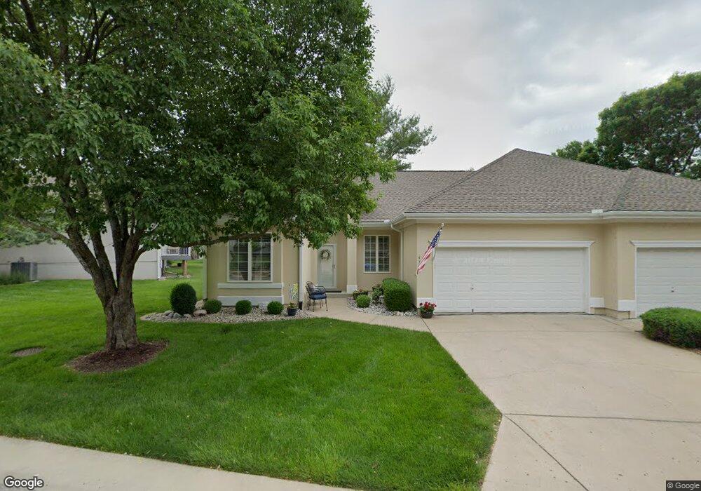
4317 S Davidson Dr Independence, MO 64055
39th East NeighborhoodEstimated Value: $282,319 - $322,000
2
Beds
2
Baths
1,319
Sq Ft
$228/Sq Ft
Est. Value
About This Home
This home is located at 4317 S Davidson Dr, Independence, MO 64055 and is currently estimated at $300,330, approximately $227 per square foot. 4317 S Davidson Dr is a home located in Jackson County with nearby schools including William Yates Elementary School, Delta Woods Middle School, and Blue Springs High School.
Ownership History
Date
Name
Owned For
Owner Type
Purchase Details
Closed on
Oct 23, 2024
Sold by
Schlie Fred W and Schlie Darlene J
Bought by
Schlie Living Trust and Schlie
Current Estimated Value
Purchase Details
Closed on
Apr 22, 2019
Sold by
Elliott Kenneth R and Mela Carol L
Bought by
Schlie Fred W and Schlie Darlene J
Home Financials for this Owner
Home Financials are based on the most recent Mortgage that was taken out on this home.
Original Mortgage
$111,273
Interest Rate
4.3%
Mortgage Type
VA
Purchase Details
Closed on
May 4, 2007
Sold by
Groves Else E and Groves Carol M
Bought by
Elliott Ruby Pauline and Ruby Pauline Elliott Revocable Trust
Purchase Details
Closed on
Mar 26, 1998
Sold by
Wind River Homes Lc
Bought by
Howe Ralph W and Howe Tommye J
Create a Home Valuation Report for This Property
The Home Valuation Report is an in-depth analysis detailing your home's value as well as a comparison with similar homes in the area
Home Values in the Area
Average Home Value in this Area
Purchase History
| Date | Buyer | Sale Price | Title Company |
|---|---|---|---|
| Schlie Living Trust | -- | None Listed On Document | |
| Schlie Fred W | -- | Stewart Title Co | |
| Elliott Ruby Pauline | -- | Heart Of America Title & Esc | |
| Howe Ralph W | -- | -- | |
| Wind River Homes Lc | -- | -- |
Source: Public Records
Mortgage History
| Date | Status | Borrower | Loan Amount |
|---|---|---|---|
| Previous Owner | Schlie Fred W | $111,273 |
Source: Public Records
Tax History Compared to Growth
Tax History
| Year | Tax Paid | Tax Assessment Tax Assessment Total Assessment is a certain percentage of the fair market value that is determined by local assessors to be the total taxable value of land and additions on the property. | Land | Improvement |
|---|---|---|---|---|
| 2025 | $2,360 | $39,560 | $8,466 | $31,094 |
| 2024 | $2,311 | $34,401 | $1,782 | $32,619 |
| 2023 | $2,311 | $34,401 | $4,864 | $29,537 |
| 2022 | $3,005 | $39,140 | $3,347 | $35,793 |
| 2021 | $3,004 | $39,140 | $3,347 | $35,793 |
| 2020 | $2,674 | $34,327 | $3,347 | $30,980 |
| 2019 | $2,585 | $34,327 | $3,347 | $30,980 |
| 2018 | $2,318 | $29,876 | $2,913 | $26,963 |
| 2017 | $2,318 | $29,876 | $2,913 | $26,963 |
| 2016 | $2,250 | $29,127 | $3,990 | $25,137 |
| 2014 | $2,014 | $25,932 | $4,126 | $21,806 |
Source: Public Records
Map
Nearby Homes
- 17209 E 44th St Ct S N A
- 4402 S Atherton Ct
- 16904 E 43rd St S
- 4410 S Atherton Ct
- 17103 E 45th St S
- 4317 S Coachman Dr
- 4326 S Milton Dr
- 17012 E 46th Street Ct S
- 17318 E Us Highway 40
- 4217 E 42nd Street Way S
- 4162 S Bryant Dr
- 3909 S Marshall Dr
- 3920 S Milton Dr
- 3909 S Milton Dr
- 4833 S Tierney Dr
- 3722 S Bolger Ct
- 3618 S Bolger Ct
- 3830 S Summit Ridge Dr
- 16002 E 41st St S
- 3609 S Bolger Ct
- 4319 S Davidson Dr
- 4315 S Davidson Dr
- 17202 E 44th Street Ct S
- 4313 S Davidson Dr
- 17204 E 44th Street Ct S
- 4316 S Davidson Dr
- 17206 E 44th Street Ct S
- 4312 S Davidson Dr
- 4314 S Davidson Dr
- 17200 E 44th Street Ct S
- 4318 S Davidson Dr
- 4320 S Davidson Dr
- 17208 E 44th Street Ct S
- 4322 S Davidson Dr
- 4311 S Davidson Dr
- 17210 E 44th Street Ct S
- 4324 S Davidson Dr
- 4309 S Davidson Dr
- 4306 S Davidson Dr
- 17201 E 44th Street Ct S