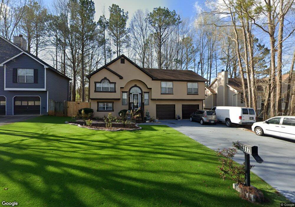
4317 Starboard Dr Powder Springs, GA 30127
Estimated Value: $316,000 - $339,000
3
Beds
3
Baths
1,474
Sq Ft
$225/Sq Ft
Est. Value
About This Home
This home is located at 4317 Starboard Dr, Powder Springs, GA 30127 and is currently estimated at $331,535, approximately $224 per square foot. 4317 Starboard Dr is a home located in Cobb County with nearby schools including Powder Springs Elementary School, Cooper Middle School, and McEachern High School.
Ownership History
Date
Name
Owned For
Owner Type
Purchase Details
Closed on
Oct 4, 2002
Sold by
Robinson Wayne E
Bought by
Ojiemuda Ike
Current Estimated Value
Home Financials for this Owner
Home Financials are based on the most recent Mortgage that was taken out on this home.
Original Mortgage
$138,460
Outstanding Balance
$57,586
Interest Rate
6.18%
Mortgage Type
FHA
Estimated Equity
$273,949
Purchase Details
Closed on
Feb 6, 1995
Sold by
N H Dev Inc
Bought by
Robinson Wayne E Sheila
Home Financials for this Owner
Home Financials are based on the most recent Mortgage that was taken out on this home.
Original Mortgage
$106,950
Interest Rate
9.21%
Mortgage Type
VA
Create a Home Valuation Report for This Property
The Home Valuation Report is an in-depth analysis detailing your home's value as well as a comparison with similar homes in the area
Home Values in the Area
Average Home Value in this Area
Purchase History
| Date | Buyer | Sale Price | Title Company |
|---|---|---|---|
| Ojiemuda Ike | $140,700 | -- | |
| Robinson Wayne E Sheila | $104,900 | -- |
Source: Public Records
Mortgage History
| Date | Status | Borrower | Loan Amount |
|---|---|---|---|
| Open | Ojiemuda Ike | $138,460 | |
| Previous Owner | Robinson Wayne E Sheila | $106,950 |
Source: Public Records
Tax History Compared to Growth
Tax History
| Year | Tax Paid | Tax Assessment Tax Assessment Total Assessment is a certain percentage of the fair market value that is determined by local assessors to be the total taxable value of land and additions on the property. | Land | Improvement |
|---|---|---|---|---|
| 2025 | $3,069 | $135,052 | $22,000 | $113,052 |
| 2024 | $3,071 | $135,052 | $22,000 | $113,052 |
| 2023 | $2,529 | $135,052 | $22,000 | $113,052 |
| 2022 | $1,669 | $69,836 | $10,800 | $59,036 |
| 2021 | $1,669 | $69,836 | $10,800 | $59,036 |
| 2020 | $1,669 | $69,836 | $10,800 | $59,036 |
| 2019 | $1,548 | $64,324 | $8,000 | $56,324 |
| 2018 | $1,548 | $64,324 | $8,000 | $56,324 |
| 2017 | $1,199 | $51,180 | $8,000 | $43,180 |
| 2016 | $1,201 | $51,180 | $8,000 | $43,180 |
| 2015 | $839 | $37,328 | $4,800 | $32,528 |
| 2014 | $847 | $37,328 | $0 | $0 |
Source: Public Records
Map
Nearby Homes
- 3961 Brushy St
- 3936 Ladiga St
- 3947 Ladiga St
- 3950 Ladiga St
- 3940 Ladiga St
- Taylorsville Basement Plan at Westmont Preserve
- Taylorsville Plan at Westmont Preserve
- Dakota Plan at Westmont Preserve
- Sherwood Plan at Westmont Preserve
- Johnson Basement Plan at Westmont Preserve
- Gibson Plan at Westmont Preserve
- Johnson Plan at Westmont Preserve
- Northbrook Plan at Westmont Preserve
- 4427 Brick Tunnel St
- 4439 Brick Tunnel St
- 4419 Brick Tunnel St
- 4431 Brick Tunnel St
- 4415 Brick Tunnel St
- 4411 Brick Tunnel St
- 4319 Starboard Dr
- 4315 Starboard Dr
- 4363 Port Ln
- 4329 Starboard Dr
- 4327 Starboard Dr
- 4313 Starboard Dr
- 4365 Port Ln
- 4314 Starboard Dr
- 4316 Starboard Dr
- 4361 Port Ln Unit 52
- 4361 Port Ln
- 4312 Starboard Dr
- 4318 Starboard Dr
- 4367 Port Ln
- 4311 Starboard Dr
- 0 Port Ln Unit 8664251
- 0 Port Ln Unit 8463172
- 0 Port Ln Unit 7236658
- 0 Port Ln Unit 7099458
- 0 Port Ln Unit 8824933