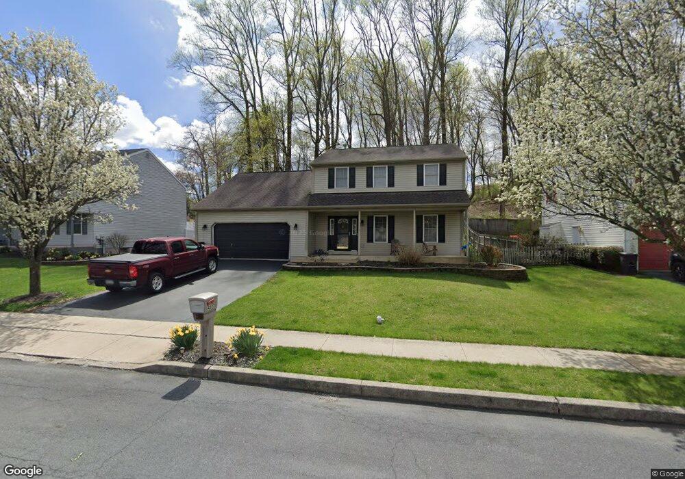
4317 Sutton Cir Reading, PA 19606
Estimated Value: $405,348 - $449,000
4
Beds
3
Baths
2,094
Sq Ft
$203/Sq Ft
Est. Value
About This Home
This home is located at 4317 Sutton Cir, Reading, PA 19606 and is currently estimated at $425,837, approximately $203 per square foot. 4317 Sutton Cir is a home located in Berks County with nearby schools including Lorane Elementary School, Exeter Township Junior High School, and Exeter Township Senior High School.
Ownership History
Date
Name
Owned For
Owner Type
Purchase Details
Closed on
Jul 6, 2010
Sold by
Mullen Michael P and Boyd Jeffrey R
Bought by
Mullen Michael P
Current Estimated Value
Home Financials for this Owner
Home Financials are based on the most recent Mortgage that was taken out on this home.
Original Mortgage
$172,800
Interest Rate
4.82%
Mortgage Type
New Conventional
Create a Home Valuation Report for This Property
The Home Valuation Report is an in-depth analysis detailing your home's value as well as a comparison with similar homes in the area
Home Values in the Area
Average Home Value in this Area
Purchase History
| Date | Buyer | Sale Price | Title Company |
|---|---|---|---|
| Mullen Michael P | -- | Old Republic National Title |
Source: Public Records
Mortgage History
| Date | Status | Borrower | Loan Amount |
|---|---|---|---|
| Closed | Mullen Michael P | $172,800 |
Source: Public Records
Tax History Compared to Growth
Tax History
| Year | Tax Paid | Tax Assessment Tax Assessment Total Assessment is a certain percentage of the fair market value that is determined by local assessors to be the total taxable value of land and additions on the property. | Land | Improvement |
|---|---|---|---|---|
| 2025 | $2,013 | $132,700 | $31,800 | $100,900 |
| 2024 | $6,302 | $132,700 | $31,800 | $100,900 |
| 2023 | $6,096 | $132,700 | $31,800 | $100,900 |
| 2022 | $6,028 | $132,700 | $31,800 | $100,900 |
| 2021 | $5,936 | $132,700 | $31,800 | $100,900 |
| 2020 | $5,870 | $132,700 | $31,800 | $100,900 |
| 2019 | $5,805 | $132,700 | $31,800 | $100,900 |
| 2018 | $5,788 | $132,700 | $31,800 | $100,900 |
| 2017 | $5,705 | $132,700 | $31,800 | $100,900 |
| 2016 | $1,420 | $132,700 | $31,800 | $100,900 |
| 2015 | $1,420 | $132,700 | $31,800 | $100,900 |
| 2014 | $1,371 | $132,700 | $31,800 | $100,900 |
Source: Public Records
Map
Nearby Homes
- 55 1 Holly Dr
- 60-6 Mint Tier Unit 6
- 31 1 Wister
- 4536 Del Mar Dr
- 6-4 Willow Way
- 4482 Heron Dr
- 5 Craig Dr
- 0 Perkiomen Ave Unit PABK2061892
- 4690 Pheasant Run
- 202 W 39th St
- 4851 Perkiomen Ave
- 601 W 37th St
- 105 Gibraltar Rd
- 30 Estates Dr
- 56 Hearthstone Dr
- 3505 Circle Ave
- 16 Ironstone Dr
- 6 Taylor Dr
- 4861 Dunham Dr
- 404 Lorane Rd
- 4321 Sutton Cir
- 4313 Sutton Cir
- 52-55 Holly Dr
- 4342 Hillside Rd
- 4325 Sutton Cir
- 4312 Sutton Cir
- 4328 Sutton Cir
- 4346 Hillside Rd
- 4329 Sutton Cir
- 4350 Hillside Rd
- 4337 Hillside Rd
- 4341 Hillside Rd
- 4340 Sutton Cir
- 4333 Hillside Rd
- 4333 Sutton Cir
- 75 Rock Haven Ct
- 41 Rock Haven Ct
- 49 Rock Haven Ct
- 33 Rock Haven Ct
- 59 Rock Haven Ct