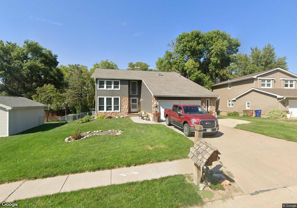
4318 Anchor Mill Rd Bellevue, NE 68123
Estimated Value: $337,537 - $378,000
4
Beds
3
Baths
2,394
Sq Ft
$151/Sq Ft
Est. Value
About This Home
This home is located at 4318 Anchor Mill Rd, Bellevue, NE 68123 and is currently estimated at $361,384, approximately $150 per square foot. 4318 Anchor Mill Rd is a home located in Sarpy County with nearby schools including Anderson Grove Elementary School, Papillion Middle School, and Papillion La Vista South High School.
Ownership History
Date
Name
Owned For
Owner Type
Purchase Details
Closed on
Mar 29, 2005
Sold by
Townsend William M and Townsend Joann M
Bought by
Hrbek Scott A and Hrbek Lori D
Current Estimated Value
Home Financials for this Owner
Home Financials are based on the most recent Mortgage that was taken out on this home.
Original Mortgage
$164,800
Outstanding Balance
$85,044
Interest Rate
5.78%
Estimated Equity
$276,340
Create a Home Valuation Report for This Property
The Home Valuation Report is an in-depth analysis detailing your home's value as well as a comparison with similar homes in the area
Home Values in the Area
Average Home Value in this Area
Purchase History
| Date | Buyer | Sale Price | Title Company |
|---|---|---|---|
| Hrbek Scott A | $206,000 | -- |
Source: Public Records
Mortgage History
| Date | Status | Borrower | Loan Amount |
|---|---|---|---|
| Open | Hrbek Scott A | $164,800 |
Source: Public Records
Tax History
| Year | Tax Paid | Tax Assessment Tax Assessment Total Assessment is a certain percentage of the fair market value that is determined by local assessors to be the total taxable value of land and additions on the property. | Land | Improvement |
|---|---|---|---|---|
| 2025 | $5,062 | $304,421 | $50,000 | $254,421 |
| 2024 | $5,869 | $293,707 | $45,000 | $248,707 |
| 2023 | $5,869 | $280,607 | $40,000 | $240,607 |
| 2022 | $5,647 | $254,741 | $40,000 | $214,741 |
| 2021 | $5,221 | $232,148 | $34,000 | $198,148 |
| 2020 | $5,135 | $227,051 | $34,000 | $193,051 |
| 2019 | $4,841 | $214,253 | $34,000 | $180,253 |
| 2018 | $4,766 | $207,949 | $28,000 | $179,949 |
| 2017 | $4,562 | $199,071 | $28,000 | $171,071 |
| 2016 | $4,368 | $190,921 | $28,000 | $162,921 |
| 2015 | $4,253 | $186,386 | $26,000 | $160,386 |
| 2014 | $4,223 | $183,912 | $26,000 | $157,912 |
| 2012 | -- | $183,961 | $26,000 | $157,961 |
Source: Public Records
Map
Nearby Homes
- 12015 S 44th St
- 12013 Daniell Rd
- 4210 Barksdale Cir
- 11814 Quail Dr
- 12033 Daniell Rd
- 12037 Daniell Rd
- 12039 S 45th Ave
- 12110 Quail Dr
- 12038 S 45th Ave
- 12105 Daniell Rd
- 12109 Daniell Rd
- 4302 Chennault St
- 4404 Chennault St
- 12203 Daniell Rd
- 4305 Barksdale Dr
- 11912 S 48th St
- 11706 Fisher House Rd
- 12408 Quail Dr
- 12501 Quail Dr
- 12509 Quail Dr
- 4314 Anchor Mill Rd
- 4322 Anchor Mill Rd
- 4327 Jerry Gilbert Cir
- 11919 Gow Ln
- 4310 Anchor Mill Rd
- 4323 Jerry Gilbert Cir
- 4323 Gilbert Cir
- 4313 Anchor Mill Rd
- 11915 Gow Ln
- 4317 Anchor Mill Rd
- 4331 Jerry Gilbert Cr
- 4331 Jerry Gilbert Cir
- 4331 Gilbert Cir
- 4319 Jerry Gilbert Cir
- 4309 Anchor Mill Rd
- 4306 Anchor Mill Rd
- 11911 Gow Ln
- 4315 Jerry Gilbert Cir
- 11920 Gow Ln
- 4305 Anchor Mill Rd
Your Personal Tour Guide
Ask me questions while you tour the home.