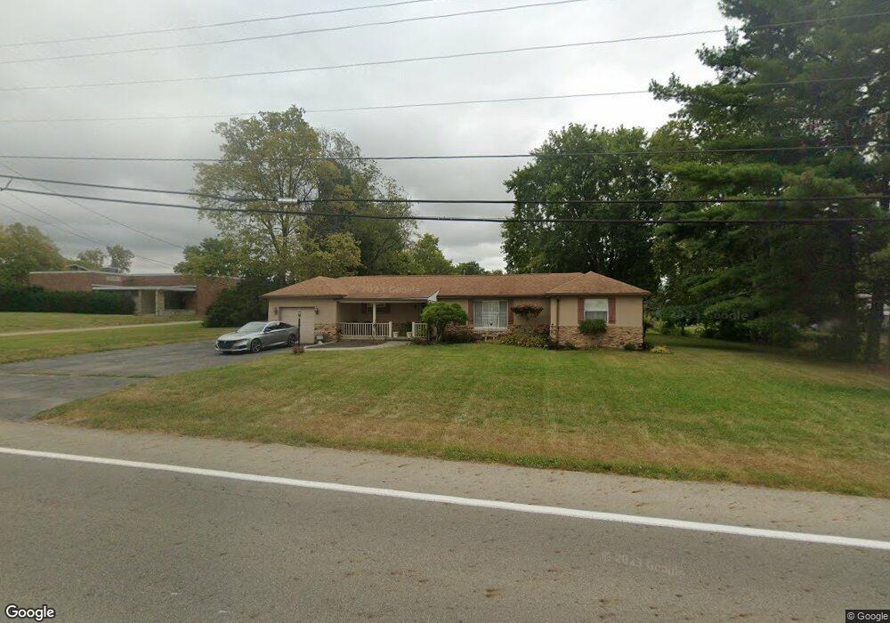
4318 Derr Rd Springfield, OH 45503
Estimated Value: $189,130 - $222,000
3
Beds
1
Bath
1,072
Sq Ft
$198/Sq Ft
Est. Value
About This Home
This home is located at 4318 Derr Rd, Springfield, OH 45503 and is currently estimated at $211,783, approximately $197 per square foot. 4318 Derr Rd is a home located in Clark County with nearby schools including Northridge Elementary School, Kenton Ridge Middle & High School, and Emmanuel Christian Academy.
Ownership History
Date
Name
Owned For
Owner Type
Purchase Details
Closed on
Apr 10, 1996
Sold by
Crall John S
Bought by
Lockard Thomas A and Lockard Julia
Current Estimated Value
Home Financials for this Owner
Home Financials are based on the most recent Mortgage that was taken out on this home.
Original Mortgage
$63,750
Interest Rate
7.46%
Mortgage Type
Balloon
Purchase Details
Closed on
May 7, 1992
Create a Home Valuation Report for This Property
The Home Valuation Report is an in-depth analysis detailing your home's value as well as a comparison with similar homes in the area
Home Values in the Area
Average Home Value in this Area
Purchase History
| Date | Buyer | Sale Price | Title Company |
|---|---|---|---|
| Lockard Thomas A | $75,000 | -- | |
| -- | $53,500 | -- |
Source: Public Records
Mortgage History
| Date | Status | Borrower | Loan Amount |
|---|---|---|---|
| Closed | Lockard Thomas A | $63,750 |
Source: Public Records
Tax History
| Year | Tax Paid | Tax Assessment Tax Assessment Total Assessment is a certain percentage of the fair market value that is determined by local assessors to be the total taxable value of land and additions on the property. | Land | Improvement |
|---|---|---|---|---|
| 2025 | $1,753 | $49,220 | $10,140 | $39,080 |
| 2024 | $1,697 | $39,240 | $7,420 | $31,820 |
| 2023 | $1,697 | $39,240 | $7,420 | $31,820 |
| 2022 | $1,703 | $39,240 | $7,420 | $31,820 |
| 2021 | $1,648 | $32,170 | $6,090 | $26,080 |
| 2020 | $1,649 | $32,170 | $6,090 | $26,080 |
| 2019 | $1,681 | $32,170 | $6,090 | $26,080 |
| 2018 | $1,401 | $25,730 | $5,620 | $20,110 |
| 2017 | $1,206 | $25,726 | $5,618 | $20,108 |
| 2016 | $1,198 | $25,726 | $5,618 | $20,108 |
| 2015 | $1,156 | $23,916 | $5,618 | $18,298 |
| 2014 | $1,156 | $23,916 | $5,618 | $18,298 |
| 2013 | $1,130 | $23,916 | $5,618 | $18,298 |
Source: Public Records
Map
Nearby Homes
- 1052 Cheyenne Ave Unit 1052
- 1341 Student Ave
- 4733 Curtis Dr
- 1415 Montego Dr
- 4322 Midfield St Unit 15
- 4256 Midfield St Unit 9
- 4741 Cullen Ave
- 4802 Willowbrook Dr
- 4446 Ridgewood Rd E Unit 3
- 1201 Kingsgate Rd
- 4577 Reno Ln Unit 2
- 1644 Delmar Dr
- 519 Moorefield Rd
- 4652 Reno Ln Unit 15
- 1500 Kingsgate Rd Unit 19430
- 1502 Kingsgate Rd Unit 19432
- 1500 Kingsgate Rd
- 1502 Kingsgate Rd
- 3631 Kingsgate Ln
- 1309 Richmoor Rd
- 4321 Prince Cir
- 4309 Prince Cir
- 4322 Prince Cir
- 4289 Prince Cir
- 4310 Prince Cir
- 4319 Tritle Trail
- 4277 Prince Cir
- 1105 Student Ave
- 4331 Tritle Trail
- 4290 Prince Cir
- 4311 Tritle Trail
- 1101 Student Ave
- 4259 Prince Cir
- 4303 Tritle Trail
- 4278 Prince Cir
- 4287 Tritle Trail
- 4260 Prince Cir
- 4370 Tudor Cir
- 1020 Montego Dr
- 4349 Burchill St
Your Personal Tour Guide
Ask me questions while you tour the home.