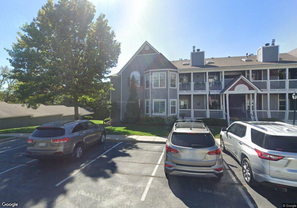
4318 S Bryant Ct Unit 49 Independence, MO 64055
39th East NeighborhoodEstimated Value: $178,202 - $193,000
2
Beds
2
Baths
1,225
Sq Ft
$150/Sq Ft
Est. Value
About This Home
This home is located at 4318 S Bryant Ct Unit 49, Independence, MO 64055 and is currently estimated at $184,301, approximately $150 per square foot. 4318 S Bryant Ct Unit 49 is a home located in Jackson County with nearby schools including William Southern Elementary School, Bridger Middle School, and Pioneer Ridge Middle School.
Ownership History
Date
Name
Owned For
Owner Type
Purchase Details
Closed on
Apr 19, 2022
Sold by
Nilgun Pehriz
Bought by
Henry Brenda K and Smith Keith
Current Estimated Value
Purchase Details
Closed on
Nov 17, 2016
Sold by
Wallace John W and Wallace Julie G
Bought by
Pehriz Nilgun
Purchase Details
Closed on
Apr 24, 2013
Sold by
Marble Sharon A
Bought by
Wallace John W and Wallace Julie G
Purchase Details
Closed on
Aug 6, 2007
Sold by
Allee Edward W and Allee Margaret E
Bought by
Marble Sharon A
Create a Home Valuation Report for This Property
The Home Valuation Report is an in-depth analysis detailing your home's value as well as a comparison with similar homes in the area
Home Values in the Area
Average Home Value in this Area
Purchase History
| Date | Buyer | Sale Price | Title Company |
|---|---|---|---|
| Henry Brenda K | -- | Kansas City Title | |
| Pehriz Nilgun | -- | Kansas City Title Inc | |
| Wallace John W | -- | Kansas City Title Inc | |
| Marble Sharon A | -- | None Available |
Source: Public Records
Tax History
| Year | Tax Paid | Tax Assessment Tax Assessment Total Assessment is a certain percentage of the fair market value that is determined by local assessors to be the total taxable value of land and additions on the property. | Land | Improvement |
|---|---|---|---|---|
| 2025 | $1,909 | $27,639 | $4,427 | $23,212 |
| 2024 | $1,865 | $27,550 | $1,062 | $26,488 |
| 2023 | $1,865 | $27,550 | $3,629 | $23,921 |
| 2022 | $1,544 | $20,900 | $989 | $19,911 |
| 2021 | $1,543 | $20,900 | $989 | $19,911 |
| 2020 | $1,390 | $18,297 | $989 | $17,308 |
| 2019 | $1,368 | $18,297 | $989 | $17,308 |
| 2018 | $886,739 | $14,368 | $989 | $13,379 |
| 2017 | $1,125 | $14,368 | $989 | $13,379 |
| 2016 | $1,120 | $14,155 | $989 | $13,166 |
| 2014 | $1,095 | $14,155 | $989 | $13,166 |
Source: Public Records
Map
Nearby Homes
- 4326 S Bryant Dr
- 4322 S Milton Dr
- 4317 S Megan Ct Unit 19
- 4225 S Milton Dr
- 16904 E 43rd St S
- 17005 E 43rd Terrace Ct S
- 4005 S Coachman Dr
- 17012 E 46th Street Ct S
- 4315 S Davidson Dr
- 17105 E 45th St S
- 17221 E 44th Terrace Ct S
- 4705 S Brentwood Ave
- 4707 S Brentwood Ave
- 4709 S Brentwood Ave
- 4711 S Brentwood Ave
- 17318 E Us Highway 40
- 4712 S Brentwood Ave
- 4714 S Brentwood Ave
- 5300 Lees Summit Rd
- 15504 E 44th Terrace S
- 4318 S Bryant Ct
- 4318 S Bryant Ct Unit 7
- 4318 S Bryant Ct Unit 10
- 4318 S Bryant Ct Unit 51
- 4318 S Bryant Ct Unit 47
- 4318 S Bryant Ct Unit 48
- 4318 S Bryant Ct Unit 52
- 4318 S Bryant Ct Unit 50
- 4318 S Bryant Ct Unit 45
- 4318 S Bryant Ct Unit 46
- 4318 S Bryant Ct Unit 43
- 4318 S Bryant Ct Unit 44
- 4318 S Bryant Ct Unit 2
- 4318 S Bryant Ct Unit 9
- 16701 E 43rd St S
- 4312 S Bryant Ct Unit 1
- 4312 S Bryant Ct
- 4312 S Bryant Ct
- 4312 S Bryant Ct
- 4312 S Bryant Ct Unit 41
Your Personal Tour Guide
Ask me questions while you tour the home.