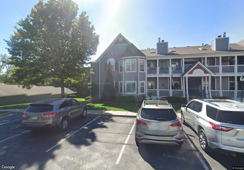
4318 S Bryant Ct Unit 51 Independence, MO 64055
39th East NeighborhoodEstimated Value: $182,384 - $197,000
2
Beds
2
Baths
1,347
Sq Ft
$141/Sq Ft
Est. Value
About This Home
This home is located at 4318 S Bryant Ct Unit 51, Independence, MO 64055 and is currently estimated at $190,596, approximately $141 per square foot. 4318 S Bryant Ct Unit 51 is a home located in Jackson County with nearby schools including William Southern Elementary School, Bridger Middle School, and Pioneer Ridge Middle School.
Ownership History
Date
Name
Owned For
Owner Type
Purchase Details
Closed on
Jul 25, 2019
Sold by
Donahue James G and Donahue Maria C
Bought by
Heumann Edeitraud
Current Estimated Value
Purchase Details
Closed on
Jun 13, 2019
Sold by
Mitchell Maynard J
Bought by
Donahue James G and Donahue Maria C
Purchase Details
Closed on
Jan 9, 2008
Sold by
Mitchell Maynard J
Bought by
Mitchell Maynard J and Maynard J Mitchell Revocable Living Tr
Purchase Details
Closed on
Nov 1, 2007
Sold by
Mitchell Maynard J and Mitchell Pauline J
Bought by
Mitchell Maynard J and Maynard J Mitchell & Pauline J Mitchell
Create a Home Valuation Report for This Property
The Home Valuation Report is an in-depth analysis detailing your home's value as well as a comparison with similar homes in the area
Home Values in the Area
Average Home Value in this Area
Purchase History
| Date | Buyer | Sale Price | Title Company |
|---|---|---|---|
| Heumann Edeitraud | -- | None Available | |
| Donahue James G | -- | None Available | |
| Mitchell Maynard J | -- | None Available | |
| Mitchell Maynard J | -- | None Available | |
| Mitchell Maynard J | -- | None Available | |
| Mitchell Maynard J | -- | None Available | |
| Mitchell Maynard J | -- | None Available |
Source: Public Records
Tax History Compared to Growth
Tax History
| Year | Tax Paid | Tax Assessment Tax Assessment Total Assessment is a certain percentage of the fair market value that is determined by local assessors to be the total taxable value of land and additions on the property. | Land | Improvement |
|---|---|---|---|---|
| 2025 | $1,988 | $30,153 | $4,427 | $25,726 |
| 2024 | $1,988 | $28,690 | $1,049 | $27,641 |
| 2023 | $1,942 | $28,690 | $3,671 | $25,019 |
| 2022 | $1,684 | $22,800 | $989 | $21,811 |
| 2021 | $1,683 | $22,800 | $989 | $21,811 |
| 2020 | $1,510 | $19,873 | $989 | $18,884 |
| 2019 | $1,486 | $19,873 | $989 | $18,884 |
| 2018 | $886,741 | $14,888 | $989 | $13,899 |
| 2017 | $1,160 | $14,888 | $989 | $13,899 |
| 2016 | $1,160 | $14,668 | $989 | $13,679 |
| 2014 | $1,135 | $14,668 | $989 | $13,679 |
Source: Public Records
Map
Nearby Homes
- 4326 S Bryant Dr
- 4317 S Coachman Dr
- 4162 S Bryant Dr
- 16904 E 43rd St S
- 17012 E 46th Street Ct S
- 17103 E 45th St S
- 17209 E 44th St Ct S N A
- 15711 E 44th Terrace S
- 3920 S Milton Dr
- 16002 E 41st St S
- 3909 S Milton Dr
- 16001 E Us 40 Hwy
- 4705 S Brentwood Ave
- 4707 S Brentwood Ave
- 17318 E Us Highway 40
- 4402 S Atherton Ct
- 3909 S Marshall Dr
- 15506 E 43rd Terrace S
- 5300 Lees Summit Rd
- Hawthorne Villas Plan at Ashton Farms
- 4318 S Bryant Ct
- 4318 S Bryant Ct Unit 7
- 4318 S Bryant Ct Unit 10
- 4318 S Bryant Ct Unit 47
- 4318 S Bryant Ct Unit 48
- 4318 S Bryant Ct Unit 52
- 4318 S Bryant Ct Unit 49
- 4318 S Bryant Ct Unit 50
- 4318 S Bryant Ct Unit 45
- 4318 S Bryant Ct Unit 46
- 4318 S Bryant Ct Unit 43
- 4318 S Bryant Ct Unit 44
- 4318 S Bryant Ct Unit 2
- 4318 S Bryant Ct Unit 9
- 16701 E 43rd St S
- 4312 S Bryant Ct Unit 1
- 4312 S Bryant Ct
- 4312 S Bryant Ct
- 4312 S Bryant Ct
- 4312 S Bryant Ct Unit 41