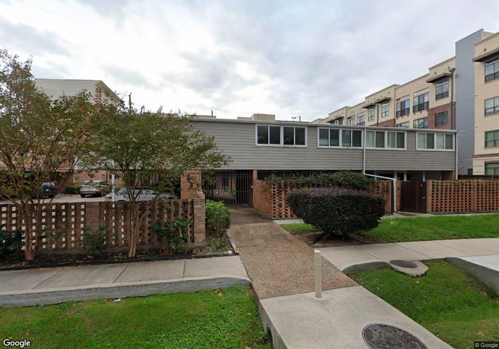
4319 Bettis Dr Unit 8 Houston, TX 77027
River Oaks NeighborhoodEstimated Value: $327,675 - $696,000
3
Beds
1
Bath
1,372
Sq Ft
$397/Sq Ft
Est. Value
About This Home
This home is located at 4319 Bettis Dr Unit 8, Houston, TX 77027 and is currently estimated at $545,169, approximately $397 per square foot. 4319 Bettis Dr Unit 8 is a home located in Harris County with nearby schools including School at St. George Place, Lanier Middle School, and Lamar High School.
Ownership History
Date
Name
Owned For
Owner Type
Purchase Details
Closed on
Sep 28, 2007
Sold by
Fannie Mae
Bought by
Kebede Yared
Current Estimated Value
Purchase Details
Closed on
Jun 5, 2007
Sold by
Sherwood Ann L
Bought by
Federal National Mortgage Association
Purchase Details
Closed on
Aug 6, 1999
Sold by
Sullivan Laverne Joyce
Bought by
Sherwood Ann L
Home Financials for this Owner
Home Financials are based on the most recent Mortgage that was taken out on this home.
Original Mortgage
$62,900
Interest Rate
7.65%
Create a Home Valuation Report for This Property
The Home Valuation Report is an in-depth analysis detailing your home's value as well as a comparison with similar homes in the area
Home Values in the Area
Average Home Value in this Area
Purchase History
| Date | Buyer | Sale Price | Title Company |
|---|---|---|---|
| Kebede Yared | -- | Texas American Title Company | |
| Federal National Mortgage Association | $104,181 | None Available | |
| Sherwood Ann L | -- | First American Title |
Source: Public Records
Mortgage History
| Date | Status | Borrower | Loan Amount |
|---|---|---|---|
| Previous Owner | Sherwood Ann L | $62,900 | |
| Closed | Sherwood Ann L | $3,000 |
Source: Public Records
Tax History Compared to Growth
Tax History
| Year | Tax Paid | Tax Assessment Tax Assessment Total Assessment is a certain percentage of the fair market value that is determined by local assessors to be the total taxable value of land and additions on the property. | Land | Improvement |
|---|---|---|---|---|
| 2025 | $2,443 | $197,452 | $37,516 | $159,936 |
| 2024 | $2,443 | $197,452 | $37,516 | $159,936 |
| 2023 | $2,443 | $197,452 | $37,516 | $159,936 |
| 2022 | $3,739 | $197,452 | $37,516 | $159,936 |
| 2021 | $3,598 | $154,380 | $29,332 | $125,048 |
| 2020 | $3,738 | $154,380 | $29,332 | $125,048 |
| 2019 | $3,907 | $154,380 | $29,332 | $125,048 |
| 2018 | $2,839 | $154,380 | $29,332 | $125,048 |
| 2017 | $3,904 | $154,380 | $29,332 | $125,048 |
| 2016 | $3,904 | $154,380 | $29,332 | $125,048 |
| 2015 | -- | $154,380 | $29,332 | $125,048 |
| 2014 | -- | $154,380 | $29,332 | $125,048 |
Source: Public Records
Map
Nearby Homes
- 2207 Bancroft St Unit 906
- 2207 Bancroft St Unit 1003
- 2207 Bancroft St Unit 1104
- 2207 Bancroft St Unit 604
- 2308 Briarglen Dr
- 2127 Bancroft St
- 2109 Bancroft St
- 2211 Briarglen Dr Unit 502
- 2047 Westcreek Ln Unit 608
- 2047 Westcreek Ln Unit 1005
- 4506 Bryn Mawr Ln
- 2603 W Lane Dr Unit E
- 4521 San Felipe St Unit 2304-5
- 4521 San Felipe St Unit 1704
- 4521 San Felipe St Unit 3101
- 4521 San Felipe St Unit 1903
- 4521 San Felipe St Unit 3202
- 4521 San Felipe St Unit 2104
- 4521 San Felipe St Unit 2601
- 4521 San Felipe St Unit 2101
- 4319 Bettis Dr Unit 3
- 4319 Bettis Dr Unit 1
- 4319 Bettis Dr Unit 2
- 4319 Bettis Dr Unit 7
- 4319 Bettis Dr Unit 6
- 4319 Bettis Dr Unit 5
- 4319 Bettis Dr Unit 4
- 4311 Bettis Dr
- 2270 Bancroft St
- 2266 Bancroft St
- 2266 Bancroft Ln
- 2262 Bancroft St
- 2258 Bancroft St
- 2254 Bancroft St
- 2250 Bancroft St
- 2242 Bancroft St
- 2242 Bancroft Ln
- 2238 Bancroft St
- 2218 Bancroft St
- 2207 Bancroft Ln Unit 705