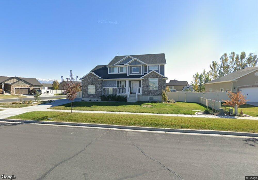
4319 W 1315 S Unit 423 Syracuse, UT 84075
Estimated Value: $617,000 - $690,000
4
Beds
3
Baths
2,419
Sq Ft
$275/Sq Ft
Est. Value
About This Home
This home is located at 4319 W 1315 S Unit 423, Syracuse, UT 84075 and is currently estimated at $664,988, approximately $274 per square foot. 4319 W 1315 S Unit 423 is a home located in Davis County with nearby schools including Buffalo Point School, Syracuse Junior High School, and Syracuse High School.
Ownership History
Date
Name
Owned For
Owner Type
Purchase Details
Closed on
Jul 28, 2025
Sold by
Emmertson Cory and Emmertson Rachael
Bought by
Cory And Rachael Emmertson Revocable Trust and Emmertson
Current Estimated Value
Purchase Details
Closed on
Jan 19, 2012
Sold by
Bennett Wayne Z
Bought by
First National Bank Of Layton
Purchase Details
Closed on
May 9, 2011
Sold by
U S Development Inc
Bought by
Emmertson Cory and Emmertson Rachael
Create a Home Valuation Report for This Property
The Home Valuation Report is an in-depth analysis detailing your home's value as well as a comparison with similar homes in the area
Home Values in the Area
Average Home Value in this Area
Purchase History
| Date | Buyer | Sale Price | Title Company |
|---|---|---|---|
| Cory And Rachael Emmertson Revocable Trust | -- | None Listed On Document | |
| Cory And Rachael Emmertson Revocable Trust | -- | None Listed On Document | |
| First National Bank Of Layton | $346,055 | None Available | |
| Emmertson Cory | -- | Bonneville Superior |
Source: Public Records
Tax History Compared to Growth
Tax History
| Year | Tax Paid | Tax Assessment Tax Assessment Total Assessment is a certain percentage of the fair market value that is determined by local assessors to be the total taxable value of land and additions on the property. | Land | Improvement |
|---|---|---|---|---|
| 2025 | $3,648 | $352,000 | $112,419 | $239,581 |
| 2024 | $3,454 | $335,500 | $96,994 | $238,506 |
| 2023 | $3,254 | $576,000 | $139,056 | $436,944 |
| 2022 | $3,407 | $330,550 | $73,809 | $256,741 |
| 2021 | $3,009 | $452,000 | $107,078 | $344,922 |
| 2020 | $2,792 | $406,000 | $91,091 | $314,909 |
| 2019 | $2,675 | $384,000 | $92,162 | $291,838 |
| 2018 | $2,512 | $358,000 | $88,143 | $269,857 |
| 2016 | $2,334 | $174,405 | $34,604 | $139,801 |
| 2015 | $2,469 | $175,725 | $34,783 | $140,942 |
| 2014 | $2,259 | $163,870 | $34,783 | $129,087 |
| 2013 | -- | $161,150 | $33,265 | $127,885 |
Source: Public Records
Map
Nearby Homes
- 1238 S 4290 W
- 1157 S 4425 W
- 1155 S 4475 W
- 1139 S 4475 W
- 4191 W 1425 S
- Bradford Plan at Harvest Fields
- Avery Plan at Harvest Fields
- Sullivan Plan at Harvest Fields
- Presley Plan at Harvest Fields
- Ashmore Plan at Harvest Fields
- Bridgeport Plan at Harvest Fields
- Malan Plan at Harvest Fields
- Havenwood Plan at Harvest Fields
- Hamilton Plan at Harvest Fields
- Havenwood with Loft Plan at Harvest Fields
- 1039 S 4250 W
- 4468 W 1050 S
- 4578 W 1150 S
- 1084 S 4090 W
- 964 S 4475 W Unit 123
- 4337 W 1315 S
- 1321 S 4300 W Unit 415
- 1321 S 4300 W
- 1328 S 4300 W Unit 424
- 1272 S 4300 W
- 1327 S 4300 W Unit 414
- 1331 S 4350 W
- 1343 S 4350 W
- 1269 S 4300 W
- 1269 S 4300 W Unit 416
- 1331 S 4300 W
- 1331 S 4300 W Unit 413
- 1299 S 4350 W Unit 219
- 1266 S 4300 W
- 1338 S 4300 W Unit 425
- 1336 S 4300 W Unit 425
- 1359 S 4350 W
- 1359 S 4350 W Unit 433
- 1279 S 4350 W
- 1341 S 4300 W