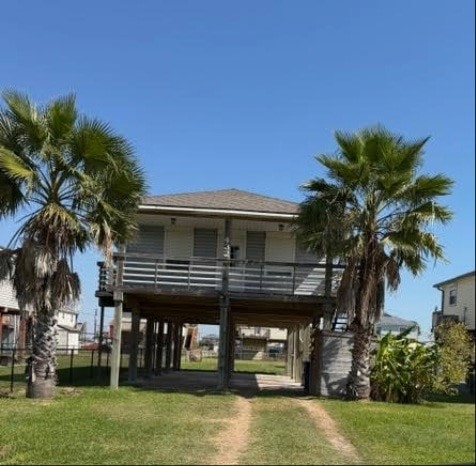
432 Angel Wing St Freeport, TX 77541
Estimated payment $1,934/month
Highlights
- Community Beach Access
- Living Room
- Central Heating and Cooling System
- Traditional Architecture
- 2 Attached Carport Spaces
- Carpet
About This Home
RECENT FORECLOSURE! Property is PRICED TO SELL and being sold in "AS IS CONDITION". Price is well below the competition. Since the owner has never lived in the property, there is no knowledge of the property condition other than it needs some TLC. Room measurements and taxes are approximate and Agent/Seller make no guarantee regarding the accuracy of the information provided. Please verify! Please contact listing agent for title company information if Seller is paying the Owner's Title Policy.
Home Details
Home Type
- Single Family
Est. Annual Taxes
- $6,442
Year Built
- Built in 2007
Parking
- 2 Attached Carport Spaces
Home Design
- Traditional Architecture
- Composition Roof
- Vinyl Siding
Interior Spaces
- 1,100 Sq Ft Home
- 1-Story Property
- Living Room
- Washer and Electric Dryer Hookup
Flooring
- Carpet
- Laminate
Bedrooms and Bathrooms
- 3 Bedrooms
- 2 Full Bathrooms
Schools
- Freeport Elementary School
- O'hara Lanier Middle School
- Brazosport High School
Additional Features
- 7,797 Sq Ft Lot
- Central Heating and Cooling System
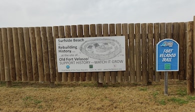
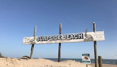
Community Details
Overview
- Gulf Ridge Subdivision
Recreation
- Community Beach Access
Map
Home Values in the Area
Average Home Value in this Area
Tax History
| Year | Tax Paid | Tax Assessment Tax Assessment Total Assessment is a certain percentage of the fair market value that is determined by local assessors to be the total taxable value of land and additions on the property. | Land | Improvement |
|---|---|---|---|---|
| 2025 | $3,641 | $343,850 | $92,790 | $251,060 |
| 2023 | $3,641 | $346,370 | $98,250 | $248,120 |
| 2022 | $6,035 | $273,770 | $70,960 | $202,810 |
| 2021 | $5,713 | $245,740 | $51,970 | $193,770 |
| 2020 | $5,530 | $232,430 | $51,970 | $180,460 |
| 2019 | $4,841 | $196,360 | $33,530 | $162,830 |
| 2018 | $4,876 | $196,360 | $33,530 | $162,830 |
| 2017 | $4,835 | $194,250 | $33,530 | $160,720 |
| 2016 | $4,431 | $178,020 | $15,590 | $162,430 |
| 2014 | $3,482 | $135,190 | $14,030 | $121,160 |
Property History
| Date | Event | Price | List to Sale | Price per Sq Ft |
|---|---|---|---|---|
| 11/05/2025 11/05/25 | For Sale | $265,000 | -- | $241 / Sq Ft |
Purchase History
| Date | Type | Sale Price | Title Company |
|---|---|---|---|
| Trustee Deed | $245,504 | None Listed On Document | |
| Vendors Lien | -- | Great American Title | |
| Warranty Deed | -- | Great American Title Co | |
| Vendors Lien | -- | Alamo Title 03 |
Mortgage History
| Date | Status | Loan Amount | Loan Type |
|---|---|---|---|
| Previous Owner | $114,000 | Purchase Money Mortgage | |
| Previous Owner | $116,100 | Purchase Money Mortgage |
Source: Houston Association of REALTORS®
MLS Number: 63223735
APN: 4510-0002-000
Disclaimer: Certain information contained herein is derived from information provided by parties other than Homes.com. All information provided is deemed reliable, but is not guaranteed to be accurate and should be independently verified.
![]() Copyright 2025, Houston REALTORS® Information Service, Inc.
Copyright 2025, Houston REALTORS® Information Service, Inc.
The information provided is exclusively for consumers’ personal, non-commercial use, and may not be used for any purpose other than to identify prospective properties consumers may be interested in purchasing.
Information is deemed reliable but not guaranteed.
- 433 Seabean St
- 424 Angel Wing St
- 722 Ft Velasco Dr
- 902 Treaty Dr
- 312 Angel Wing St
- 310 Angel Wing St Unit 312
- 918 Fort Velasco Dr
- 907 Fort Velasco Dr
- 0000 Crab St
- 910 Monument Dr
- 818 Surf Dr
- 511 Caisson St
- 00 Treaty Dr
- 417 Olive St
- 411 Olive St
- 517 Olive St
- 904 Surf Dr
- 1010 Fort Velasco Dr
- 611 Fort Velasco Dr
- 1014 Fort Velasco Dr
- 414 Caisson St
- 1019 Treaty Dr
- 610 Fort Velasco Dr
- 528 Thunder Rd
- 738 Caisson St
- 320 Thunder Rd
- 305 Jettyview Rd Unit A
- 510 Oyster St
- 24 King Fish Ln
- 413 Pompano Ln
- 913 Bluewater Hwy
- 126 W 6th St Unit 3
- 126 W 6th St Unit 2
- 218 W Broad St
- 231 W Broad St
- 530 W 1st St
- 623 W 5th St
- 707 W 6th St
- 715 W 9th St
- 310 S Avenue D
