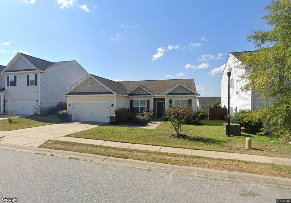
432 Council Loop Unit 211 Columbia, SC 29209
Southeast Columbia NeighborhoodEstimated Value: $257,141 - $286,000
4
Beds
2
Baths
1,841
Sq Ft
$148/Sq Ft
Est. Value
About This Home
This home is located at 432 Council Loop Unit 211, Columbia, SC 29209 and is currently estimated at $271,785, approximately $147 per square foot. 432 Council Loop Unit 211 is a home located in Richland County with nearby schools including Annie Burnside Elementary School, Crayton Middle School, and A. C. Flora High School.
Ownership History
Date
Name
Owned For
Owner Type
Purchase Details
Closed on
May 22, 2024
Sold by
Burnside Farm Associates Llc and Burnside Farms Development Llc
Bought by
City Of Columbia Heights
Current Estimated Value
Purchase Details
Closed on
May 5, 2023
Sold by
Holford Jacqueline M
Bought by
Nolon Chandrea Franks
Home Financials for this Owner
Home Financials are based on the most recent Mortgage that was taken out on this home.
Original Mortgage
$177,248
Interest Rate
6.42%
Mortgage Type
FHA
Purchase Details
Closed on
Aug 30, 2018
Sold by
Essex Homes Southeast Inc
Bought by
Holford Jacqueline M and Holford Jacki M
Home Financials for this Owner
Home Financials are based on the most recent Mortgage that was taken out on this home.
Original Mortgage
$152,000
Interest Rate
3.5%
Mortgage Type
Adjustable Rate Mortgage/ARM
Create a Home Valuation Report for This Property
The Home Valuation Report is an in-depth analysis detailing your home's value as well as a comparison with similar homes in the area
Home Values in the Area
Average Home Value in this Area
Purchase History
| Date | Buyer | Sale Price | Title Company |
|---|---|---|---|
| City Of Columbia Heights | -- | None Listed On Document | |
| Nolon Chandrea Franks | $260,000 | None Listed On Document | |
| Holford Jacqueline M | $171,000 | None Available |
Source: Public Records
Mortgage History
| Date | Status | Borrower | Loan Amount |
|---|---|---|---|
| Previous Owner | Nolon Chandrea Franks | $177,248 | |
| Previous Owner | Holford Jacqueline M | $152,000 |
Source: Public Records
Tax History
| Year | Tax Paid | Tax Assessment Tax Assessment Total Assessment is a certain percentage of the fair market value that is determined by local assessors to be the total taxable value of land and additions on the property. | Land | Improvement |
|---|---|---|---|---|
| 2024 | $1,860 | $260,000 | $45,000 | $215,000 |
| 2023 | $1,793 | $6,840 | $0 | $0 |
| 2022 | $1,240 | $171,000 | $33,500 | $137,500 |
| 2021 | $1,281 | $6,840 | $0 | $0 |
| 2020 | $1,351 | $6,840 | $0 | $0 |
| 2019 | $1,360 | $6,840 | $0 | $0 |
| 2018 | $125 | $250 | $0 | $0 |
Source: Public Records
Map
Nearby Homes
- 173 Council Loop
- 300 E Lake Trail
- 225 E Lake Trail
- 174 Preston Green Dr
- 267 Ashewood Commons Dr
- 31 Silverleaf Ct
- 11 Paperbark Ct
- 48 Castle Cary Ct
- 123 Gayle Pond Trace
- 267 Ashewood Lake Dr
- 25 Willow Hurst Ct
- 7801 Skylark Dr
- 577 Swamp Grass Dr
- 578 Swamp Grass Dr
- 576 Swamp Grass Dr
- 582 Swamp Grass Dr
- 569 Swamp Grass Dr
- 164 Springway Dr
- 7520 Pell St
- 583 Swamp Grass Dr
- 432 Council Loop
- 436 Council Loop
- 428 Council Loop
- 514 Scribes Ln
- 440 Council Loop
- 424 Council Loop
- 510 Scribes Ln
- 516 Scribes Ln
- 437 Council Loop
- 433 Council Loop
- 506 Scribes Ln
- 520 Scribes Ln
- 429 Council Loop
- 420 Council Loop
- 441 Council Loop
- 425 Council Loop
- 524 Scribes Ln
- 107 Beacons Field Rd
- 111 Beacon's Field Rd
- 416 Council Loop
Your Personal Tour Guide
Ask me questions while you tour the home.