Estimated Value: $207,949 - $238,000
3
Beds
1
Bath
912
Sq Ft
$246/Sq Ft
Est. Value
About This Home
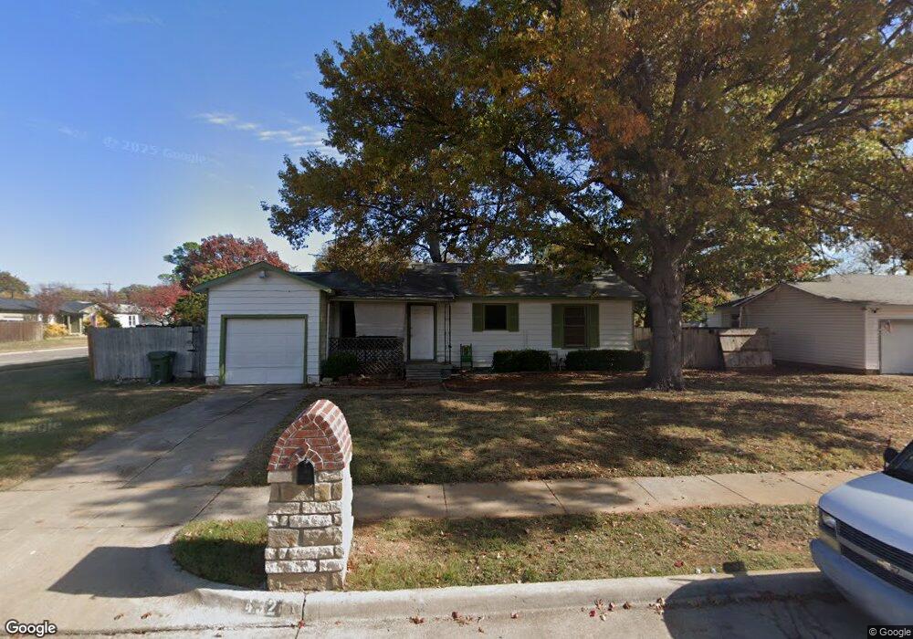
This home is located at 432 Harrison Ln, Hurst, TX 76053 and is currently estimated at $224,487, approximately $246 per square foot. 432 Harrison Ln is a home located in Tarrant County with nearby schools including Harrison Lane Elementary School, Hurst J High School, and L.D. Bell High School.
Ownership History
Date
Name
Owned For
Owner Type
Purchase Details
Closed on
Dec 19, 2024
Sold by
Foldi Gary
Bought by
Highstorm Llc
Current Estimated Value
Purchase Details
Closed on
Oct 30, 2002
Sold by
Marion Nora D
Bought by
Foldi Gary
Home Financials for this Owner
Home Financials are based on the most recent Mortgage that was taken out on this home.
Original Mortgage
$57,600
Interest Rate
5.95%
Purchase Details
Closed on
Nov 27, 2001
Sold by
Jeremiah Land Management Trust
Bought by
Marion Nora D
Home Financials for this Owner
Home Financials are based on the most recent Mortgage that was taken out on this home.
Original Mortgage
$73,594
Interest Rate
6.57%
Mortgage Type
FHA
Purchase Details
Closed on
Aug 20, 2001
Sold by
Dash Property Co
Bought by
Jeremiah Land Management Trust
Home Financials for this Owner
Home Financials are based on the most recent Mortgage that was taken out on this home.
Original Mortgage
$51,100
Interest Rate
6.96%
Mortgage Type
Purchase Money Mortgage
Create a Home Valuation Report for This Property
The Home Valuation Report is an in-depth analysis detailing your home's value as well as a comparison with similar homes in the area
Home Values in the Area
Average Home Value in this Area
Purchase History
| Date | Buyer | Sale Price | Title Company |
|---|---|---|---|
| Highstorm Llc | -- | Capital Title | |
| Foldi Gary | -- | Commonwealth Land Title | |
| Marion Nora D | -- | First American Title Co | |
| Jeremiah Land Management Trust | -- | First American Title Co | |
| Dash Property Co | -- | First American Title Co |
Source: Public Records
Mortgage History
| Date | Status | Borrower | Loan Amount |
|---|---|---|---|
| Previous Owner | Foldi Gary | $57,600 | |
| Previous Owner | Marion Nora D | $73,594 | |
| Previous Owner | Dash Property Co | $51,100 |
Source: Public Records
Tax History
| Year | Tax Paid | Tax Assessment Tax Assessment Total Assessment is a certain percentage of the fair market value that is determined by local assessors to be the total taxable value of land and additions on the property. | Land | Improvement |
|---|---|---|---|---|
| 2025 | $3,909 | $130,000 | $55,000 | $75,000 |
| 2024 | $3,909 | $191,376 | $55,000 | $136,376 |
| 2023 | $3,902 | $194,763 | $35,000 | $159,763 |
| 2022 | $3,930 | $170,682 | $35,000 | $135,682 |
| 2021 | $3,732 | $154,725 | $35,000 | $119,725 |
| 2020 | $3,247 | $134,958 | $35,000 | $99,958 |
| 2019 | $3,095 | $126,471 | $35,000 | $91,471 |
| 2018 | $2,352 | $96,093 | $15,000 | $81,093 |
| 2017 | $2,432 | $96,093 | $15,000 | $81,093 |
| 2016 | $2,190 | $86,544 | $15,000 | $71,544 |
| 2015 | $1,621 | $61,800 | $13,500 | $48,300 |
| 2014 | $1,621 | $61,800 | $13,500 | $48,300 |
Source: Public Records
Map
Nearby Homes
Your Personal Tour Guide
Ask me questions while you tour the home.