Estimated Value: $256,669 - $283,000
3
Beds
3
Baths
1,683
Sq Ft
$161/Sq Ft
Est. Value
About This Home
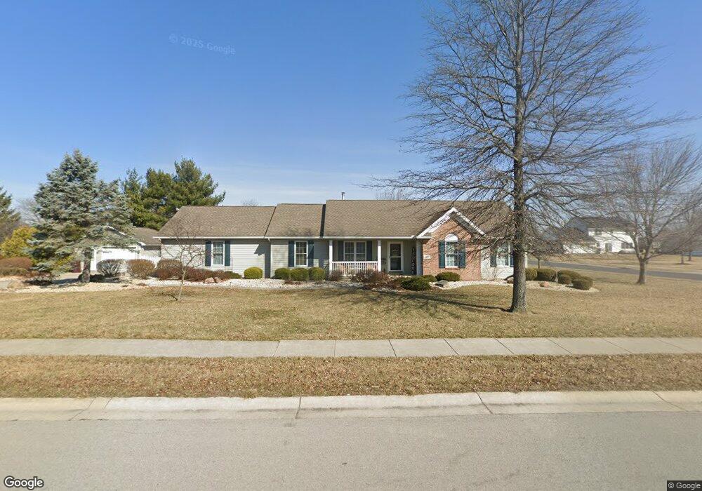
This home is located at 432 Hays Ave, Ada, OH 45810 and is currently estimated at $271,556, approximately $161 per square foot. 432 Hays Ave is a home located in Hardin County with nearby schools including Ada Elementary School and Ada High School.
Ownership History
Date
Name
Owned For
Owner Type
Purchase Details
Closed on
Dec 17, 2018
Sold by
Neumeier James R and Neumeier Bonnie L
Bought by
Shepherd Edward and Shepherd Charlotte
Current Estimated Value
Purchase Details
Closed on
Jul 30, 2007
Sold by
Daniels Deanna
Bought by
Neumeier James R and Neumeier Bonnie L
Purchase Details
Closed on
Jun 13, 1997
Bought by
Daniels Deanna
Create a Home Valuation Report for This Property
The Home Valuation Report is an in-depth analysis detailing your home's value as well as a comparison with similar homes in the area
Home Values in the Area
Average Home Value in this Area
Purchase History
| Date | Buyer | Sale Price | Title Company |
|---|---|---|---|
| Shepherd Edward | $247,000 | None Available | |
| Neumeier James R | $226,000 | None Available | |
| Daniels Deanna | $21,000 | -- |
Source: Public Records
Tax History Compared to Growth
Tax History
| Year | Tax Paid | Tax Assessment Tax Assessment Total Assessment is a certain percentage of the fair market value that is determined by local assessors to be the total taxable value of land and additions on the property. | Land | Improvement |
|---|---|---|---|---|
| 2024 | $2,806 | $71,140 | $13,020 | $58,120 |
| 2023 | $2,806 | $71,140 | $13,020 | $58,120 |
| 2022 | $2,782 | $61,720 | $13,670 | $48,050 |
| 2021 | $3,057 | $61,720 | $13,670 | $48,050 |
| 2020 | $3,100 | $61,720 | $13,670 | $48,050 |
| 2019 | $2,661 | $53,540 | $13,020 | $40,520 |
| 2018 | $2,141 | $53,540 | $13,020 | $40,520 |
| 2017 | $2,093 | $53,540 | $13,020 | $40,520 |
| 2016 | $1,960 | $52,910 | $8,680 | $44,230 |
| 2015 | $2,251 | $52,910 | $8,680 | $44,230 |
| 2014 | $1,909 | $52,910 | $8,680 | $44,230 |
| 2013 | $2,009 | $52,910 | $8,680 | $44,230 |
Source: Public Records
Map
Nearby Homes
- 710 S Main St
- 623 S Gilbert St
- 314 E University Ave
- 617 S Gilbert St
- 613 S Gilbert St
- 308-310 S Simon St
- 301 S Main St
- 212 N Simon St
- 118 W Buckeye Ave
- 211 S Main St
- 211 W Buckeye Ave Unit 211 1/2
- 210 N Gilbert St
- 442 Edwards St
- 444 Edwards St Unit A, B
- 444 Edwards St Unit 2
- 128 W North Ave
- 629 N Main St
- 4071 Township Road 35
- 2864 Ohio 309
- 3931 County Road 80