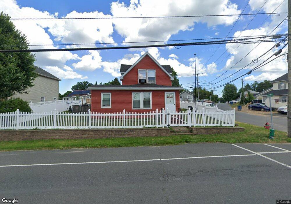
432 Laurence Pkwy South Amboy, NJ 08879
Estimated Value: $390,752 - $443,000
--
Bed
--
Bath
1,349
Sq Ft
$315/Sq Ft
Est. Value
About This Home
This home is located at 432 Laurence Pkwy, South Amboy, NJ 08879 and is currently estimated at $424,938, approximately $315 per square foot. 432 Laurence Pkwy is a home located in Middlesex County with nearby schools including Old Bridge High School, Matawan Montessori Academy, and St. Joseph Elementary School.
Ownership History
Date
Name
Owned For
Owner Type
Purchase Details
Closed on
Feb 15, 2023
Sold by
Coghan Debra
Bought by
Schworn Robert A
Current Estimated Value
Home Financials for this Owner
Home Financials are based on the most recent Mortgage that was taken out on this home.
Original Mortgage
$276,210
Outstanding Balance
$267,544
Interest Rate
6.33%
Mortgage Type
VA
Estimated Equity
$157,394
Purchase Details
Closed on
Jul 17, 2002
Sold by
Thomsen Stanley
Bought by
Schworn Robert and Schworn Dorothy
Home Financials for this Owner
Home Financials are based on the most recent Mortgage that was taken out on this home.
Original Mortgage
$153,000
Interest Rate
6.73%
Create a Home Valuation Report for This Property
The Home Valuation Report is an in-depth analysis detailing your home's value as well as a comparison with similar homes in the area
Home Values in the Area
Average Home Value in this Area
Purchase History
| Date | Buyer | Sale Price | Title Company |
|---|---|---|---|
| Schworn Robert A | -- | Foundation Title | |
| Schworn Robert | $170,000 | -- |
Source: Public Records
Mortgage History
| Date | Status | Borrower | Loan Amount |
|---|---|---|---|
| Open | Schworn Robert A | $276,210 | |
| Previous Owner | Schworn Robert | $153,000 |
Source: Public Records
Tax History Compared to Growth
Tax History
| Year | Tax Paid | Tax Assessment Tax Assessment Total Assessment is a certain percentage of the fair market value that is determined by local assessors to be the total taxable value of land and additions on the property. | Land | Improvement |
|---|---|---|---|---|
| 2025 | $6,353 | $110,900 | $42,800 | $68,100 |
| 2024 | $6,093 | $110,900 | $42,800 | $68,100 |
| 2023 | $6,093 | $110,900 | $42,800 | $68,100 |
| 2022 | $5,429 | $110,900 | $42,800 | $68,100 |
| 2021 | $4,089 | $110,900 | $42,800 | $68,100 |
| 2020 | $5,249 | $110,900 | $42,800 | $68,100 |
| 2019 | $5,657 | $110,900 | $42,800 | $68,100 |
| 2018 | $5,094 | $110,900 | $42,800 | $68,100 |
| 2017 | $4,920 | $110,900 | $42,800 | $68,100 |
| 2016 | $5,312 | $110,900 | $42,800 | $68,100 |
| 2015 | $4,719 | $110,900 | $42,800 | $68,100 |
| 2014 | $4,656 | $110,900 | $42,800 | $68,100 |
Source: Public Records
Map
Nearby Homes
- 438 Brookside Ave
- 310 Woodland Ave
- 169 Norwood Ave
- 198 Hillcrest Ave
- 696 Grove Ave
- 274 Prospect Ave
- 146 Orchard Ave
- 250 Brookside Ave
- 281 Prospect Ave
- 429 Lea Ave
- 21 Lantana Way
- 301 Shoreland Cir
- 269 Garfield Ave
- 235 Garfield Ave
- 809 Summerfield Ave
- 25 Catherine Ct
- 107 Boulevard W
- 4 Linda Ct Unit 4
- 4 Linda Ct
- 106 Boulevard W
- 434 Laurence Pkwy
- 433 Brookside Ave
- 715 Laurence Pkwy
- 427 Laurence Pkwy
- 717 Laurence Pkwy
- 436 Brookside Ave
- 490 Brookside Ave
- 748 Hilltop Ave
- 426 Laurence Pkwy
- 120 Laurence Pkwy
- 493 Brookside Ave
- 491 Brookside Ave
- 2819 747 Hilltop Ave
- 425 Laurence Pkwy
- 747 Hilltop Ave
- 122 Laurence Pkwy
- 720 Laurence Pkwy
- 746 Hilltop Ave
- 440 Brookside Ave
- 487 Brookside Ave