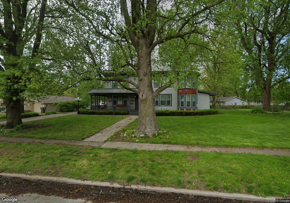
432 N 5th St Unit 1 Auburn, IL 62615
Estimated Value: $76,000 - $109,000
--
Bed
--
Bath
--
Sq Ft
6,011
Sq Ft Lot
About This Home
This home is located at 432 N 5th St Unit 1, Auburn, IL 62615 and is currently estimated at $98,211. 432 N 5th St Unit 1 is a home located in Sangamon County with nearby schools including Auburn Elementary School, Auburn Middle School, and Auburn Junior High School.
Ownership History
Date
Name
Owned For
Owner Type
Purchase Details
Closed on
Jun 8, 2018
Sold by
Garrelts Julia A and Garrelts Matt
Bought by
Jarrard Ronald W
Current Estimated Value
Home Financials for this Owner
Home Financials are based on the most recent Mortgage that was taken out on this home.
Original Mortgage
$70,695
Outstanding Balance
$62,132
Interest Rate
5.25%
Mortgage Type
FHA
Estimated Equity
$36,079
Purchase Details
Closed on
Jun 19, 2015
Purchase Details
Closed on
Nov 5, 2011
Purchase Details
Closed on
Apr 15, 2010
Purchase Details
Closed on
Jun 18, 1997
Create a Home Valuation Report for This Property
The Home Valuation Report is an in-depth analysis detailing your home's value as well as a comparison with similar homes in the area
Home Values in the Area
Average Home Value in this Area
Purchase History
| Date | Buyer | Sale Price | Title Company |
|---|---|---|---|
| Jarrard Ronald W | $72,000 | Illinois Real Estate Title | |
| -- | $62,000 | -- | |
| -- | $33,400 | -- | |
| -- | -- | -- | |
| -- | -- | -- |
Source: Public Records
Mortgage History
| Date | Status | Borrower | Loan Amount |
|---|---|---|---|
| Open | Jarrard Ronald W | $70,695 |
Source: Public Records
Tax History Compared to Growth
Tax History
| Year | Tax Paid | Tax Assessment Tax Assessment Total Assessment is a certain percentage of the fair market value that is determined by local assessors to be the total taxable value of land and additions on the property. | Land | Improvement |
|---|---|---|---|---|
| 2024 | $624 | $16,755 | $4,854 | $11,901 |
| 2023 | $572 | $15,322 | $4,439 | $10,883 |
| 2022 | $517 | $14,507 | $4,203 | $10,304 |
| 2021 | $489 | $13,931 | $4,036 | $9,895 |
| 2020 | $488 | $13,882 | $4,022 | $9,860 |
| 2019 | $468 | $13,538 | $3,922 | $9,616 |
| 2018 | $453 | $13,258 | $3,841 | $9,417 |
| 2017 | $439 | $12,767 | $3,699 | $9,068 |
| 2016 | $420 | $12,687 | $3,676 | $9,011 |
| 2015 | $601 | $12,539 | $3,633 | $8,906 |
| 2014 | $809 | $12,733 | $3,689 | $9,044 |
| 2013 | -- | $12,315 | $3,568 | $8,747 |
Source: Public Records
Map
Nearby Homes
- 446 N 7th St Unit 1
- 0 Illinois 104
- 158 E Monroe St
- 109 N Violet Dr Unit 1
- 3926 Circle Dr Unit 1
- 207 W Elm St
- 10553 S Main St Unit 1
- 6716 Tower Heights Rd
- 108 Kodiak Dr
- 233 W South St Unit 1
- 1 Henrietta
- 0 State Route 4
- 34 Buckingham Rd Unit 1
- 512 High School St Unit 1
- 131 E Olive St
- 530 S Grand Ave
- 448 Wintergreen Dr
- 26 Circle
- 0 Withers Rd
- 852 Oxford Dr Unit 1
- 432 N 5th St Unit 1
- 432 N 5th St
- 414 N 5th St Unit 1
- 506 N 5th St Unit 1
- 413 N 6th St Unit 1
- 410 N 5th St Unit 1
- 409 N 6th St Unit 1
- 510 N 5th St
- 501 N 5th St Unit 1
- 405 N 6th St Unit 1
- 514 N 5th St
- 511 N 6th St Unit 1
- 402 N 5th St Unit 1
- 516 N 5th St Unit 1
- 515 N 6th St Unit 1
- 401 N 6th St Unit 1
- 601 W Maple Ave
- 518 N 5th St Unit 1
- 502 N 6th St
- 515 N 5th St Unit 1