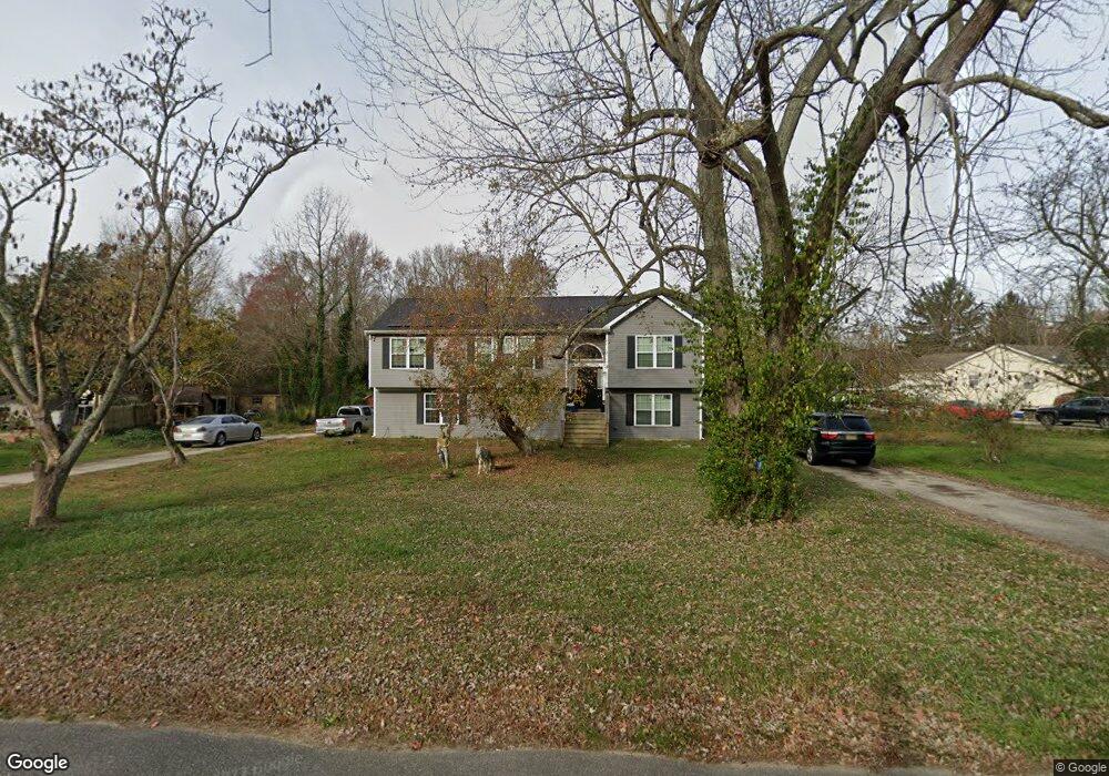
432 N Lincoln Ave Vineland, NJ 08361
Estimated Value: $320,000 - $413,000
--
Bed
--
Bath
1,668
Sq Ft
$219/Sq Ft
Est. Value
About This Home
This home is located at 432 N Lincoln Ave, Vineland, NJ 08361 and is currently estimated at $366,018, approximately $219 per square foot. 432 N Lincoln Ave is a home located in Cumberland County with nearby schools including Pauline J. Petway Elementary School, Anthony Rossi Elementary School, and Johnstone School.
Ownership History
Date
Name
Owned For
Owner Type
Purchase Details
Closed on
Dec 20, 2016
Sold by
Bigelow Linda D
Bought by
Bigelow Linda D and Cantie Rachel D
Current Estimated Value
Purchase Details
Closed on
Jun 7, 2016
Sold by
Bigelow Linda D and Estate Of James H Bigelow
Bought by
Bigelow Linda D
Purchase Details
Closed on
Dec 15, 1994
Sold by
Garcia America and Garcia Elias
Bought by
Bigelow James H
Purchase Details
Closed on
Mar 21, 1994
Sold by
Garcia Elias and Garcia America
Bought by
Garcia Elias and Garcia America
Create a Home Valuation Report for This Property
The Home Valuation Report is an in-depth analysis detailing your home's value as well as a comparison with similar homes in the area
Home Values in the Area
Average Home Value in this Area
Purchase History
| Date | Buyer | Sale Price | Title Company |
|---|---|---|---|
| Bigelow Linda D | -- | None Available | |
| Bigelow Linda D | -- | None Available | |
| Bigelow James H | $80,000 | Beacon Title Svcs Agency Inc | |
| Garcia Elias | -- | -- | |
| Garcia Elias | -- | -- |
Source: Public Records
Tax History Compared to Growth
Tax History
| Year | Tax Paid | Tax Assessment Tax Assessment Total Assessment is a certain percentage of the fair market value that is determined by local assessors to be the total taxable value of land and additions on the property. | Land | Improvement |
|---|---|---|---|---|
| 2025 | $6,486 | $203,700 | $46,400 | $157,300 |
| 2024 | $6,486 | $203,700 | $46,400 | $157,300 |
| 2023 | $6,443 | $203,700 | $46,400 | $157,300 |
| 2022 | $6,252 | $203,700 | $46,400 | $157,300 |
| 2021 | $6,137 | $203,700 | $46,400 | $157,300 |
| 2020 | $5,962 | $203,700 | $46,400 | $157,300 |
| 2019 | $5,881 | $203,700 | $46,400 | $157,300 |
| 2018 | $1,450 | $51,600 | $46,400 | $5,200 |
| 2017 | $1,378 | $51,600 | $46,400 | $5,200 |
| 2016 | $3,550 | $137,800 | $46,400 | $91,400 |
| 2015 | $2,919 | $137,800 | $46,400 | $91,400 |
| 2014 | $2,733 | $137,800 | $46,400 | $91,400 |
Source: Public Records
Map
Nearby Homes
- 3635 Maple Ave
- 3258 E Landis Ave
- 3020 E Oak Rd
- 191 Redcrest St
- 117 Redcrest St
- 2818 Vine Rd
- 3070 E Chestnut Ave
- 866 N Brewster Rd
- 208 S Brewster Rd
- 0 Post Rd Unit NJAC2018654
- 116 Lejan Terrace
- 1404 S Central Ave
- 2227 E Landis Ave
- 4926 Landis Ave
- 1402 S Central Ave
- 1402 Central
- 101 Oaklawn Terrace
- 4024 Renee Dr
- 208 Oaklawn Terrace
- 560 Union Rd
- 388 N Lincoln Ave
- 462 N Lincoln Ave
- 441 N Lincoln Ave
- 360 N Lincoln Ave
- 3861 Maple Ave
- 3835 Maple Ave
- 484 N Lincoln Ave
- 3809 Maple Ave
- 357 N Lincoln Ave
- 491 N Lincoln Ave
- 3840 Maple Ave
- 516 N Lincoln Ave
- 3759 Maple Ave
- 3810 Maple Ave
- 307 N Lincoln Ave
- 279 N Lincoln Ave
- 548 N Lincoln Ave
- 4000 Maple Ave
- 272 N Lincoln Ave
- 263 N Lincoln Ave