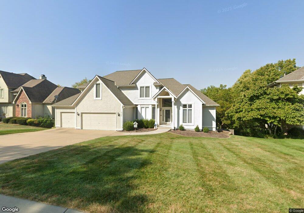
432 NW Highcliffe Dr Lees Summit, MO 64081
Estimated Value: $569,289 - $622,000
5
Beds
5
Baths
3,288
Sq Ft
$181/Sq Ft
Est. Value
About This Home
This home is located at 432 NW Highcliffe Dr, Lees Summit, MO 64081 and is currently estimated at $594,822, approximately $180 per square foot. 432 NW Highcliffe Dr is a home located in Jackson County with nearby schools including Cedar Creek Elementary School, Pleasant Lea Middle School, and Lee's Summit Senior High School.
Ownership History
Date
Name
Owned For
Owner Type
Purchase Details
Closed on
May 18, 2010
Sold by
Mercer David K
Bought by
Mercer Sheila N
Current Estimated Value
Purchase Details
Closed on
Oct 3, 1997
Sold by
Shaw John D and Shaw Linda S
Bought by
Mercer David K and Mercer Sheila N
Home Financials for this Owner
Home Financials are based on the most recent Mortgage that was taken out on this home.
Original Mortgage
$193,600
Outstanding Balance
$37,833
Interest Rate
9.87%
Mortgage Type
Purchase Money Mortgage
Estimated Equity
$556,989
Purchase Details
Closed on
Jun 19, 1996
Sold by
Custom Homes Llc
Bought by
Shaw John D and Shaw Linda S
Home Financials for this Owner
Home Financials are based on the most recent Mortgage that was taken out on this home.
Original Mortgage
$175,000
Interest Rate
7.64%
Mortgage Type
Purchase Money Mortgage
Create a Home Valuation Report for This Property
The Home Valuation Report is an in-depth analysis detailing your home's value as well as a comparison with similar homes in the area
Home Values in the Area
Average Home Value in this Area
Purchase History
| Date | Buyer | Sale Price | Title Company |
|---|---|---|---|
| Mercer Sheila N | -- | None Available | |
| Mercer David K | -- | Chicago Title Insurance Co | |
| Shaw John D | -- | -- |
Source: Public Records
Mortgage History
| Date | Status | Borrower | Loan Amount |
|---|---|---|---|
| Open | Mercer David K | $193,600 | |
| Previous Owner | Shaw John D | $175,000 |
Source: Public Records
Tax History
| Year | Tax Paid | Tax Assessment Tax Assessment Total Assessment is a certain percentage of the fair market value that is determined by local assessors to be the total taxable value of land and additions on the property. | Land | Improvement |
|---|---|---|---|---|
| 2025 | $6,336 | $94,998 | $11,951 | $83,047 |
| 2024 | $6,290 | $87,742 | $11,571 | $76,171 |
| 2023 | $6,290 | $87,742 | $8,651 | $79,091 |
| 2022 | $6,427 | $79,610 | $9,624 | $69,986 |
| 2021 | $6,560 | $79,610 | $9,624 | $69,986 |
| 2020 | $6,308 | $75,811 | $9,624 | $66,187 |
| 2019 | $6,136 | $92,186 | $9,624 | $82,562 |
| 2018 | $5,980 | $68,566 | $7,155 | $61,411 |
| 2016 | $5,253 | $59,622 | $6,023 | $53,599 |
Source: Public Records
Map
Nearby Homes
- 2122 NW Ashurst Dr
- 334 NW Ambersham Dr
- 433 NW Kaylea Ct
- 2110 NW Ashurst Dr
- 2074 NW O'Brien Rd
- 2070 NW O'Brien Rd
- 2214 NW Killarney Ln
- 2123 NW Killarney Ln
- 2127 NW Killarney Ln
- 507 NW Ashurst Ct
- 2224 NW Summerfield Dr
- 2430 NW Windwood Dr
- 109 SW Drew Ln
- 2635 NW Ashurst Ln
- 336 NW Thoreau Cir
- 2031 SW 4th St
- 129 NW Morton Dr
- 2114 NW Killarney Ln
- 1905 SW 3rd St
- 2809 NW Audubon Ln
- 428 NW Highcliffe Dr
- 436 NW Highcliffe Dr
- 429 NW Highcliffe Dr
- 424 NW Highcliffe Dr
- 500 NW Highcliffe Dr
- 501 NW Highcliffe Dr
- 504 NW Highcliffe Dr
- 2213 NW Ashurst Dr
- 420 NW Highcliffe Dr
- 415 NW Ambersham Dr
- 413 NW Highcliffe Dr
- 419 NW Ambersham Dr
- 411 NW Ambersham Dr
- 2209 NW Ashurst Dr
- 508 NW Highcliffe Dr
- 508 NW Brookhaven Dr
- 416 NW Highcliffe Dr
- 423 NW Ambersham Dr
- 2208 NW Ashurst Dr
- 505 NW Highcliffe Dr
Your Personal Tour Guide
Ask me questions while you tour the home.