Estimated Value: $688,000 - $750,000
3
Beds
3
Baths
2,862
Sq Ft
$248/Sq Ft
Est. Value
About This Home
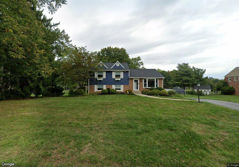
This home is located at 432 Robin Hill Rd, Wayne, PA 19087 and is currently estimated at $710,957, approximately $248 per square foot. 432 Robin Hill Rd is a home located in Montgomery County with nearby schools including Roberts Elementary School, Upper Merion Middle School, and Upper Merion High School.
Ownership History
Date
Name
Owned For
Owner Type
Purchase Details
Closed on
Jun 17, 2021
Sold by
Maruszczak William L and Maruszczak Bridget M
Bought by
Hood Mary Ann
Current Estimated Value
Home Financials for this Owner
Home Financials are based on the most recent Mortgage that was taken out on this home.
Original Mortgage
$388,000
Outstanding Balance
$351,286
Interest Rate
2.9%
Mortgage Type
New Conventional
Estimated Equity
$359,671
Purchase Details
Closed on
Mar 29, 1996
Sold by
Maruszczak William I
Bought by
Maruszczak William I and Maruszczak Bridget M
Create a Home Valuation Report for This Property
The Home Valuation Report is an in-depth analysis detailing your home's value as well as a comparison with similar homes in the area
Home Values in the Area
Average Home Value in this Area
Purchase History
| Date | Buyer | Sale Price | Title Company |
|---|---|---|---|
| Hood Mary Ann | $485,000 | None Available | |
| Maruszczak William I | -- | -- |
Source: Public Records
Mortgage History
| Date | Status | Borrower | Loan Amount |
|---|---|---|---|
| Open | Hood Mary Ann | $388,000 |
Source: Public Records
Tax History Compared to Growth
Tax History
| Year | Tax Paid | Tax Assessment Tax Assessment Total Assessment is a certain percentage of the fair market value that is determined by local assessors to be the total taxable value of land and additions on the property. | Land | Improvement |
|---|---|---|---|---|
| 2025 | $5,690 | $184,640 | $63,020 | $121,620 |
| 2024 | $5,690 | $184,640 | $63,020 | $121,620 |
| 2023 | $5,488 | $184,640 | $63,020 | $121,620 |
| 2022 | $5,254 | $184,640 | $63,020 | $121,620 |
| 2021 | $5,091 | $184,640 | $63,020 | $121,620 |
| 2020 | $4,865 | $184,640 | $63,020 | $121,620 |
| 2019 | $4,782 | $184,640 | $63,020 | $121,620 |
| 2018 | $4,782 | $184,640 | $63,020 | $121,620 |
| 2017 | $4,610 | $184,640 | $63,020 | $121,620 |
| 2016 | $4,539 | $184,640 | $63,020 | $121,620 |
| 2015 | $4,371 | $184,640 | $63,020 | $121,620 |
| 2014 | $4,371 | $184,640 | $63,020 | $121,620 |
Source: Public Records
Map
Nearby Homes
- 356 King of Prussia Rd
- 897 Croton Rd
- 679 Crestwood Rd
- 952 Hobbs Rd
- 413 Hillside Rd
- 545 Kingwood Rd
- 648 Shoemaker Ln
- 570 Fletcher Rd
- 1048 Whitegate Rd
- 820 Weadley Rd
- 346 W Church Rd
- 459 S Gulph Rd
- 545 Hughes Rd
- 191 Gunport Rd
- 962 Weadley Rd
- 359 Valley View Rd
- 424 Weadley Rd
- 691 Twin Bridge Dr
- 422 Bluebuff Rd
- 501 W Dekalb Pike
- 438 Robin Hill Rd
- 426 Robin Hill Rd
- 420 Robin Hill Rd
- 442 Robin Hill Rd
- 696 Raven Rd
- 433 Robin Hill Rd
- 429 Robin Hill Rd
- 439 Robin Hill Rd
- 412 Robin Hill Rd
- 421 Robin Hill Rd
- 692 Raven Rd
- 413 Robin Hill Rd
- 438 Brookwood Rd
- 466 Brookwood Rd
- 432 Brookwood Rd
- 697 Mallard Rd
- 697 Raven Rd
- 426 Brookwood Rd
- 448 Brookwood Rd
- 703 Mallard Rd