Estimated Value: $499,000 - $661,431
4
Beds
2
Baths
1,500
Sq Ft
$380/Sq Ft
Est. Value
About This Home
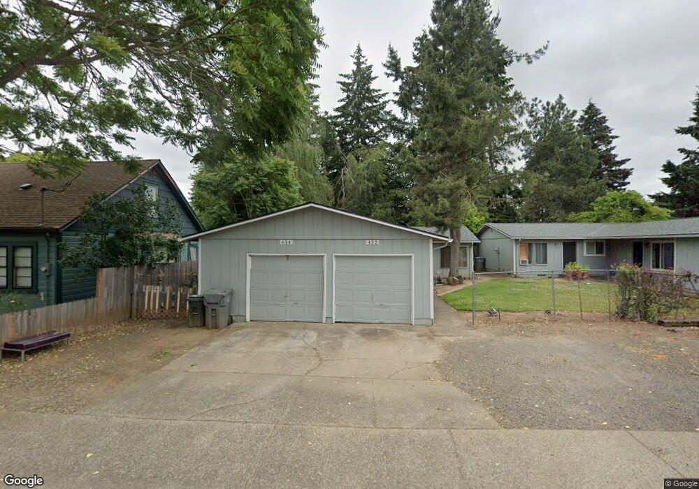
This home is located at 432 S Locust St, Canby, OR 97013 and is currently estimated at $569,608, approximately $379 per square foot. 432 S Locust St is a home with nearby schools including Josefa L. Sambrano Elementary School, Cecile Trost Elementary School, and Carus School.
Ownership History
Date
Name
Owned For
Owner Type
Purchase Details
Closed on
Mar 5, 2024
Sold by
Morgan Brandi S
Bought by
Derek C Morgan And Brandi S Morgan Revocable and Morgan
Current Estimated Value
Purchase Details
Closed on
Dec 3, 2022
Sold by
Haring David R
Bought by
Morgan Derek C and Morgan Brandi S
Home Financials for this Owner
Home Financials are based on the most recent Mortgage that was taken out on this home.
Original Mortgage
$314,690
Interest Rate
7.08%
Mortgage Type
Seller Take Back
Purchase Details
Closed on
Mar 1, 1990
Bought by
Haring David R and Haring Karen E
Create a Home Valuation Report for This Property
The Home Valuation Report is an in-depth analysis detailing your home's value as well as a comparison with similar homes in the area
Home Values in the Area
Average Home Value in this Area
Purchase History
| Date | Buyer | Sale Price | Title Company |
|---|---|---|---|
| Derek C Morgan And Brandi S Morgan Revocable | -- | None Listed On Document | |
| Morgan Derek C | $400,000 | -- | |
| Haring David R | $121,000 | -- |
Source: Public Records
Mortgage History
| Date | Status | Borrower | Loan Amount |
|---|---|---|---|
| Previous Owner | Morgan Derek C | $314,690 |
Source: Public Records
Tax History Compared to Growth
Tax History
| Year | Tax Paid | Tax Assessment Tax Assessment Total Assessment is a certain percentage of the fair market value that is determined by local assessors to be the total taxable value of land and additions on the property. | Land | Improvement |
|---|---|---|---|---|
| 2025 | $6,170 | $348,241 | -- | -- |
| 2024 | $5,997 | $338,099 | -- | -- |
| 2023 | $5,997 | $328,252 | $0 | $0 |
| 2022 | $5,516 | $318,692 | $0 | $0 |
| 2021 | $5,311 | $309,410 | $0 | $0 |
| 2020 | $5,216 | $300,399 | $0 | $0 |
| 2019 | $4,967 | $291,650 | $0 | $0 |
| 2018 | $4,857 | $283,155 | $0 | $0 |
| 2017 | $4,733 | $274,908 | $0 | $0 |
| 2016 | $4,576 | $266,901 | $0 | $0 |
| 2015 | $4,419 | $259,127 | $0 | $0 |
| 2014 | $4,291 | $251,580 | $0 | $0 |
Source: Public Records
Map
Nearby Homes
- 385 SE Township Rd
- 486 S Knott St
- 550 SE 5th Ave
- 248 SE Township Rd
- 582 S Maple St
- 363 SE 7th Ave
- 620 SE 2nd Ave
- 620 SE 2nd Ave Unit 11
- 387 SE 7th Ave
- 423 SE 7th Ave
- 574 S Ivy St
- 1111 SE 3rd Ave Unit 74
- 835 SE 1st Ave Unit 64
- 835 SE 1st Ave Unit 14
- 835 SE 1st Ave Unit 12
- 835 SE 1st Ave Unit 17
- 331 SE 9th Ave
- 575 S Ponderosa St
- 481 S Holly St
- 299 SW 3rd Ave
- 452 S Locust St
- 402 S Locust St
- 485 S Manzanita Ct
- 475 S Manzanita Ct
- 400 S Locust St
- 425 SE 4th Ave
- 435 S Locust St
- 403 S Locust St
- 455 SE 4th Ave
- 474 S Locust St
- 494 S Locust St
- 490 S Locust St
- 478 S Locust St
- 478 S Locust St Unit 3
- 495 S Manzanita Ct
- 486 S Locust St
- 391 S Locust St
- 396 S Locust St
- 475 SE 4th Ave
- 390 SE Township Rd Unit 4