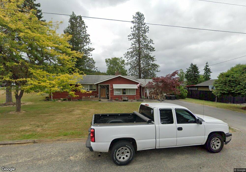
432 SW 19th St Chehalis, WA 98532
Estimated Value: $395,688 - $436,000
3
Beds
2
Baths
1,608
Sq Ft
$257/Sq Ft
Est. Value
About This Home
This home is located at 432 SW 19th St, Chehalis, WA 98532 and is currently estimated at $412,922, approximately $256 per square foot. 432 SW 19th St is a home located in Lewis County with nearby schools including James W. Lintott Elementary School, Olympic Elementary School, and Orin C. Smith Elementary School.
Ownership History
Date
Name
Owned For
Owner Type
Purchase Details
Closed on
Jun 30, 2025
Sold by
Lund Daryl J
Bought by
Haddock Cheryl Lund
Current Estimated Value
Purchase Details
Closed on
Nov 21, 2024
Sold by
Big D Land Llc
Bought by
Lund Daryl
Home Financials for this Owner
Home Financials are based on the most recent Mortgage that was taken out on this home.
Original Mortgage
$229,500
Interest Rate
6.32%
Mortgage Type
New Conventional
Purchase Details
Closed on
Sep 29, 2020
Sold by
Lund Daryl J
Bought by
Big D Land Llc
Purchase Details
Closed on
Nov 24, 2009
Sold by
Lund Daryl J
Bought by
Lund Daryl J
Create a Home Valuation Report for This Property
The Home Valuation Report is an in-depth analysis detailing your home's value as well as a comparison with similar homes in the area
Home Values in the Area
Average Home Value in this Area
Purchase History
| Date | Buyer | Sale Price | Title Company |
|---|---|---|---|
| Haddock Cheryl Lund | -- | None Listed On Document | |
| Lund Daryl | -- | Title Guaranty | |
| Big D Land Llc | -- | None Available | |
| Lund Daryl J | -- | None Available |
Source: Public Records
Mortgage History
| Date | Status | Borrower | Loan Amount |
|---|---|---|---|
| Previous Owner | Lund Daryl | $229,500 |
Source: Public Records
Tax History Compared to Growth
Tax History
| Year | Tax Paid | Tax Assessment Tax Assessment Total Assessment is a certain percentage of the fair market value that is determined by local assessors to be the total taxable value of land and additions on the property. | Land | Improvement |
|---|---|---|---|---|
| 2025 | $2,823 | $436,600 | $127,800 | $308,800 |
| 2024 | $2,823 | $376,000 | $127,800 | $248,200 |
| 2023 | $3,279 | $391,200 | $75,700 | $315,500 |
| 2022 | $2,912 | $304,300 | $60,300 | $244,000 |
| 2021 | $2,654 | $304,300 | $60,300 | $244,000 |
| 2020 | $2,648 | $254,300 | $57,600 | $196,700 |
| 2019 | $2,130 | $237,900 | $57,600 | $180,300 |
| 2018 | $2,378 | $209,800 | $48,000 | $161,800 |
| 2017 | $2,174 | $209,800 | $48,000 | $161,800 |
| 2016 | $2,090 | $186,200 | $49,200 | $137,000 |
| 2015 | $1,813 | $179,000 | $42,000 | $137,000 |
| 2013 | $1,813 | $178,400 | $42,000 | $136,400 |
Source: Public Records
Map
Nearby Homes
- 1933 S Market Blvd
- 535 SW 19th St
- 26 SE Spring St
- 1758 S Market Blvd
- 833 SW 20th St
- 2119 SW Olympic Dr
- 823 SW 21st St
- 226 SW 16th St
- 374 SW 15th St
- 386 SW 15th St
- 0 SE Carlesta Ave Unit NWM2417104
- 1492 SW Kelly Ave
- 119 Briarwood Ct
- 1350 SW Kelly Ave
- 107 Nicola Ct
- 615 SE Prospect St
- 270 SE Valley View Way
- 90 SW 12th St
- 0 SE Summit Rd Unit NWM2316477
- 0 Tillicum Dr Unit SAR202525914
- 450 SW 19th St
- 454 SW 19th St
- 1945 S Market Blvd
- 466 SW 19th St
- 1933 - 1935 S Market Blvd
- 437 SW 19th St
- 1893 SW Hubbard Ln
- 1893 SW Hubbard St
- 460 SW 19th St
- 514 SW 19th St
- 487 SW 19th St
- 1911 S Market Blvd
- 1890 SW Hubbard St
- 1961 S Market Blvd
- 1885 SW Hubbard Ln
- 1885 SW Hubbard St
- 558 SW 19th St
- 774 776 Moonlight Ln
- 519 SW 19th St
- 744 SW Moonlight Ln