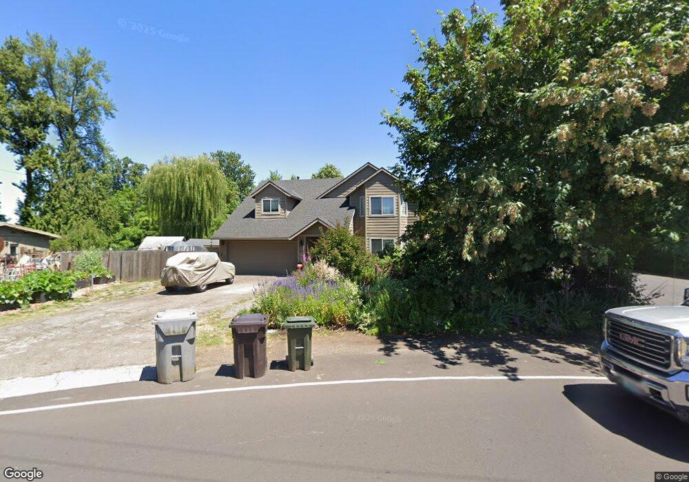
4320 Cedaroak Dr West Linn, OR 97068
Robinwood NeighborhoodEstimated Value: $637,000 - $771,000
4
Beds
3
Baths
2,188
Sq Ft
$321/Sq Ft
Est. Value
About This Home
This home is located at 4320 Cedaroak Dr, West Linn, OR 97068 and is currently estimated at $703,196, approximately $321 per square foot. 4320 Cedaroak Dr is a home located in Clackamas County with nearby schools including Cedaroak Park Primary School, West Linn High School, and Harmony Academy.
Ownership History
Date
Name
Owned For
Owner Type
Purchase Details
Closed on
Oct 26, 2018
Sold by
Gunter Todd J and Gunter Wendy G
Bought by
Gunter Todd J and Gunter Wendy G
Current Estimated Value
Purchase Details
Closed on
Jun 26, 2002
Sold by
Randall David O and Randall Carla A
Bought by
Gunter Todd J and Gunter Wendy G
Home Financials for this Owner
Home Financials are based on the most recent Mortgage that was taken out on this home.
Original Mortgage
$182,400
Outstanding Balance
$76,641
Interest Rate
6.86%
Estimated Equity
$626,555
Create a Home Valuation Report for This Property
The Home Valuation Report is an in-depth analysis detailing your home's value as well as a comparison with similar homes in the area
Home Values in the Area
Average Home Value in this Area
Purchase History
| Date | Buyer | Sale Price | Title Company |
|---|---|---|---|
| Gunter Todd J | -- | None Available | |
| Gunter Todd J | $228,000 | Fidelity National Title Co |
Source: Public Records
Mortgage History
| Date | Status | Borrower | Loan Amount |
|---|---|---|---|
| Open | Gunter Todd J | $182,400 | |
| Closed | Gunter Todd J | $34,200 |
Source: Public Records
Tax History Compared to Growth
Tax History
| Year | Tax Paid | Tax Assessment Tax Assessment Total Assessment is a certain percentage of the fair market value that is determined by local assessors to be the total taxable value of land and additions on the property. | Land | Improvement |
|---|---|---|---|---|
| 2025 | $6,934 | $359,828 | -- | -- |
| 2024 | $6,675 | $349,348 | -- | -- |
| 2023 | $6,675 | $339,173 | $0 | $0 |
| 2022 | $6,300 | $329,295 | $0 | $0 |
| 2021 | $5,981 | $319,704 | $0 | $0 |
| 2020 | $6,021 | $310,393 | $0 | $0 |
| 2019 | $5,742 | $301,353 | $0 | $0 |
| 2018 | $5,486 | $292,576 | $0 | $0 |
| 2017 | $5,273 | $284,054 | $0 | $0 |
| 2016 | $5,137 | $275,781 | $0 | $0 |
| 2015 | $4,810 | $267,749 | $0 | $0 |
| 2014 | $4,236 | $242,109 | $0 | $0 |
Source: Public Records
Map
Nearby Homes
- 19155 Nixon Ave
- 4610 Kenthorpe Way
- 3893 Cedaroak Dr
- 4622 Mapleton Dr
- 3910 Calaroga Cir
- 4400 Calaroga Dr
- 19885 Willamette Dr
- 19623 White Cloud Cir
- 18711 Willamette Dr
- 3446 Fernvilla Dr
- 18649 Old River Dr
- 19770 Wildwood Dr
- 19788 Wildwood Dr
- 20120 Larkspur Ln Unit 85
- 18418 Old River Landing
- 18515 SE River Rd
- 3340 Arbor Dr
- 2700 Underhill Ln Unit 1
- 2818 Treetop Ln
- 2488 Tulane St
- 4344 Cedaroak Dr
- 4310 Cedaroak Dr
- 4299 Terra Vista Ct
- 4300 Cedaroak Dr
- 4283 Terra Vista Ct
- 4271 Terra Vista Ct
- 19005 Nixon Ave
- 4424 Cedaroak Dr
- 4256 Terra Vista Ct
- 19025 Nixon Ave
- 4220 Terra Vista Ct
- 18917 Nixon Ave
- 18917 Nixon 1 3 Acre
- 18855 Nixonav
- 4230 Terra Vista Ct
- 18855 Nixon Ave
- 19045 Nixon Ave
- 4206 Cedaroak Dr
- 4242 Terra Vista Ct
- 4488 Cedaroak Dr