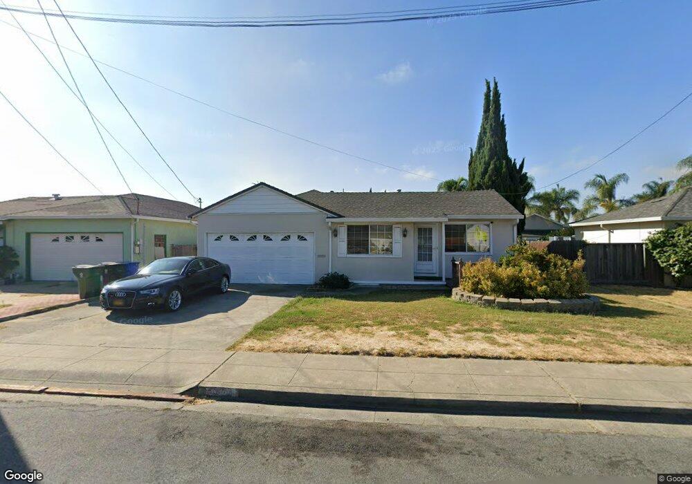
4320 Delaware Dr Fremont, CA 94538
Grimmer NeighborhoodEstimated Value: $1,345,818 - $1,795,000
3
Beds
2
Baths
1,250
Sq Ft
$1,229/Sq Ft
Est. Value
About This Home
This home is located at 4320 Delaware Dr, Fremont, CA 94538 and is currently estimated at $1,536,455, approximately $1,229 per square foot. 4320 Delaware Dr is a home located in Alameda County with nearby schools including Harvey Green Elementary School, John M. Horner Junior High School, and Irvington High School.
Ownership History
Date
Name
Owned For
Owner Type
Purchase Details
Closed on
Sep 20, 2021
Sold by
Lam Patrick S and Lam Karen Y
Bought by
Lam Family Trust and Lam
Current Estimated Value
Home Financials for this Owner
Home Financials are based on the most recent Mortgage that was taken out on this home.
Original Mortgage
$548,000
Interest Rate
2.8%
Purchase Details
Closed on
Sep 6, 2014
Sold by
Lam Patrick Seksung and Lam Karen Y
Bought by
Lam Family Trust
Purchase Details
Closed on
Mar 5, 2012
Sold by
Bank Of America National Association
Bought by
Yauman Lam Patrick Sek Sung and Yauman Lam Karen
Purchase Details
Closed on
Aug 31, 2011
Sold by
Taa Emmanuel A and Taa Bernellet C
Bought by
Bank Of America National Association
Purchase Details
Closed on
Jul 8, 2005
Sold by
Cruz Beverly and Taa Emmanuel A
Bought by
Taa Emmanuel A and Taa Bernellet C
Home Financials for this Owner
Home Financials are based on the most recent Mortgage that was taken out on this home.
Original Mortgage
$464,000
Interest Rate
5.62%
Mortgage Type
Purchase Money Mortgage
Purchase Details
Closed on
May 12, 2005
Sold by
Cruz Beverly and Ybarra Matthew
Bought by
Cruz Beverly and Tan Emmanuel A
Home Financials for this Owner
Home Financials are based on the most recent Mortgage that was taken out on this home.
Original Mortgage
$464,000
Interest Rate
5.62%
Mortgage Type
Purchase Money Mortgage
Purchase Details
Closed on
Dec 31, 2002
Sold by
Morse Diane and Morse Marvin
Bought by
Cruz Beverly
Home Financials for this Owner
Home Financials are based on the most recent Mortgage that was taken out on this home.
Original Mortgage
$332,000
Interest Rate
5.85%
Purchase Details
Closed on
May 16, 2002
Sold by
Morse Diane and Garza Diane
Bought by
Morse Marvin and Morse Diane
Home Financials for this Owner
Home Financials are based on the most recent Mortgage that was taken out on this home.
Original Mortgage
$115,000
Interest Rate
8.94%
Create a Home Valuation Report for This Property
The Home Valuation Report is an in-depth analysis detailing your home's value as well as a comparison with similar homes in the area
Home Values in the Area
Average Home Value in this Area
Purchase History
We collect this data history from publicly available records. To have your information removed, we recommend requesting removal directly through your county’s website.
| Date | Buyer | Sale Price | Title Company |
|---|---|---|---|
| Lam Family Trust | -- | Accommodation/Courtesy Recordi | |
| Lam Patrick S | -- | Wfg National Title Ins Co | |
| Lam Family Trust | -- | None Available | |
| Yauman Lam Patrick Sek Sung | $438,000 | Servicelink | |
| Bank Of America National Association | $380,000 | Accommodation | |
| Taa Emmanuel A | $155,000 | Alliance Title Company | |
| Cruz Beverly | -- | -- | |
| Cruz Beverly | $415,000 | -- | |
| Morse Marvin | -- | Fidelity National Title Co |
Source: Public Records
Mortgage History
We collect this data history from publicly available records. To have your information removed, we recommend requesting removal directly through your county’s website.
| Date | Status | Borrower | Loan Amount |
|---|---|---|---|
| Previous Owner | Lam Patrick S | $548,000 | |
| Previous Owner | Taa Emmanuel A | $464,000 | |
| Previous Owner | Cruz Beverly | $332,000 | |
| Previous Owner | Morse Marvin | $115,000 |
Source: Public Records
Tax History
| Year | Tax Paid | Tax Assessment Tax Assessment Total Assessment is a certain percentage of the fair market value that is determined by local assessors to be the total taxable value of land and additions on the property. | Land | Improvement |
|---|---|---|---|---|
| 2025 | $6,936 | $550,123 | $165,037 | $385,086 |
| 2024 | $6,936 | $539,340 | $161,802 | $377,538 |
| 2023 | $6,744 | $528,766 | $158,630 | $370,136 |
| 2022 | $6,646 | $518,398 | $155,519 | $362,879 |
| 2021 | $6,487 | $508,237 | $152,471 | $355,766 |
| 2020 | $6,469 | $503,028 | $150,908 | $352,120 |
| 2019 | $6,398 | $493,170 | $147,951 | $345,219 |
| 2018 | $6,272 | $483,503 | $145,051 | $338,452 |
| 2017 | $6,117 | $474,024 | $142,207 | $331,817 |
| 2016 | $6,008 | $464,730 | $139,419 | $325,311 |
| 2015 | $5,924 | $457,753 | $137,326 | $320,427 |
| 2014 | $5,819 | $448,787 | $134,636 | $314,151 |
Source: Public Records
Map
Nearby Homes
- 43252 Lindenwood St
- 4309 Bora Ave
- 4688 Wildwood Park Ct
- 43225 Mintwood St
- 42525 Fern Cir
- 42663 Hamilton Way
- 4759 Valpey Park Ave
- 43104 Grimmer Terrace
- 42655 Charleston Way
- 42552 Roberts Ave
- 205 Manitoba Terrace
- 257 Manitoba Green
- 42657 Newport Dr
- 3864 Jamestown Rd
- 41868 Gifford St
- 43141 Continental Dr
- 312 Winnipeg Green
- 4533 Capewood Terrace
- 3631 Trenton Ct
- 42817 Fontainebleau Park Ln
- 4308 Delaware Dr
- 4332 Delaware Dr
- 4283 Fairwood St
- 4294 Delaware Dr
- 4344 Delaware Dr
- 4309 Fairwood St
- 4271 Fairwood St
- 4319 Delaware Dr
- 4321 Fairwood St
- 4259 Fairwood St
- 4307 Delaware Dr
- 4282 Delaware Dr
- 4331 Delaware Dr
- 4356 Delaware Dr
- 4293 Delaware Dr
- 4343 Delaware Dr
- 4333 Fairwood St
- 4247 Fairwood St
- 4270 Delaware Dr
- 4368 Delaware Dr
Your Personal Tour Guide
Ask me questions while you tour the home.