Estimated Value: $272,771 - $350,000
3
Beds
2
Baths
1,080
Sq Ft
$288/Sq Ft
Est. Value
About This Home
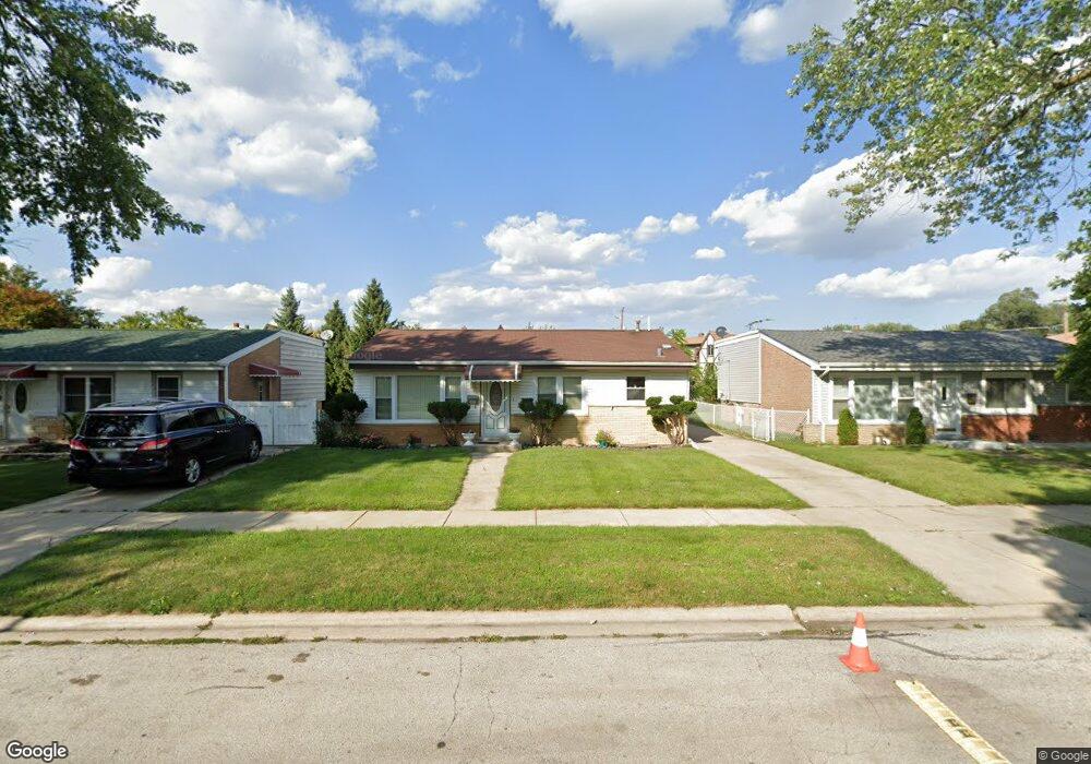
This home is located at 4320 W Linecrest Dr, Alsip, IL 60803 and is currently estimated at $311,443, approximately $288 per square foot. 4320 W Linecrest Dr is a home located in Cook County with nearby schools including Stony Creek Elementary School, Prairie Jr High School, and A B Shepard High School.
Ownership History
Date
Name
Owned For
Owner Type
Purchase Details
Closed on
Sep 29, 1998
Sold by
Heritage Trust Company
Bought by
Vosburg Russell and Vosburg Janet
Current Estimated Value
Purchase Details
Closed on
Aug 27, 1997
Sold by
Heritage Trust Company
Bought by
Vosburg Russell G and Vosburg Janet
Home Financials for this Owner
Home Financials are based on the most recent Mortgage that was taken out on this home.
Original Mortgage
$117,000
Interest Rate
11.15%
Create a Home Valuation Report for This Property
The Home Valuation Report is an in-depth analysis detailing your home's value as well as a comparison with similar homes in the area
Home Values in the Area
Average Home Value in this Area
Purchase History
| Date | Buyer | Sale Price | Title Company |
|---|---|---|---|
| Vosburg Russell | -- | -- | |
| Vosburg Russell G | -- | -- |
Source: Public Records
Mortgage History
| Date | Status | Borrower | Loan Amount |
|---|---|---|---|
| Previous Owner | Vosburg Russell G | $117,000 |
Source: Public Records
Tax History Compared to Growth
Tax History
| Year | Tax Paid | Tax Assessment Tax Assessment Total Assessment is a certain percentage of the fair market value that is determined by local assessors to be the total taxable value of land and additions on the property. | Land | Improvement |
|---|---|---|---|---|
| 2024 | $2,033 | $22,000 | $3,594 | $18,406 |
| 2023 | $2,543 | $22,000 | $3,594 | $18,406 |
| 2022 | $2,543 | $17,930 | $3,125 | $14,805 |
| 2021 | $2,355 | $17,929 | $3,125 | $14,804 |
| 2020 | $2,168 | $17,929 | $3,125 | $14,804 |
| 2019 | $2,487 | $17,093 | $2,812 | $14,281 |
| 2018 | $2,398 | $17,093 | $2,812 | $14,281 |
| 2017 | $2,116 | $17,093 | $2,812 | $14,281 |
| 2016 | $3,113 | $13,024 | $2,343 | $10,681 |
| 2015 | $4,000 | $13,024 | $2,343 | $10,681 |
| 2014 | $3,882 | $13,024 | $2,343 | $10,681 |
| 2013 | $4,713 | $16,356 | $2,343 | $14,013 |
Source: Public Records
Map
Nearby Homes
- 4317 W Linecrest Dr
- 11524 S Kildare Ave
- 11625 S Kildare Ave
- 11604 S Kenneth Ave
- 11551 S Komensky Ave
- 11811 S Tripp Ave
- 11720 S Komensky Ave
- 11749 S Karlov Ave
- 11801 S Karlov Ave Unit 303
- 11800 S Komensky Ave Unit 203
- 11553 S Joalyce Dr
- 11700 S Springfield Ave
- 3836 W 115th Place
- 3820 W 117th St
- 12026 S Kildare Ave Unit 16
- 3735 W 116th Place
- 10942 S Keeler Ave
- 11600 S Lamon Ave
- 3838 W 111th St Unit 209
- 11906 S Cicero Ave
- 4324 W Linecrest Dr
- 4316 W Linecrest Dr
- 4328 W Linecrest Dr
- 4312 W Linecrest Dr
- 4332 W Linecrest Dr
- 4308 W Linecrest Dr
- 4325 W Linecrest Dr
- 4321 W Linecrest Dr
- 4329 W Linecrest Dr
- 4336 W Linecrest Dr
- 11533 S Villa Ct Unit 2B
- 11533 S Villa Ct Unit 1C
- 11533 S Villa Ct Unit 3D
- 11533 S Villa Ct Unit 3A
- 4300 W Linecrest Dr
- 4313 W Linecrest Dr
- 4340 W Linecrest Dr
- 4256 W 116th St
- 11539 S Villa Ct Unit 1D
- 4309 W Linecrest Dr