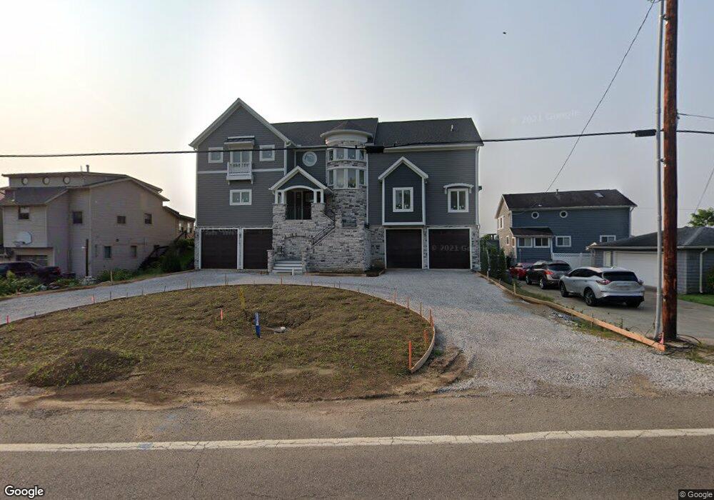
4321 N Bank Rd NE Millersport, OH 43046
Estimated Value: $1,038,000 - $1,876,000
3
Beds
2
Baths
2,732
Sq Ft
$568/Sq Ft
Est. Value
About This Home
This home is located at 4321 N Bank Rd NE, Millersport, OH 43046 and is currently estimated at $1,552,879, approximately $568 per square foot. 4321 N Bank Rd NE is a home located in Fairfield County with nearby schools including Millersport Elementary School and Millersport Jr/Sr High School.
Ownership History
Date
Name
Owned For
Owner Type
Purchase Details
Closed on
Oct 20, 2010
Sold by
Mckeever Alice E and Mckeever Richard C
Bought by
Carley Bryon H and Carley Deborah
Current Estimated Value
Home Financials for this Owner
Home Financials are based on the most recent Mortgage that was taken out on this home.
Original Mortgage
$274,230
Outstanding Balance
$180,594
Interest Rate
4.31%
Mortgage Type
New Conventional
Estimated Equity
$1,372,285
Purchase Details
Closed on
Sep 16, 2004
Sold by
Estate Of William R Miller Sr
Bought by
Mckeever Alice E
Create a Home Valuation Report for This Property
The Home Valuation Report is an in-depth analysis detailing your home's value as well as a comparison with similar homes in the area
Home Values in the Area
Average Home Value in this Area
Purchase History
| Date | Buyer | Sale Price | Title Company |
|---|---|---|---|
| Carley Bryon H | $304,700 | Attorney | |
| Mckeever Alice E | -- | -- |
Source: Public Records
Mortgage History
| Date | Status | Borrower | Loan Amount |
|---|---|---|---|
| Open | Carley Bryon H | $274,230 |
Source: Public Records
Tax History Compared to Growth
Tax History
| Year | Tax Paid | Tax Assessment Tax Assessment Total Assessment is a certain percentage of the fair market value that is determined by local assessors to be the total taxable value of land and additions on the property. | Land | Improvement |
|---|---|---|---|---|
| 2024 | $27,288 | $454,050 | $113,790 | $340,260 |
| 2023 | $17,935 | $454,050 | $113,790 | $340,260 |
| 2022 | $18,033 | $454,050 | $113,790 | $340,260 |
| 2021 | $11,143 | $247,190 | $94,830 | $152,360 |
| 2020 | $4,290 | $94,830 | $94,830 | $0 |
| 2019 | $4,291 | $94,830 | $94,830 | $0 |
| 2018 | $5,688 | $117,700 | $89,700 | $28,000 |
| 2017 | $5,689 | $113,740 | $89,700 | $24,040 |
| 2016 | $5,249 | $113,740 | $89,700 | $24,040 |
| 2015 | $5,288 | $112,730 | $89,700 | $23,030 |
| 2014 | $4,292 | $112,730 | $89,700 | $23,030 |
| 2013 | $4,292 | $112,730 | $89,700 | $23,030 |
Source: Public Records
Map
Nearby Homes
- 4255 N Bank Rd NE
- 4468 N Bank Rd NE
- 4135 Walnut Rd
- 3863 N Bank Rd NE
- 4881 Decker Ave NE
- 102 Leroy St
- 0 Beaver Rd NE
- 5102 Bateson Beach Dr NE
- 13309 Aspen Rd NE
- 13310 Shell Beach Rd NE
- 5130 Bateson Dr NE
- 3483 N Bank Rd
- 65 Stewart Ave
- 0 Aspen Rd NE
- 48 Rosebraugh Cir
- 3308 Shepard Ave
- 13556 Richards St NE
- 13200 Elm Rd NE
- 0 Forrest Rd NE
- 13061 Dogwood Rd NE
- 4327 N Bank Rd NE
- 4313 N Bank Rd NE
- 4333 N Bank Rd NE
- 4307 N Bank Rd NE
- 4345 N Bank Rd NE
- 4295 N Bank Rd NE
- 4351 N Bank Rd NE
- 4289 N Bank Rd NE
- 4357 N Bank Rd NE
- 4283 N Bank Rd NE
- 4350 N Bank Rd NE
- 4363 N Bank Rd NE
- 4277 N Bank Rd NE
- 4369 N Bank Rd NE
- 4271 N Bank Rd NE
- 4340 N Bank Rd NE
- 4340 N Bank Rd NE
- 4340 N Bank Rd NE
- 4340 N Bank Rd NE
- 4340 N Bank Rd NE