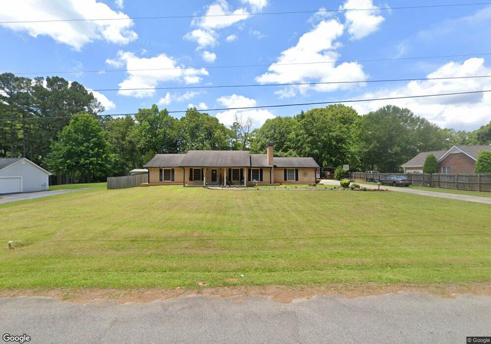
4321 Union Point Hwy Union Point, GA 30669
Estimated Value: $308,000 - $1,068,456
--
Bed
2
Baths
1,758
Sq Ft
$394/Sq Ft
Est. Value
About This Home
This home is located at 4321 Union Point Hwy, Union Point, GA 30669 and is currently estimated at $692,114, approximately $393 per square foot. 4321 Union Point Hwy is a home located in Greene County with nearby schools including Greene County High School.
Ownership History
Date
Name
Owned For
Owner Type
Purchase Details
Closed on
May 5, 2015
Sold by
The Country Club Of Greene
Bought by
Eshag Llc
Current Estimated Value
Purchase Details
Closed on
Aug 29, 2012
Sold by
F & M Bank
Bought by
The Country Club Of Greene Cou
Purchase Details
Closed on
Jun 5, 2012
Sold by
F & M Bank
Bought by
F & M Bank
Purchase Details
Closed on
Jan 1, 1966
Bought by
Greene County Country Club
Create a Home Valuation Report for This Property
The Home Valuation Report is an in-depth analysis detailing your home's value as well as a comparison with similar homes in the area
Home Values in the Area
Average Home Value in this Area
Purchase History
| Date | Buyer | Sale Price | Title Company |
|---|---|---|---|
| Eshag Llc | $440,000 | -- | |
| The Country Club Of Greene Cou | $640,000 | -- | |
| F & M Bank | $925,712 | -- | |
| Greene County Country Club | -- | -- |
Source: Public Records
Tax History Compared to Growth
Tax History
| Year | Tax Paid | Tax Assessment Tax Assessment Total Assessment is a certain percentage of the fair market value that is determined by local assessors to be the total taxable value of land and additions on the property. | Land | Improvement |
|---|---|---|---|---|
| 2025 | $5,522 | $375,160 | $234,120 | $141,040 |
| 2024 | $5,813 | $355,520 | $234,120 | $121,400 |
| 2023 | $4,901 | $297,840 | $175,000 | $122,840 |
| 2022 | $4,119 | $222,120 | $134,640 | $87,480 |
| 2021 | $4,353 | $218,920 | $134,640 | $84,280 |
| 2020 | $4,448 | $202,240 | $106,160 | $96,080 |
| 2019 | $4,600 | $202,240 | $106,160 | $96,080 |
| 2018 | $4,583 | $202,240 | $106,160 | $96,080 |
| 2017 | $4,286 | $202,416 | $106,200 | $96,216 |
| 2016 | $3,747 | $205,598 | $106,200 | $99,398 |
| 2015 | $7,443 | $357,294 | $164,469 | $192,825 |
| 2014 | $7,635 | $356,304 | $164,469 | $191,835 |
Source: Public Records
Map
Nearby Homes
- 1241 Old Siloam Rd
- 0 S Rhodes St Unit 10618488
- 1041 Hillcrest Dr
- 0 Washington Hwy Unit 7276060
- 1581 Highway 77 S Hwy
- 1581 Highway 77 S
- 215 Hunter St
- 202 Veazey St
- 324 N Rhodes St
- 112 Hendry St
- 0 Woodland Ct Unit 10543600
- 1251 Brick House Rd
- 1251 Brickhouse Rd
- 0 Old Union Point Rd Unit 1 10557753
- 1251 Adams Rd
- 5401 Union Point Hwy
- 1201 Buffalo Lick Rd
- 0 Buffalo Lick Rd Unit 10551234
- 0 Buffalo Lick Rd Unit 10551325
- 1860 Washington Hwy
- 1051 Country Club Dr
- 1031 Country Club Dr
- 1031 Country Club Dr
- 1111 Country Club Dr
- 1011 Country Club Dr
- 1131 Country Club Dr
- 1050 Country Club Dr
- 1040 Country Club Ln
- 1030 Country Club Dr
- 1030 Country Club Dr
- 1080 Country Club Dr
- 1161 Country Club Dr
- 1311 Country Club Dr
- 1291 Country Club Dr
- 1120 Country Club Dr
- 0 Union Point Unit 20146502
- 1130 Country Club Dr
- 1171 Country Club Dr
- 4421 Union Point Hwy
- 1140 Country Club Dr