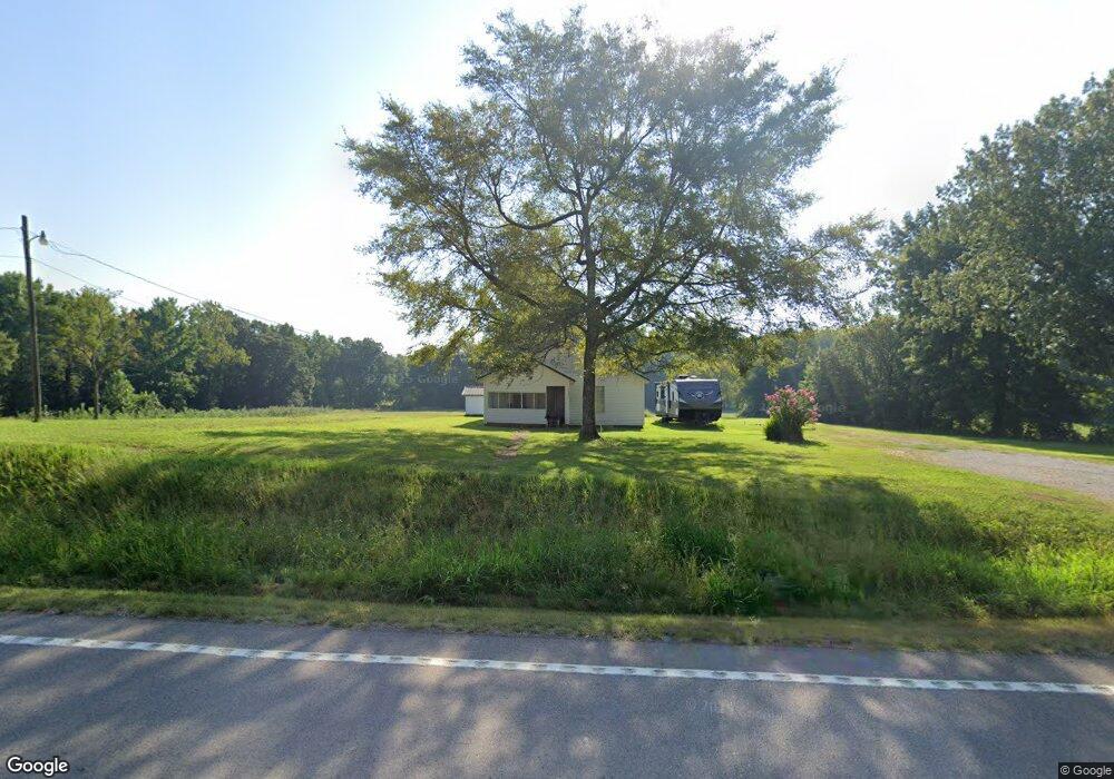
4322 Highway 349 Jonesboro, AR 72404
Estimated Value: $144,000 - $218,258
--
Bed
--
Bath
1,044
Sq Ft
$183/Sq Ft
Est. Value
About This Home
This home is located at 4322 Highway 349, Jonesboro, AR 72404 and is currently estimated at $190,753, approximately $182 per square foot. 4322 Highway 349 is a home with nearby schools including Westside Elementary School, Westside Middle School, and Westside High School.
Ownership History
Date
Name
Owned For
Owner Type
Purchase Details
Closed on
Jun 26, 2014
Sold by
Best Stephanie L
Bought by
Best David and Best Teresa
Current Estimated Value
Purchase Details
Closed on
May 7, 2008
Sold by
Best James and Best Penny
Bought by
Best Stephanie L
Purchase Details
Closed on
Jan 5, 2004
Bought by
Best
Purchase Details
Closed on
Oct 21, 1987
Bought by
Best
Purchase Details
Closed on
Jun 18, 1986
Bought by
Case and Case Absher
Create a Home Valuation Report for This Property
The Home Valuation Report is an in-depth analysis detailing your home's value as well as a comparison with similar homes in the area
Home Values in the Area
Average Home Value in this Area
Purchase History
| Date | Buyer | Sale Price | Title Company |
|---|---|---|---|
| Best David | -- | Lenders Title Co | |
| Best Stephanie L | $45,000 | Lenders Title Company | |
| Best | $200,000 | -- | |
| Best | $30,000 | -- | |
| Case | -- | -- |
Source: Public Records
Tax History Compared to Growth
Tax History
| Year | Tax Paid | Tax Assessment Tax Assessment Total Assessment is a certain percentage of the fair market value that is determined by local assessors to be the total taxable value of land and additions on the property. | Land | Improvement |
|---|---|---|---|---|
| 2025 | $1,122 | $22,154 | $13,056 | $9,098 |
| 2024 | $1,122 | $22,154 | $13,056 | $9,098 |
| 2023 | $898 | $22,154 | $13,056 | $9,098 |
| 2022 | $830 | $22,154 | $13,056 | $9,098 |
| 2021 | $777 | $16,130 | $9,080 | $7,050 |
| 2020 | $756 | $16,130 | $9,080 | $7,050 |
| 2019 | $707 | $16,130 | $9,080 | $7,050 |
| 2018 | $658 | $16,130 | $9,080 | $7,050 |
| 2017 | $564 | $16,130 | $9,080 | $7,050 |
| 2016 | $516 | $11,150 | $5,150 | $6,000 |
| 2015 | $516 | $11,150 | $5,150 | $6,000 |
| 2014 | $516 | $11,010 | $5,150 | $5,860 |
Source: Public Records
Map
Nearby Homes
- 945 County Road 111
- 1284 County Road 114
- 581 County Road 130
- 67.78 acres Cr 114
- 2572 Highway 349
- 97 County Road 130
- 219 Maurita St
- 3-Acres Damron Dr
- 20 Acres Parker Rd and I-555
- 1 Strawfloor Dr
- 18.62 acres Strawfloor Dr
- 0 Strawfloor Dr
- 14 County Road 346
- 136 County Road 107
- 9586 Highway 63 N
- 205 County Road 106
- 4008 Sloan Lake Cove
- 727 Cr 311
- 2064 Sloan Lake Dr
- 393 County Road 371
- 4249 Highway 349
- 4178 Highway 349 Unit 16
- 4178 Highway 349 Unit 42
- 4178 Highway 349 Unit 30
- 4178 Highway 349 Unit 18
- 4178 Highway 349 Unit 14
- 4178 Highway 349 Unit 38
- 4432 Highway 349
- 1641 Highway 91 W
- 1491 Highway 91 W
- 1475 Highway 91 W
- 1195 Highway 91 W
- 4078 Highway 349
- 110 Cr 477
- 110 Cr 477 Unit Lot 7
- 4099 Highway 349
- 1093 Highway 91 W
- 278 County Road 111
- 1219 Highway 91 W
- 4023 Arkansas 349