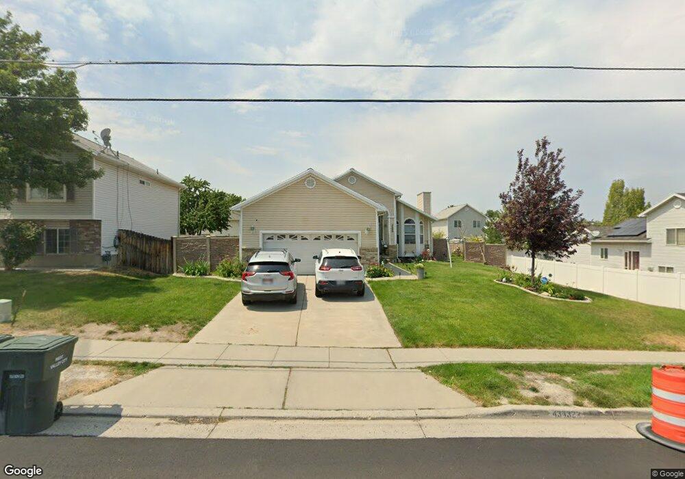
4322 S 6000 W Salt Lake City, UT 84128
Hunter NeighborhoodEstimated Value: $479,000 - $505,460
4
Beds
2
Baths
2,377
Sq Ft
$208/Sq Ft
Est. Value
About This Home
This home is located at 4322 S 6000 W, Salt Lake City, UT 84128 and is currently estimated at $494,365, approximately $207 per square foot. 4322 S 6000 W is a home located in Salt Lake County with nearby schools including Hillside Elementary School, Hunter Jr High School, and Hunter High School.
Ownership History
Date
Name
Owned For
Owner Type
Purchase Details
Closed on
Aug 9, 2010
Sold by
Cooper Phillips C
Bought by
Beckstead Neilya A
Current Estimated Value
Purchase Details
Closed on
May 21, 2009
Sold by
Beckstead Neilya A
Bought by
Beckstead Neilya A and Cooper Phillips C
Purchase Details
Closed on
May 11, 2009
Sold by
Cooper Phillips C and Beckstead Neilya A
Bought by
Beckstead Neilya A
Purchase Details
Closed on
Sep 13, 2006
Sold by
Billeter Lee and Billeter Sheila R
Bought by
Cooper Phillips C and Beckstead Neilya A
Home Financials for this Owner
Home Financials are based on the most recent Mortgage that was taken out on this home.
Original Mortgage
$187,200
Interest Rate
6.53%
Mortgage Type
Purchase Money Mortgage
Purchase Details
Closed on
May 3, 2006
Sold by
Burns M Melynda and Burns Charles R
Bought by
Billeter Lee and Billeter Shiela R
Home Financials for this Owner
Home Financials are based on the most recent Mortgage that was taken out on this home.
Original Mortgage
$166,500
Interest Rate
6.29%
Mortgage Type
Purchase Money Mortgage
Purchase Details
Closed on
Jun 16, 2003
Sold by
Burns M Melynda and Burns Charles R
Bought by
Burns Charles R and Melynda Burns M
Home Financials for this Owner
Home Financials are based on the most recent Mortgage that was taken out on this home.
Original Mortgage
$119,200
Interest Rate
4.63%
Mortgage Type
Purchase Money Mortgage
Purchase Details
Closed on
Mar 10, 1998
Sold by
Thorpe John A and Thorpe Nicole G
Bought by
Bowers M Melynda and Burns Charles R
Home Financials for this Owner
Home Financials are based on the most recent Mortgage that was taken out on this home.
Original Mortgage
$127,680
Interest Rate
7.11%
Mortgage Type
Purchase Money Mortgage
Purchase Details
Closed on
May 22, 1997
Sold by
Watt Residential Partners
Bought by
Thorpe John A and Thorpe Nicole G
Home Financials for this Owner
Home Financials are based on the most recent Mortgage that was taken out on this home.
Original Mortgage
$128,630
Interest Rate
8.14%
Mortgage Type
FHA
Create a Home Valuation Report for This Property
The Home Valuation Report is an in-depth analysis detailing your home's value as well as a comparison with similar homes in the area
Home Values in the Area
Average Home Value in this Area
Purchase History
| Date | Buyer | Sale Price | Title Company |
|---|---|---|---|
| Beckstead Neilya A | -- | None Available | |
| Beckstead Neilya A | -- | None Available | |
| Beckstead Neilya A | -- | Accommodation | |
| Cooper Phillips C | -- | Integrated Title Ins Service | |
| Billeter Lee | -- | Integrated Title Ins Service | |
| Burns Charles R | -- | -- | |
| Bowers M Melynda | -- | -- | |
| Thorpe John A | -- | First American Title |
Source: Public Records
Mortgage History
| Date | Status | Borrower | Loan Amount |
|---|---|---|---|
| Previous Owner | Cooper Phillips C | $187,200 | |
| Previous Owner | Billeter Lee | $166,500 | |
| Previous Owner | Burns Charles R | $119,200 | |
| Previous Owner | Bowers M Melynda | $127,680 | |
| Previous Owner | Thorpe John A | $128,630 |
Source: Public Records
Tax History Compared to Growth
Tax History
| Year | Tax Paid | Tax Assessment Tax Assessment Total Assessment is a certain percentage of the fair market value that is determined by local assessors to be the total taxable value of land and additions on the property. | Land | Improvement |
|---|---|---|---|---|
| 2025 | $2,772 | $478,900 | $138,500 | $340,400 |
| 2024 | $2,772 | $423,100 | $127,100 | $296,000 |
| 2023 | $2,722 | $397,800 | $122,200 | $275,600 |
| 2022 | $2,774 | $406,500 | $119,800 | $286,700 |
| 2021 | $2,504 | $329,700 | $92,200 | $237,500 |
| 2020 | $2,300 | $285,800 | $75,100 | $210,700 |
| 2019 | $2,341 | $280,600 | $74,700 | $205,900 |
| 2018 | $2,226 | $257,700 | $74,700 | $183,000 |
| 2017 | $2,063 | $242,800 | $74,700 | $168,100 |
| 2016 | $1,917 | $226,100 | $74,700 | $151,400 |
| 2015 | $1,732 | $194,500 | $81,200 | $113,300 |
| 2014 | $1,646 | $181,100 | $78,500 | $102,600 |
Source: Public Records
Map
Nearby Homes
- 4345 S Long Valley Dr
- 5960 W 4385 S
- 5905 W 4300 S
- 4197 S 6115 W
- 6081 W Haven Ridge Way
- 5944 W Vistas Haven Way Unit 34
- 6104 W Peach Ridge Way
- 6165 W Haven Ridge Way
- 4205 S Zeus Dr
- 5936 W Juniper Vista Dr
- 5950 W 4700 S
- 5758 W 4510 S
- 4483 Rodonda Linda Place
- 5644 W 4360 S
- 6344 Basin Ridge Dr
- 6085 W Autumn Vistas Dr
- 6301 Cape Ridge Ln
- 6286 W Anders Ridge Way
- 6317 W Cape Ridge Ln
- 5496 W Peggy Ln
- 4326 S 6000 W
- 6013 W Bona Dea Blvd
- 6013 Bona Dea Blvd
- 4321 Long Valley Dr
- 4321 S 6080 W
- 4327 Long Valley Dr
- 4317 Long Valley Dr
- 4317 S 6080 W Unit 545
- 4317 S 6080 W
- 4334 S 6000 W
- 4327 S 6000 W
- 4335 S Long Valley Dr
- 4335 Long Valley Dr
- 5987 Nugget Dr
- 5987 W Nugget Dr
- 4337 S 6000 W
- 4302 S 6000 W
- 4344 S 6000 W
- 4343 S 6000 W
- 4299 Long Valley Dr