Estimated Value: $290,349 - $413,000
Studio
1
Bath
2,057
Sq Ft
$173/Sq Ft
Est. Value
About This Home
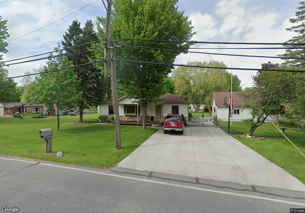
This home is located at 4322 Taft Rd, Clay, MI 48001 and is currently estimated at $355,087, approximately $172 per square foot. 4322 Taft Rd is a home located in St. Clair County.
Ownership History
Date
Name
Owned For
Owner Type
Purchase Details
Closed on
Nov 17, 2021
Sold by
Garwood David W and Garwood Jill A
Bought by
Garwood Jill A
Current Estimated Value
Purchase Details
Closed on
Apr 24, 2021
Sold by
Garwood David W and Garwood Jill A
Bought by
Garwood Jill A
Home Financials for this Owner
Home Financials are based on the most recent Mortgage that was taken out on this home.
Original Mortgage
$125,000
Interest Rate
3.1%
Mortgage Type
Stand Alone Refi Refinance Of Original Loan
Create a Home Valuation Report for This Property
The Home Valuation Report is an in-depth analysis detailing your home's value as well as a comparison with similar homes in the area
Home Values in the Area
Average Home Value in this Area
Purchase History
| Date | Buyer | Sale Price | Title Company |
|---|---|---|---|
| Garwood Jill A | -- | None Available | |
| Garwood Jill A | -- | Amrock Llc |
Source: Public Records
Mortgage History
| Date | Status | Borrower | Loan Amount |
|---|---|---|---|
| Closed | Garwood Jill A | $125,000 |
Source: Public Records
Tax History
| Year | Tax Paid | Tax Assessment Tax Assessment Total Assessment is a certain percentage of the fair market value that is determined by local assessors to be the total taxable value of land and additions on the property. | Land | Improvement |
|---|---|---|---|---|
| 2025 | $1,590 | $148,600 | $0 | $0 |
| 2024 | $1,560 | $140,000 | $0 | $0 |
| 2023 | $1,503 | $133,900 | $0 | $0 |
| 2022 | $2,591 | $123,600 | $0 | $0 |
| 2020 | $2,430 | $114,700 | $114,700 | $0 |
| 2019 | $2,394 | $105,700 | $0 | $0 |
| 2018 | $2,354 | $93,300 | $0 | $0 |
| 2017 | $2,158 | $85,100 | $0 | $0 |
| 2016 | $1,202 | $85,100 | $0 | $0 |
| 2015 | -- | $67,700 | $67,700 | $0 |
| 2014 | -- | $62,800 | $62,800 | $0 |
| 2013 | -- | $61,000 | $0 | $0 |
Source: Public Records
Map
Nearby Homes
- 9665 River St
- 9399 Oakdale St
- 9309 Oakdale
- 9279 Oakdale St
- 24 Vacant Lots Land
- 0000 Taft Rd
- 00 Taft Rd
- 3202 Fruit St
- 9084 Island Dr
- 00000 N Channel Dr
- 407-425 N Channel Dr
- 00 N Channel Dr
- 00 Dickinson Island
- 9658 Seaway Dr Unit 91
- 9634 Seaway Dr Unit 38
- 9642 Nook Rd Unit 7
- 9636 Anchor Dr Unit 99
- 5966 Starboard Ct Unit 284
- 2039 Golf Course Rd
- 9761 Marina Cir Unit 292
- 4262 Taft Rd
- 4364 Taft Rd
- 4312 Taft Rd
- 9446 Island Dr
- 4259 Taft Rd Unit Bldg-Unit
- 4259 Taft Rd
- 9642 Meadowbrook St
- 9618 Island Dr
- 9638 Meadowbrook St
- 9640 Meadowbrook St
- 9525 Island Dr
- 4410 Pointe Tremble Rd
- 9440 Island Dr
- 4416 Taft Rd
- 9645 Meadowbrook St
- 9644 Meadowbrook St
- 9642 Island Dr
- 4160 Fruit St
- 4241 Pointe Tremble Rd
- 9629 River St
Your Personal Tour Guide
Ask me questions while you tour the home.