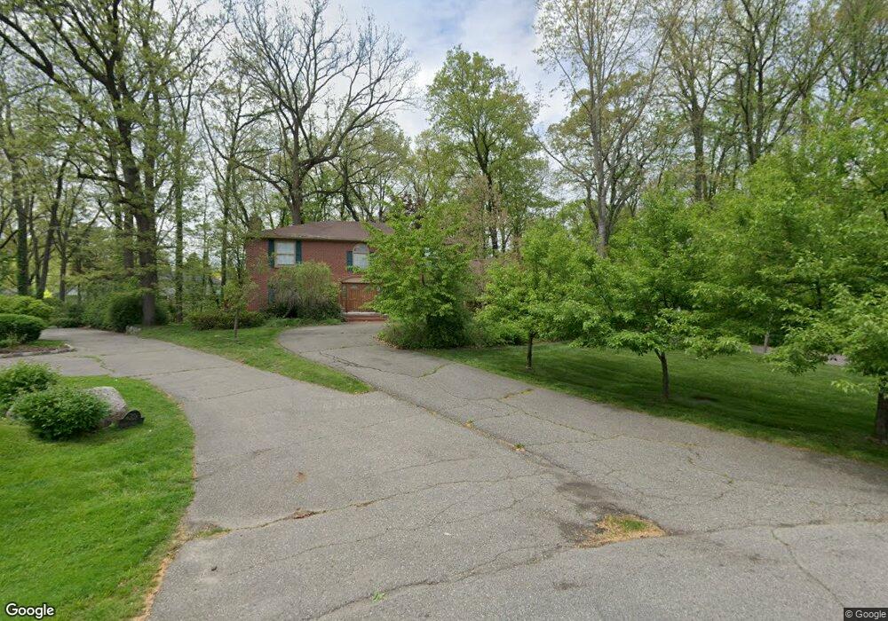
4322 Vernor Ct Bloomfield Hills, MI 48302
Estimated Value: $1,012,000 - $1,282,000
4
Beds
5
Baths
4,113
Sq Ft
$281/Sq Ft
Est. Value
About This Home
This home is located at 4322 Vernor Ct, Bloomfield Hills, MI 48302 and is currently estimated at $1,157,084, approximately $281 per square foot. 4322 Vernor Ct is a home located in Oakland County with nearby schools including Way Elementary School, South Hills Middle School, and Bloomfield Hills High School.
Ownership History
Date
Name
Owned For
Owner Type
Purchase Details
Closed on
Apr 30, 1999
Sold by
Shea Kevin P
Bought by
Smith Victoria
Current Estimated Value
Purchase Details
Closed on
Oct 15, 1998
Sold by
Hillburn David
Bought by
Shea Kevin P
Home Financials for this Owner
Home Financials are based on the most recent Mortgage that was taken out on this home.
Original Mortgage
$600,000
Interest Rate
7.02%
Create a Home Valuation Report for This Property
The Home Valuation Report is an in-depth analysis detailing your home's value as well as a comparison with similar homes in the area
Home Values in the Area
Average Home Value in this Area
Purchase History
| Date | Buyer | Sale Price | Title Company |
|---|---|---|---|
| Smith Victoria | $820,000 | -- | |
| Shea Kevin P | $750,000 | -- |
Source: Public Records
Mortgage History
| Date | Status | Borrower | Loan Amount |
|---|---|---|---|
| Previous Owner | Shea Kevin P | $600,000 |
Source: Public Records
Tax History Compared to Growth
Tax History
| Year | Tax Paid | Tax Assessment Tax Assessment Total Assessment is a certain percentage of the fair market value that is determined by local assessors to be the total taxable value of land and additions on the property. | Land | Improvement |
|---|---|---|---|---|
| 2024 | $8,155 | $498,630 | $0 | $0 |
| 2023 | $7,777 | $453,230 | $0 | $0 |
| 2022 | $14,573 | $423,030 | $0 | $0 |
| 2021 | $14,876 | $397,560 | $0 | $0 |
| 2020 | $6,854 | $389,730 | $0 | $0 |
| 2019 | $14,266 | $385,340 | $0 | $0 |
| 2018 | $14,442 | $368,230 | $0 | $0 |
| 2017 | $14,016 | $358,250 | $0 | $0 |
| 2016 | $14,754 | $361,870 | $0 | $0 |
| 2015 | -- | $349,080 | $0 | $0 |
| 2014 | -- | $309,500 | $0 | $0 |
| 2011 | -- | $289,080 | $0 | $0 |
Source: Public Records
Map
Nearby Homes
- 801 W Long Lake Rd
- 921 Pine Thistle Ln
- 4255 Telegraph Rd
- 3797 Burning Tree Dr
- 830 N Pemberton Rd
- 1027 Joanne Ct
- 4650 Lahser Rd
- 1214 Copperwood Dr
- 3531 Brookside Dr
- 3627 Shallow Brook Dr
- 3715 Lahser Rd
- 3435 Devon Brook Dr
- 3515 Brookside Dr
- 3403 Chickering Ln
- 931 Vaughan Rd
- 5080 Tootmoor Rd
- 5008 Kings Gate Way
- 1347 N Carillon Ct
- 00 Telegraph Rd
- 0 Telegraph Rd
- 4328 Vernor Ct
- 4316 Vernor Ct
- 4225 Sunningdale Dr
- 4207 Sunningdale Dr
- 4334 Vernor Ct
- 4243 Sunningdale Dr
- 4189 Sunningdale Dr
- 4310 Vernor Ct
- 4340 Vernor Ct
- 4261 Sunningdale Dr
- 4354 Compton Way
- 4252 Stoneleigh Rd
- 4226 Sunningdale Dr
- 4298 Compton Way
- 4171 Sunningdale Dr
- 4248 Sunningdale Dr
- 4206 Sunningdale Dr
- 4188 Sunningdale Dr
- 4153 Sunningdale Dr
- 4362 Compton Way