Estimated Value: $262,317
--
Bed
--
Bath
3,444
Sq Ft
$76/Sq Ft
Est. Value
About This Home
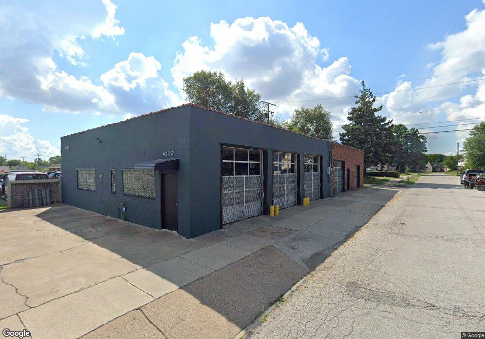
This home is located at 4323 Brookpark Rd, Parma, OH 44134 and is currently estimated at $262,317, approximately $76 per square foot. 4323 Brookpark Rd is a home located in Cuyahoga County with nearby schools including Thoreau Park Elementary School, Shiloh Middle School, and Parma High School.
Ownership History
Date
Name
Owned For
Owner Type
Purchase Details
Closed on
Jun 17, 2020
Sold by
Halmos John P
Bought by
Maniates Llc
Current Estimated Value
Home Financials for this Owner
Home Financials are based on the most recent Mortgage that was taken out on this home.
Original Mortgage
$130,400
Outstanding Balance
$115,590
Interest Rate
3.2%
Mortgage Type
Future Advance Clause Open End Mortgage
Estimated Equity
$146,727
Purchase Details
Closed on
Oct 16, 2006
Sold by
Frank John and Katakos Demetrios
Bought by
Halmos John P
Purchase Details
Closed on
Apr 13, 2001
Sold by
John Frank Inc
Bought by
Frank John
Create a Home Valuation Report for This Property
The Home Valuation Report is an in-depth analysis detailing your home's value as well as a comparison with similar homes in the area
Home Values in the Area
Average Home Value in this Area
Purchase History
| Date | Buyer | Sale Price | Title Company |
|---|---|---|---|
| Maniates Llc | $163,000 | Title Alliance Of North | |
| Halmos John P | $65,000 | Executive Title Agency | |
| Frank John | -- | -- |
Source: Public Records
Mortgage History
| Date | Status | Borrower | Loan Amount |
|---|---|---|---|
| Open | Maniates Llc | $130,400 |
Source: Public Records
Tax History Compared to Growth
Tax History
| Year | Tax Paid | Tax Assessment Tax Assessment Total Assessment is a certain percentage of the fair market value that is determined by local assessors to be the total taxable value of land and additions on the property. | Land | Improvement |
|---|---|---|---|---|
| 2024 | $4,884 | $60,025 | $8,540 | $51,485 |
| 2023 | $4,802 | $57,060 | $9,140 | $47,920 |
| 2022 | $4,784 | $57,050 | $9,140 | $47,920 |
| 2021 | $4,953 | $57,050 | $9,140 | $47,920 |
| 2020 | $3,765 | $41,160 | $8,540 | $32,620 |
| 2019 | $3,678 | $117,600 | $24,400 | $93,200 |
| 2018 | $3,735 | $41,160 | $8,540 | $32,620 |
| 2017 | $3,911 | $42,080 | $15,720 | $26,360 |
| 2016 | $3,889 | $42,080 | $15,720 | $26,360 |
| 2015 | $4,151 | $42,080 | $15,720 | $26,360 |
| 2014 | $4,151 | $45,710 | $17,080 | $28,630 |
Source: Public Records
Map
Nearby Homes
- 4315 Woodway Ave
- 4311 Woodway Ave
- 5252 W 45th St
- 3807 Freehold Ave
- 4439 Woodway Ave
- 3707 Freehold Ave
- 3706 Woodway Ave
- 4323 Russell Ave
- 3714 Russell Ave
- 4523 Wetzel Ave
- 4915 Tuxedo Ave
- 3402 North Ave
- 3323 North Ave
- 3801 Burger Ave
- 5406 Merkle Ave
- 4701 Burger Ave
- 4706 Burger Ave
- 4506 Bader Ave
- 5511 Velma Ave
- 3820 Bader Ave
- 5219 W 44th St
- 4407 Brookpark Rd
- 5220 W 44th St
- 5220 W 44th St Unit DOWN
- 5227 W 44th St
- 5224 W 44th St
- 5231 W 44th St
- 5228 W 44th St
- 5224 Roseside Ave
- 5232 W 44th St
- 5228 Roseside Ave
- 5235 W 44th St
- 4423 Brookpark Rd
- 5220 Roseside Ave
- 5232 Roseside Ave
- 5219 W 45th St
- 5236 W 44th St
- 5239 W 44th St
- 5223 W 45th St
- 4207 Brookpark Rd