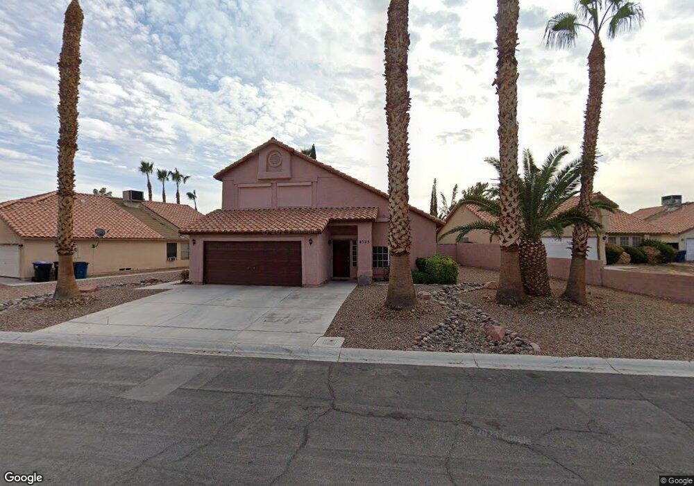
4323 Peaceful Path Ct North Las Vegas, NV 89032
Cheyenne NeighborhoodEstimated Value: $422,666 - $454,000
4
Beds
3
Baths
1,965
Sq Ft
$225/Sq Ft
Est. Value
About This Home
This home is located at 4323 Peaceful Path Ct, North Las Vegas, NV 89032 and is currently estimated at $442,917, approximately $225 per square foot. 4323 Peaceful Path Ct is a home located in Clark County with nearby schools including Claude & Stella Parson Elementary School, Theron L Swainston Middle School, and Cheyenne High School.
Ownership History
Date
Name
Owned For
Owner Type
Purchase Details
Closed on
Jun 28, 2022
Sold by
Latonya Washington
Bought by
Carnell Washington Living Trust
Current Estimated Value
Purchase Details
Closed on
May 15, 2014
Sold by
Washington Latonya R
Bought by
Washington Latonya
Purchase Details
Closed on
Dec 3, 2008
Sold by
Washington Carnell
Bought by
Washington Latonya R
Purchase Details
Closed on
Mar 16, 1998
Sold by
Washington Carnell
Bought by
Washington Carnell and The Carnell Washington Living Trust
Purchase Details
Closed on
Jul 16, 1997
Sold by
Washington Michael Anthony and Washington Dwain Edward
Bought by
Washington Carnell
Purchase Details
Closed on
Feb 17, 1997
Sold by
Washington Carnell and Washington Woodrow
Bought by
Washington Michael Anthony and Washington Dwain Edward
Create a Home Valuation Report for This Property
The Home Valuation Report is an in-depth analysis detailing your home's value as well as a comparison with similar homes in the area
Home Values in the Area
Average Home Value in this Area
Purchase History
| Date | Buyer | Sale Price | Title Company |
|---|---|---|---|
| Carnell Washington Living Trust | -- | None Listed On Document | |
| Washington Latonya | -- | None Available | |
| Washington Latonya R | -- | None Available | |
| Washington Carnell | -- | -- | |
| Washington Carnell | -- | -- | |
| Washington Michael Anthony | -- | -- |
Source: Public Records
Tax History Compared to Growth
Tax History
| Year | Tax Paid | Tax Assessment Tax Assessment Total Assessment is a certain percentage of the fair market value that is determined by local assessors to be the total taxable value of land and additions on the property. | Land | Improvement |
|---|---|---|---|---|
| 2025 | $2,001 | $85,838 | $31,850 | $53,988 |
| 2024 | $2,001 | $85,838 | $31,850 | $53,988 |
| 2023 | $2,001 | $82,709 | $30,800 | $51,909 |
| 2022 | $1,853 | $73,320 | $25,550 | $47,770 |
| 2021 | $1,716 | $70,626 | $24,850 | $45,776 |
| 2020 | $1,591 | $67,978 | $22,400 | $45,578 |
| 2019 | $1,491 | $65,057 | $19,950 | $45,107 |
| 2018 | $1,422 | $60,295 | $16,800 | $43,495 |
| 2017 | $1,980 | $59,016 | $14,700 | $44,316 |
| 2016 | $1,332 | $52,480 | $10,850 | $41,630 |
| 2015 | $1,329 | $39,837 | $7,000 | $32,837 |
| 2014 | $1,287 | $38,380 | $7,000 | $31,380 |
Source: Public Records
Map
Nearby Homes
- 4108 Dove Creek Rd
- 4115 Tatum Ct
- 4335 Twin Peaks Dr
- 4230 Valley Spruce Way
- 3938 Redfield Ave
- 4013 Extenso Dr
- 4508 W San Miguel Ave
- 4002 Extenso Dr
- 3830 Passionfruit St
- 3904 Six Gun Rd
- 4341 San Mateo St
- 3928 Biddle St
- 4524 Denali Ave
- 3784 Nerine Pass Way
- 4216 N Decatur Blvd
- 4508 San Mateo St
- 3937 Jamison Park Ln
- 3816 Sunking St
- 4076 Topaz Hills Dr
- 3930 Burma Rd
- 4319 Peaceful Path Ct
- 4327 Peaceful Path Ct
- 4029 Dove Creek Rd
- 4331 Peaceful Path Ct
- 4045 Dove Creek Rd
- 4025 Dove Creek Rd
- 4320 Peaceful Path Ct
- 4036 Dove Creek Rd
- 4021 Dove Creek Rd
- 4335 Peaceful Path Ct
- 4332 Peaceful Path Ct
- 4032 Dove Creek Rd
- 4049 Dove Creek Rd
- 4336 Peaceful Path Ct
- 4040 Dove Creek Rd
- 4028 Dove Creek Rd
- 4332 Twin Peaks Dr
- 4044 Dove Creek Rd
- 4337 Silvercrest Ct